WEDNESDAY WEATHER OUTLOOK FROM GARFIELD COUNTY EMERGENCY MANAGEMENT – 01/21/2026
Good morning, Garfield County!
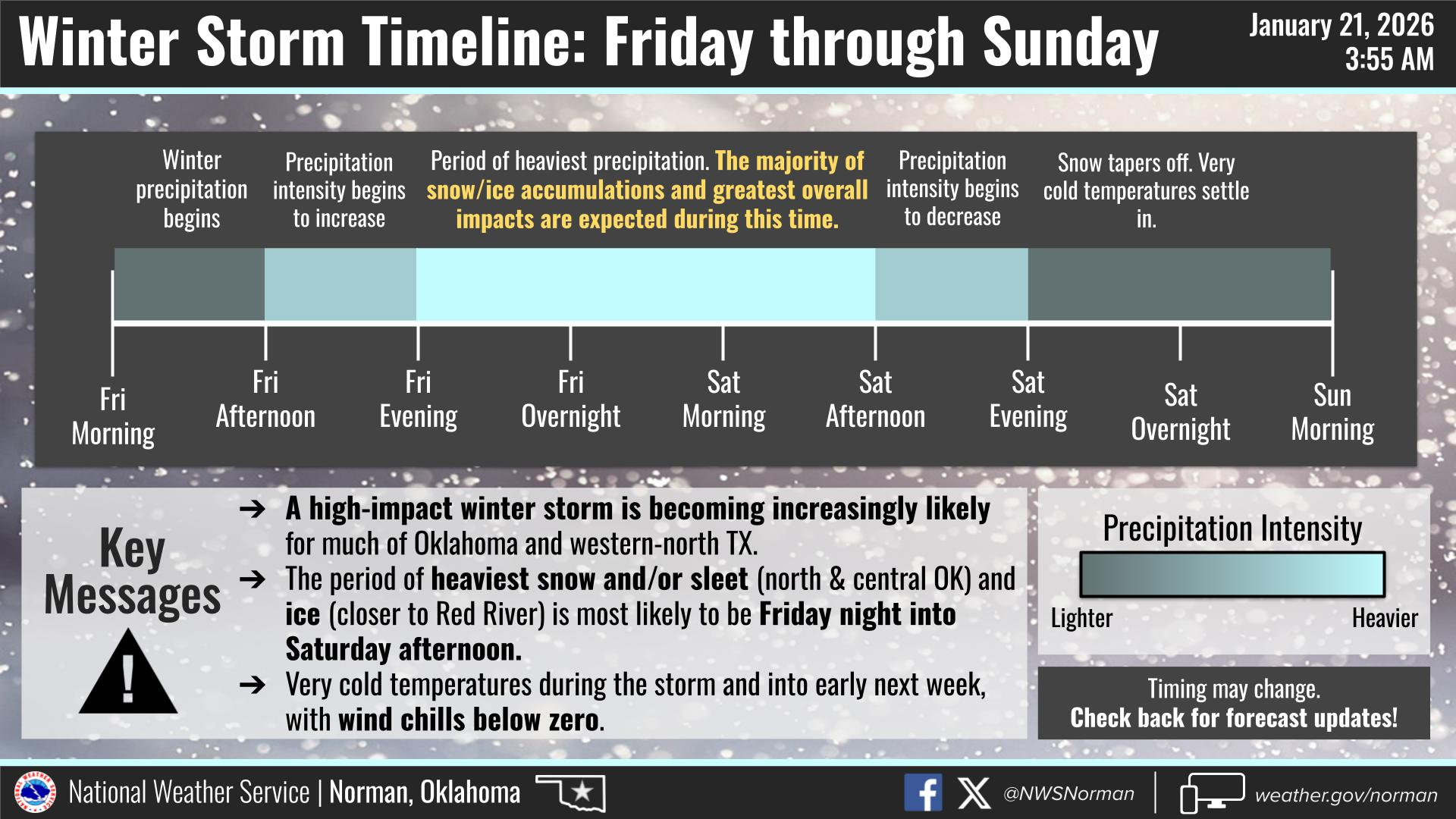
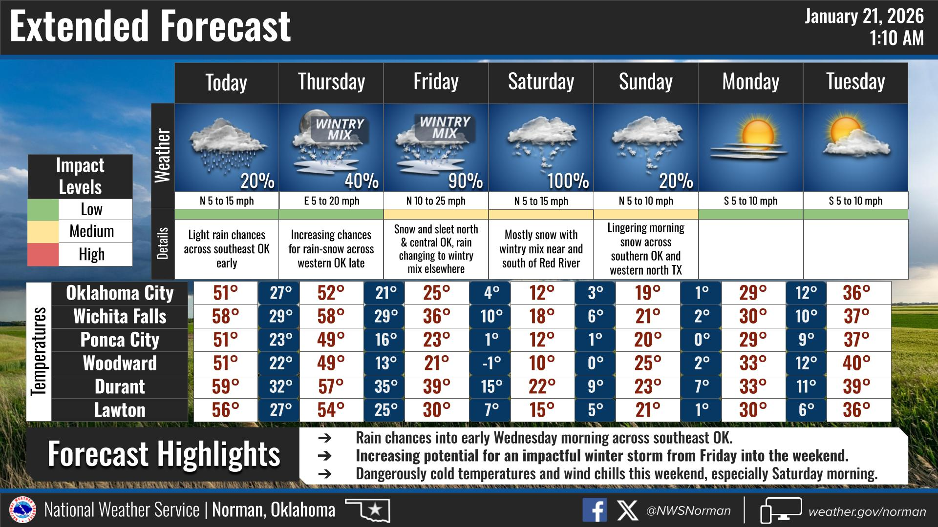
WINTER STORM WATCH FROM FRIDAY, 12:00PM UNTIL SUNDAY AT 6:00 PM
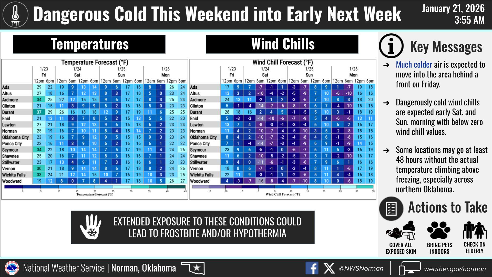
EXTREME COLD WATCH FROM MIDNIGHT FRIDAY UNTIL 12:00 PM ON SATURDAY
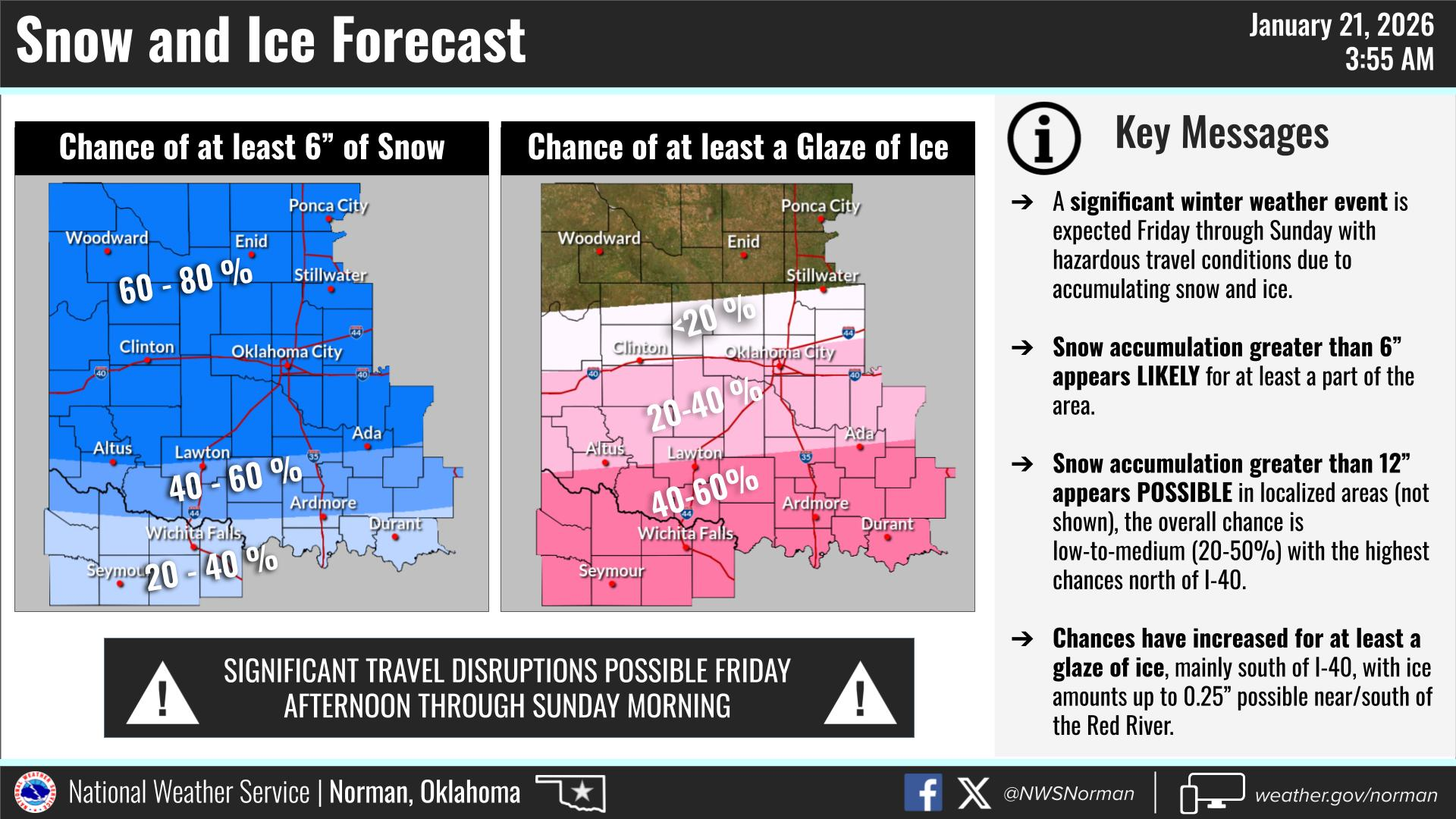
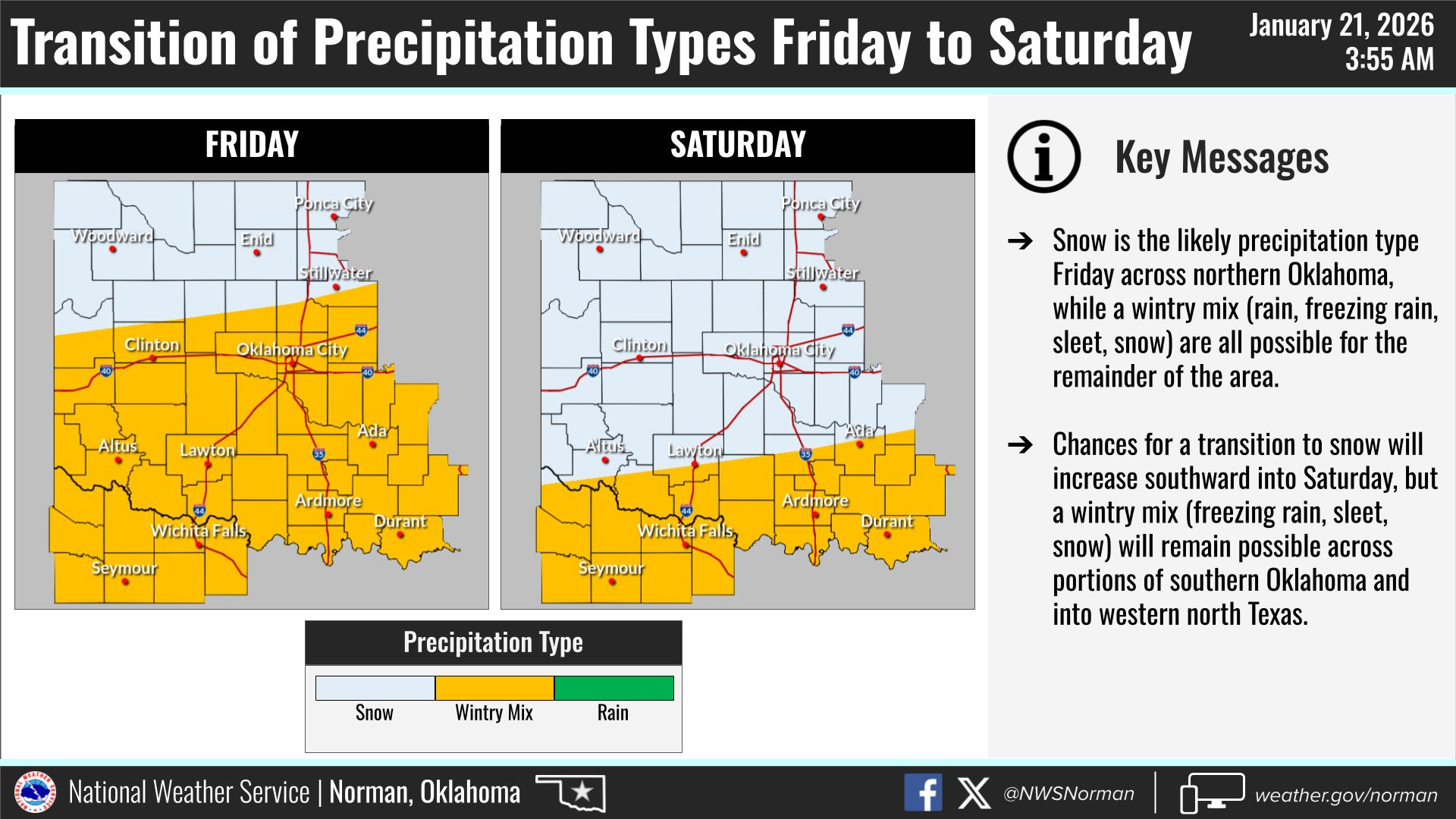
If you haven’t already, you should start preparing now, for a significant winter storm. Beginning Friday and continues through early Sunday. Our main threats will be hazardous travel conditions, and dangerously cold temperatures. We are forecasted to see at least 6 inches of snow across the area. There could be areas with much higher amounts. Wind chills will range from 1 to 15 below zero, starting Friday and continuing through the first part of next week. Use extreme caution, dress in layers, and if all possible stay indoors. Frostbite and Hypothermia will be a concern, as this will be some of the coldest temperatures we have experienced in several years. We will update as needed.
Here is your forecast from the NWS/Norman:
Today – Sunny. Highs in the lower 50s. North winds 10 to 15 mph, becoming northwest around 5 mph this afternoon.
Tonight – Mostly clear. Cold with lows in the lower 20s. Southwest winds around 5 mph, becoming east around 5 mph after midnight.
Safety Tips:
- Cold Safety: With wind chills starting in the lower 20s this morning, be sure to dress in layers if you are heading out early.
- Winter Prep: Use today’s clear weather to ensure your home and vehicles are prepped for the incoming winter storm.
- Stay Informed: Download the Garfield County EM app to receive the latest weather alerts and updates directly to your phone.
Have a safe day!
Jacob Price GCEM-1