TODAY’S WEATHER OUTLOOK FROM GARFIELD COUNTY EMERGENCY MANAGEMENT – 2/25/2026
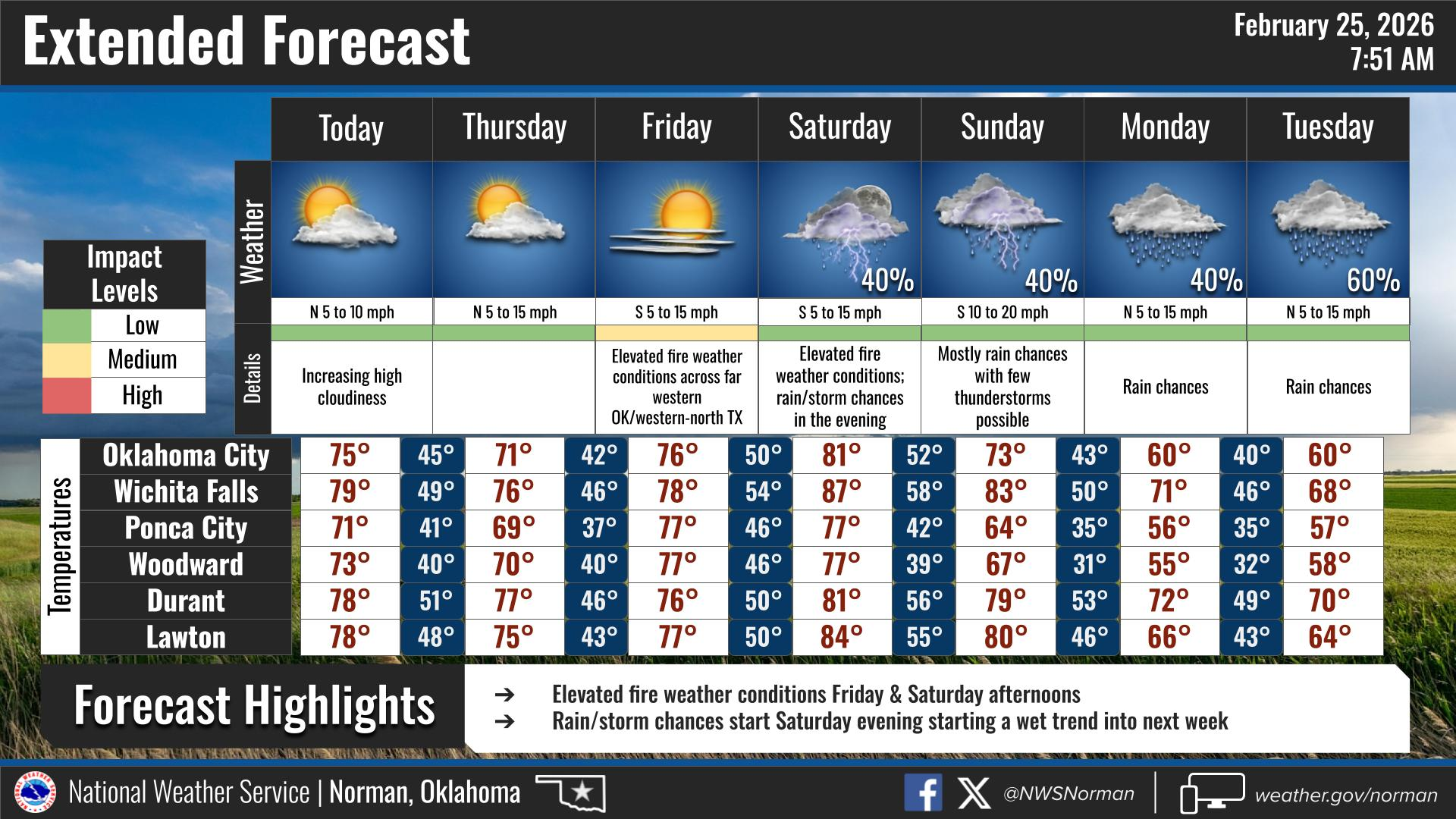
We’re in the middle of a pretty warm stretch. Temperatures are running well above normal, and we’ll stay that way through the end of the week with mostly dry conditions and breezy afternoons.
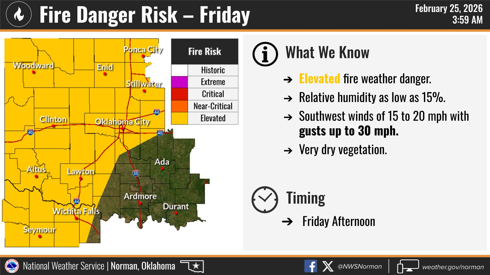
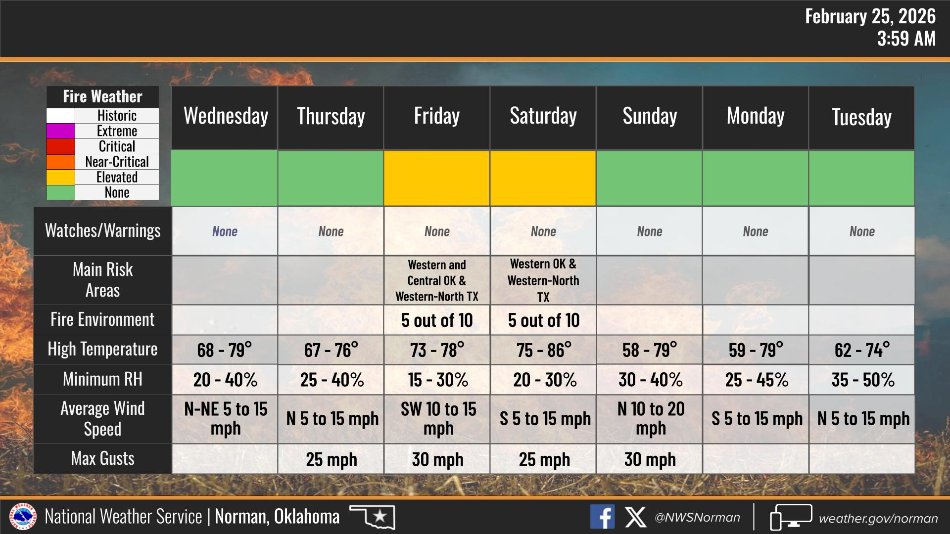
With the warm temps, low humidity, and periodic gusty southwest winds, we’re looking at elevated to near-critical fire weather conditions at times through Saturday. Fine fuels are dry, and it won’t take much for a fire to spread quickly — especially during the afternoon hours when humidity bottoms out and winds pick up.
Friday currently looks like one of the higher concern days this week for fire danger. If you’re planning any outdoor burning, welding, or anything that throws sparks, I’d strongly recommend holding off. Even routine outdoor equipment use needs to be done carefully.
We’ll start to see some changes late weekend into early next week with cooler air and eventual rain chances, which should help ease the fire threat.
HERE IS YOUR FORECAST FROM THE NWS/NORMAN:
TODAY – Mostly sunny. Highs in the lower 70s. Northeast winds 5 to 10 mph.
TONIGHT – Mostly clear in the evening, then becoming partly cloudy. Lows in the lower 40s. South winds around 5 mph, becoming north after midnight.
Have a great day!
Jacob Price GCEM-1