TODAY’S WEATHER OUTLOOK FROM GARFIELD COUNTY EMERGENCY MANAGEMENT – 2/20/2026
Good morning, Garfield County.
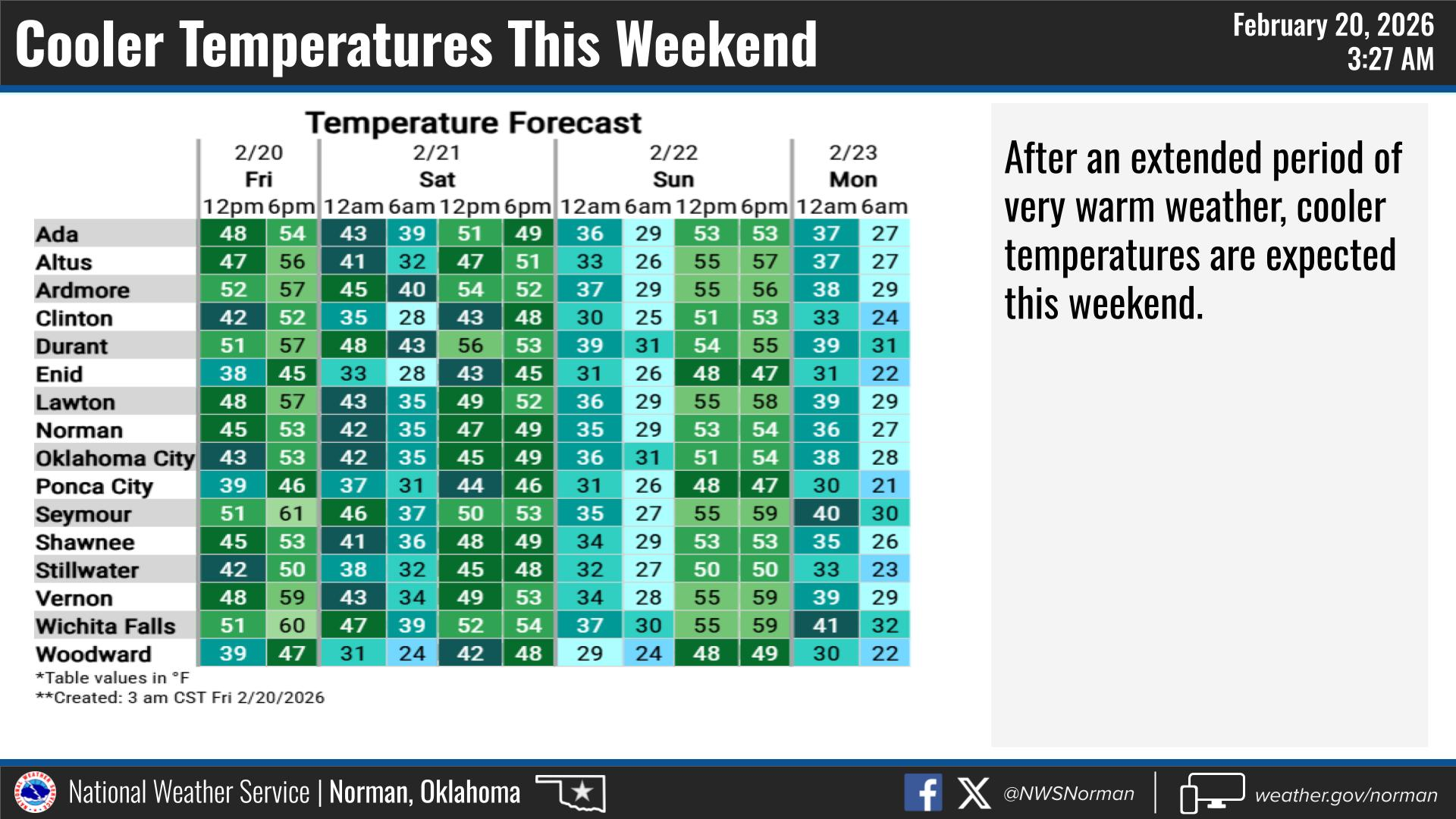
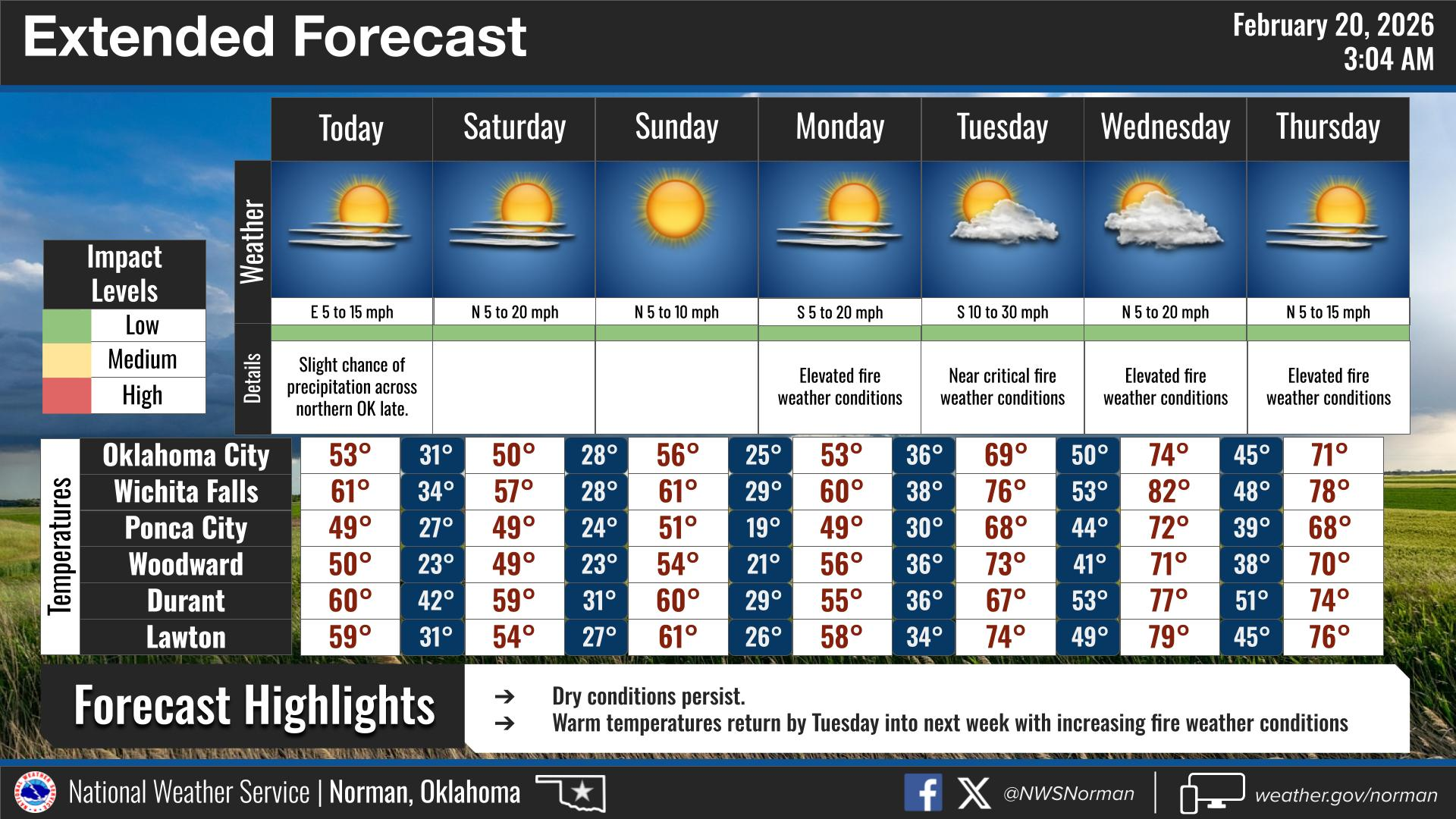
We’re off to a cold start this morning, so if you’re heading out early, be sure to bundle up. We’ll see a mix of clouds and sunshine throughout the day, with afternoon highs reaching the upper 40s. Overall, it will be a decent day just on the cool side. Winds may be breezy at times, which will make it feel a little colder than the actual temperature.
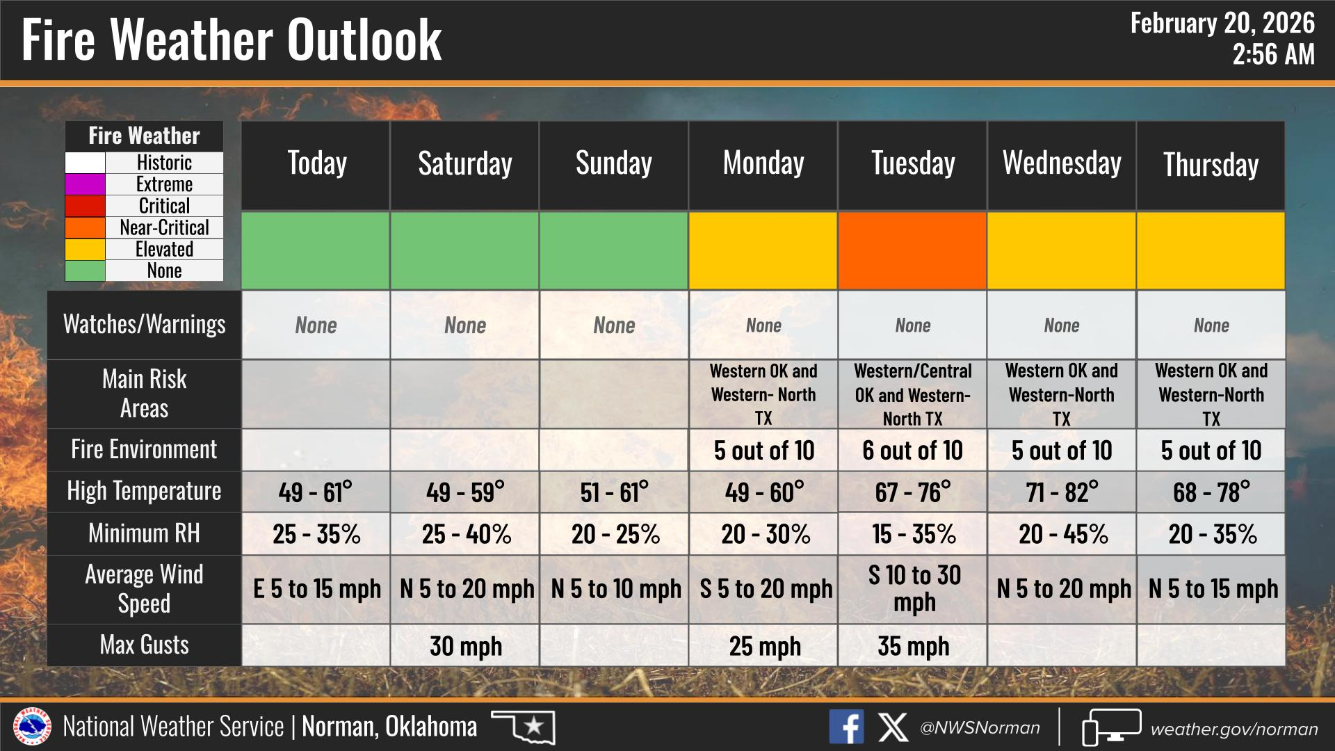
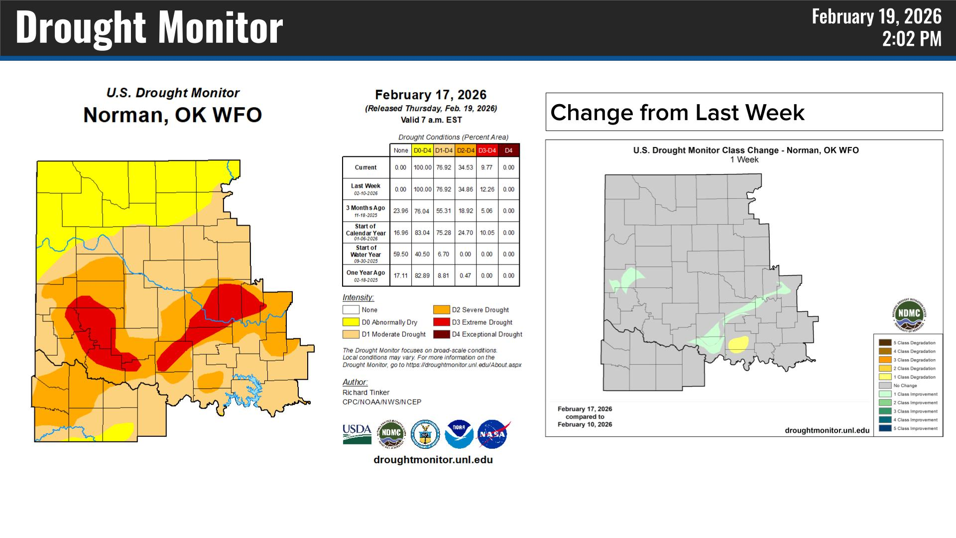
The elevated fire weather conditions we’ve experienced recently have calmed down for now and should remain lower through the weekend. However, conditions are still very dry across the county. Please continue to use extreme caution with any controlled burning and follow all local guidelines.
I’ve been in Oklahoma City this week attending the annual Emergency Management Conference and training. I want to sincerely thank our first responders for their quick response to the fires we saw over the past few days. Your professionalism and dedication do not go unnoticed. I also want to thank our residents for doing your part by taking precautions and avoiding outdoor burning.
HERE IS TODAY’S FORECAST FROM THE NWS/NORMAN:
TODAY – Mostly sunny. Highs in the upper 40s. North winds 5 to 10 mph, becoming east this afternoon.
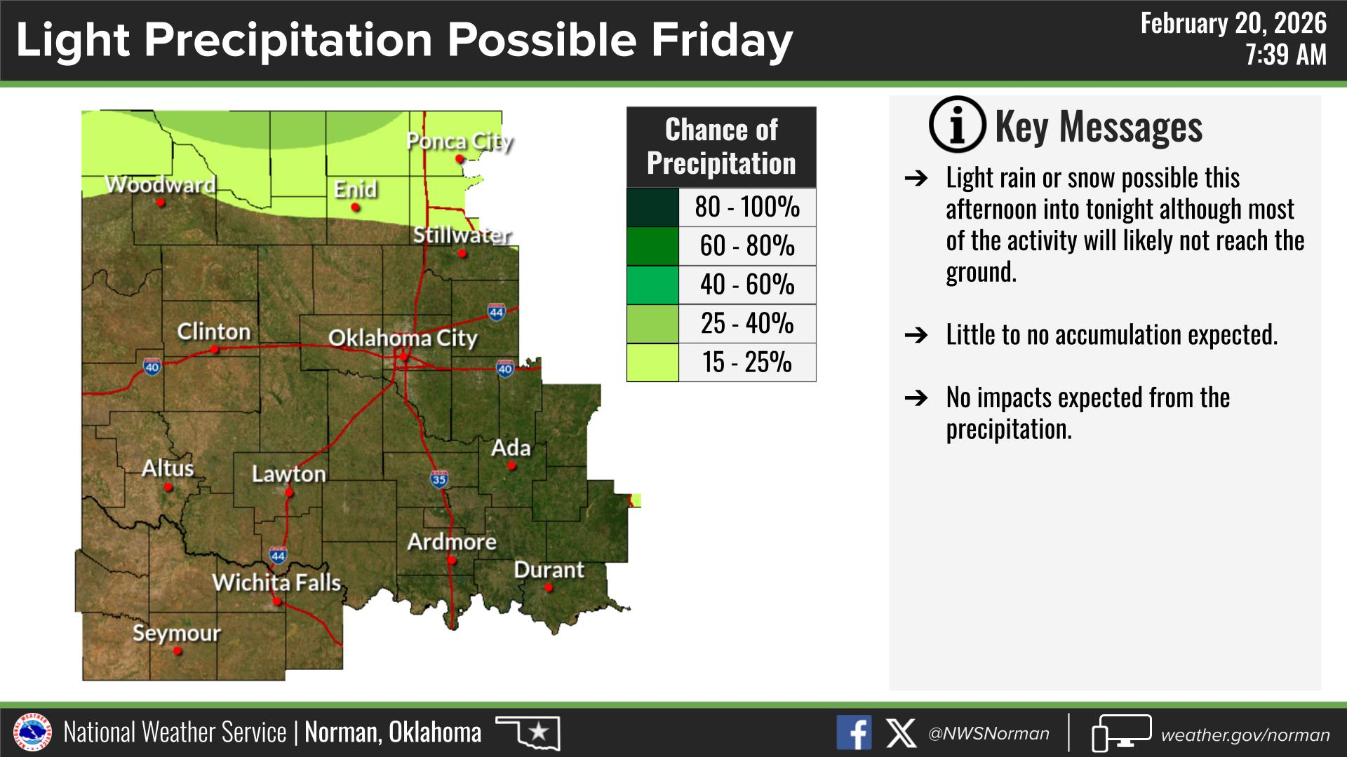
TONIGHT – Mostly clear. A slight chance of rain and snow showers in the evening. Cold with lows in the mid 20s. Northeast winds 10 to 15 mph. Chance of precipitation 20 percent.
Have a Great Friday!
Jacob Price GCEM-1