FRIDAY WEATHER OUTLOOK FROM GARFIELD COUNTY EMERGENCY MANAGEMENT – 01/23/2026
Good morning, Garfield County!
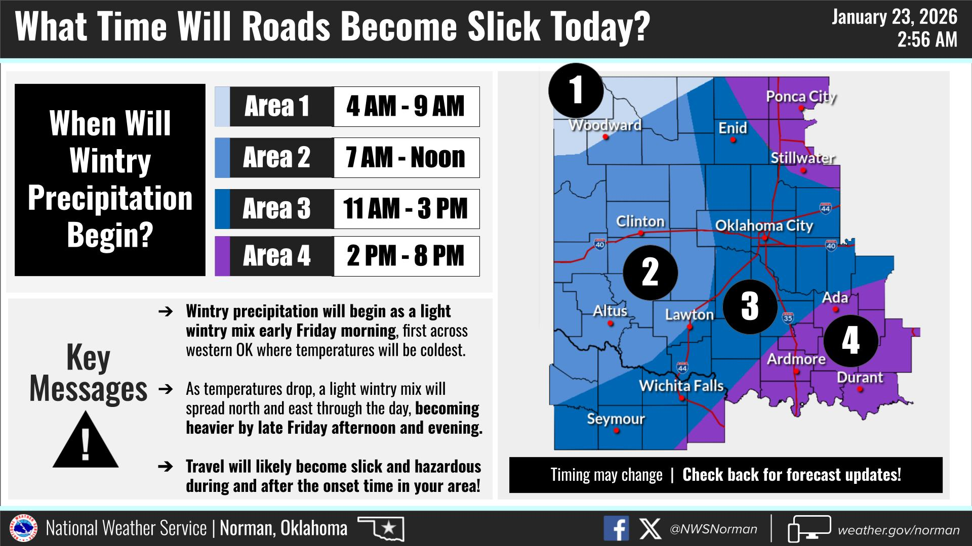
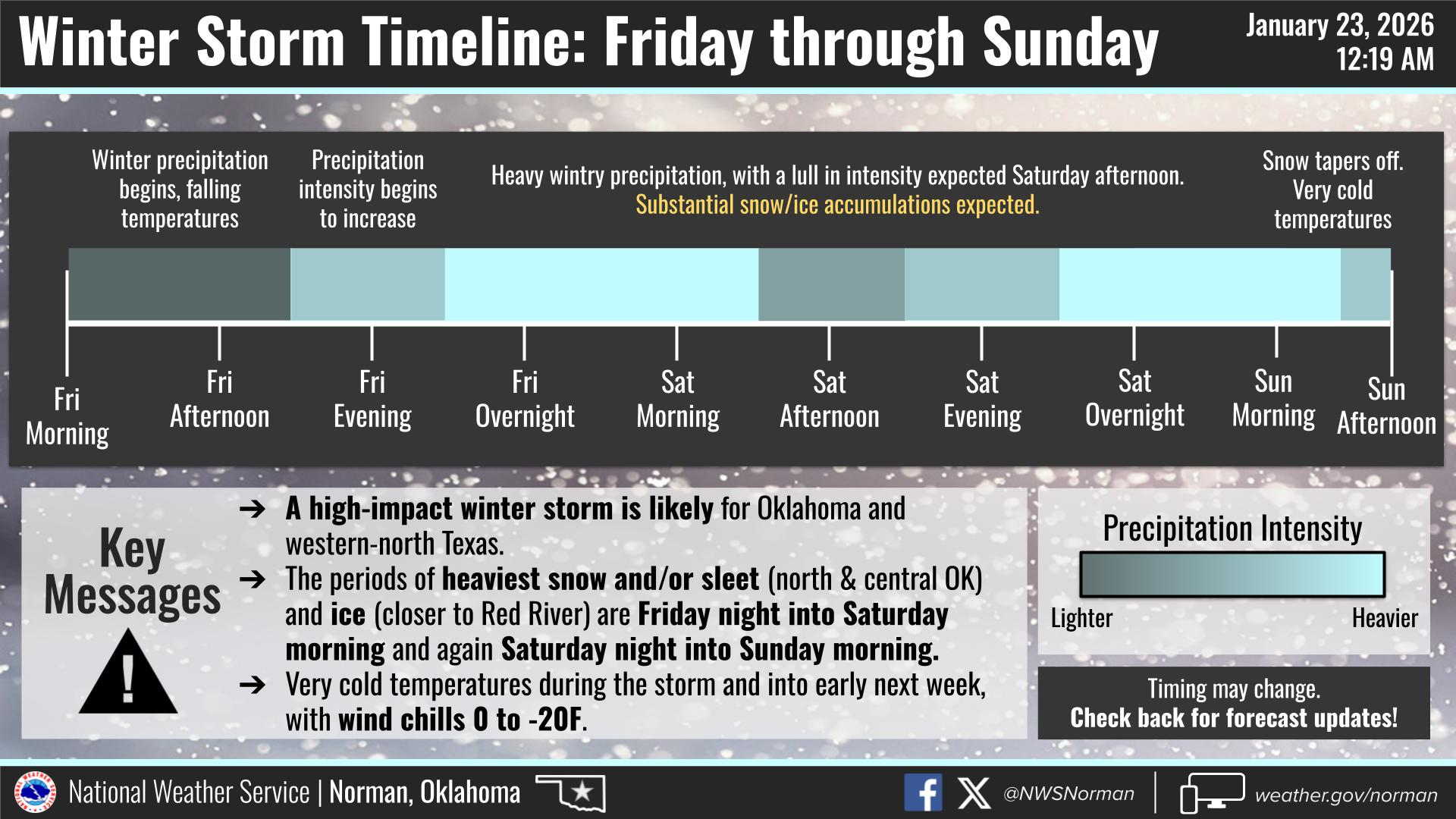
The front has arrived. Expect a blustery day with temperatures falling throughout the afternoon. Heaviest snow and sleet are expected tonight through Saturday morning, and then again Saturday night into Sunday. I still advise against any travel this afternoon into evening. The timeline given for roads to become slick, is between 11:00am – 3:00pm. Get home early if possible and avoid traveling through Sunday. If you have to get out, drive slowly, dress in layers, make sure your phone is charged, take extra water, and let someone know where you are going. Frostbite and Hypothermia are big concerns with the temperatures. Cover all exposed skin and take frequent warming breaks.
Today’s Forecast from the NWS/Norman:
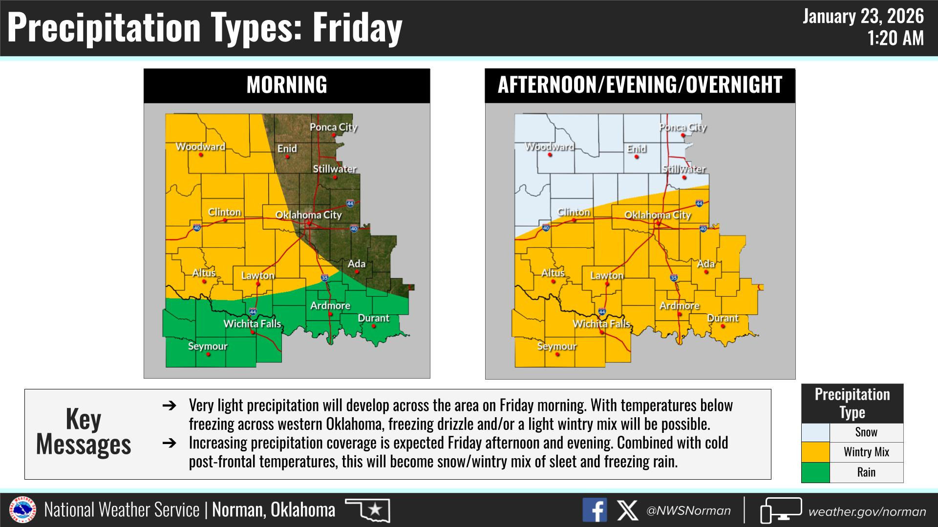
Today – Cloudy. A chance of snow and freezing rain this afternoon. Little or no snow accumulation. Ice accumulation around a trace. Blustery and much colder with highs in the upper 20s. Temperature falling to around 19 this afternoon. Northeast winds 20 to 25 mph with gusts up to 40 mph. Chance of precipitation 50 percent. Wind chill values as low as zero.
Tonight – Snow. Snow may be heavy at times after midnight. Snow accumulation of 4 to 6 inches. Colder with lows around 3 above. Northeast winds 15 to 20 mph with gusts up to 30 mph. Chance of snow near 100 percent. Wind chill values as low as 13 below.
Important Winter Storm Details:
- Active Warnings:
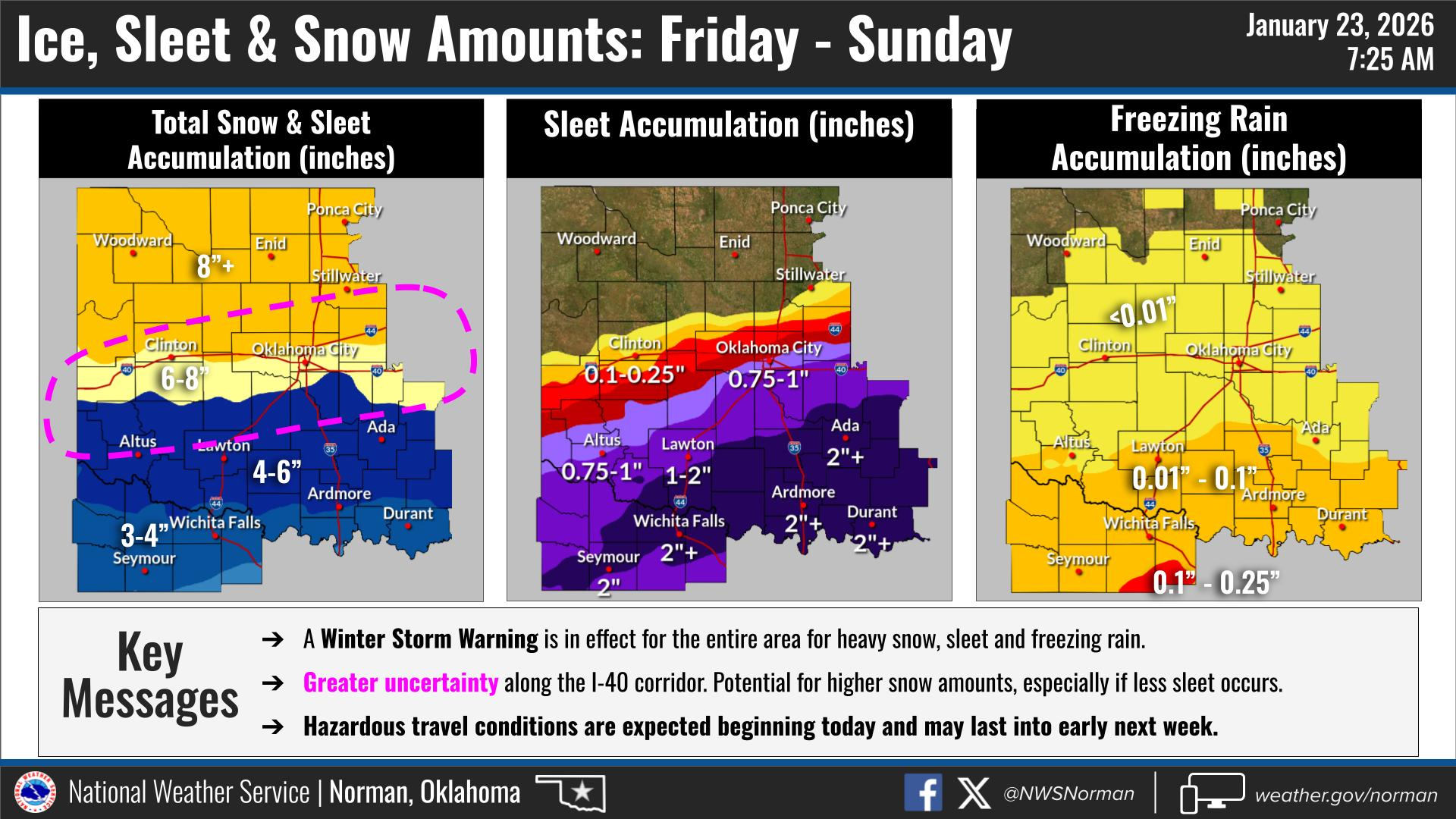
-Winter Storm Warning in effect from January 23, 06:00 AM CST until January 25, 12:00 PM CST
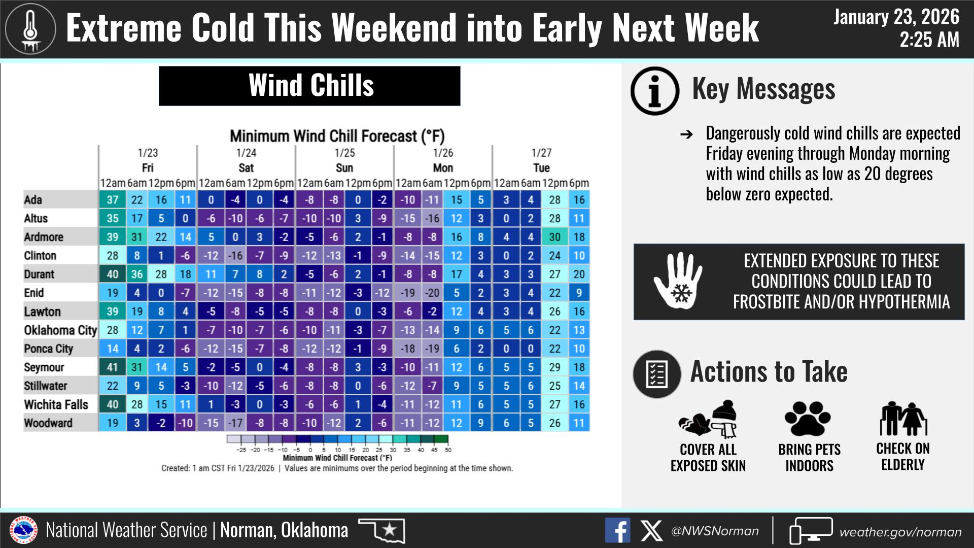
-Extreme Cold Warning in effect from January 24, 12:00 AM CST until January 26, 09:00 AM CST
- Snow Totals: We are trending toward 8+” of total accumulation through Sunday.
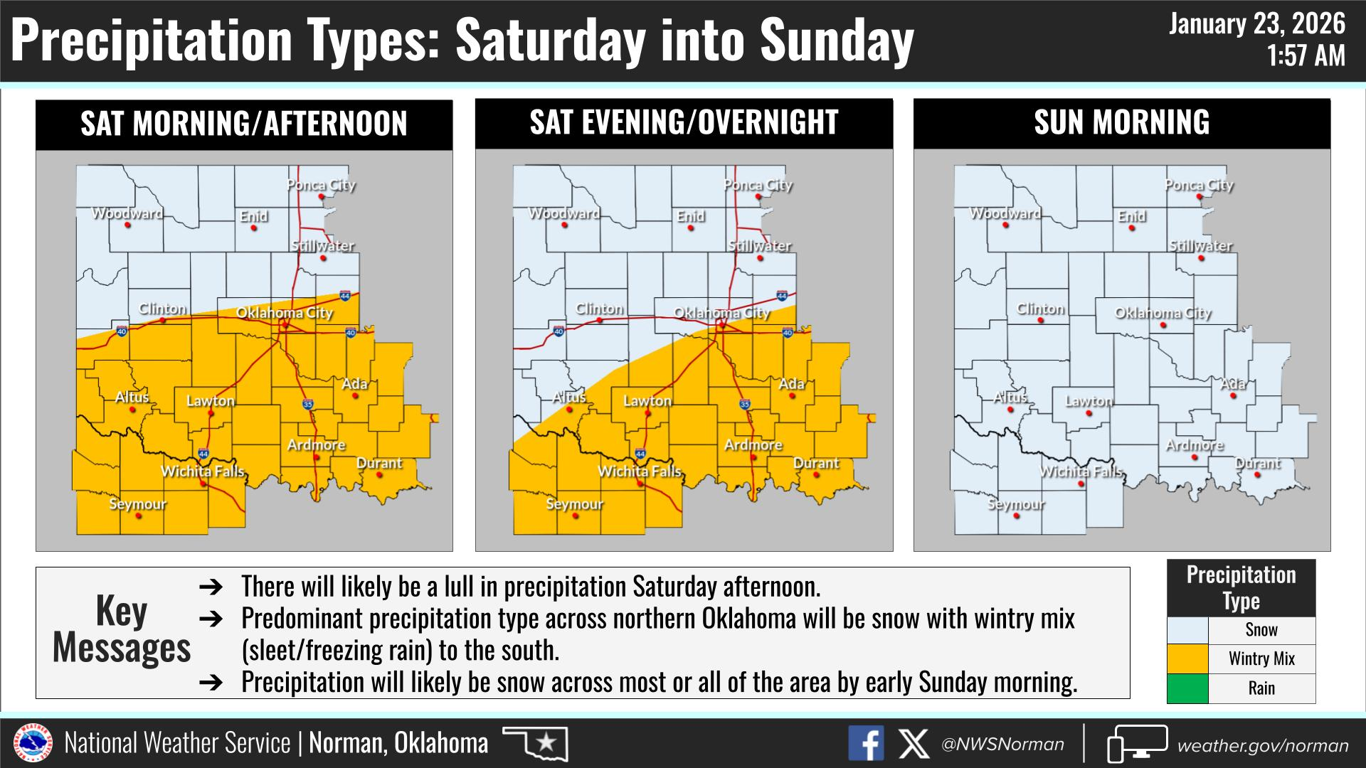
- Timeline: Wintry mix starts this morning, becoming heavy snow/sleet tonight. A brief lull is possible Saturday afternoon before another round moves in.
- Dangerous Cold: Lows will plummet to around 3°F tonight, with wind chills as low as -16°F.
Safety Tips:
- Travel: Road conditions will become extremely dangerous by this evening. Please avoid travel if possible.
- Home Prep: Keep those faucets dripping and unhook any hoses.
- Exposure: If you have to be out, bundle up. Frostbite can settle in very quickly in these wind chills.
STAY WARM AND HAVE A GREAT DAY!
JACOB PRICE GCEM-1