0305L-FRIDAY OUTLOOK FROM GARFIELD COUNTY EMERGENCY MANAGEMENT- 11/21/25
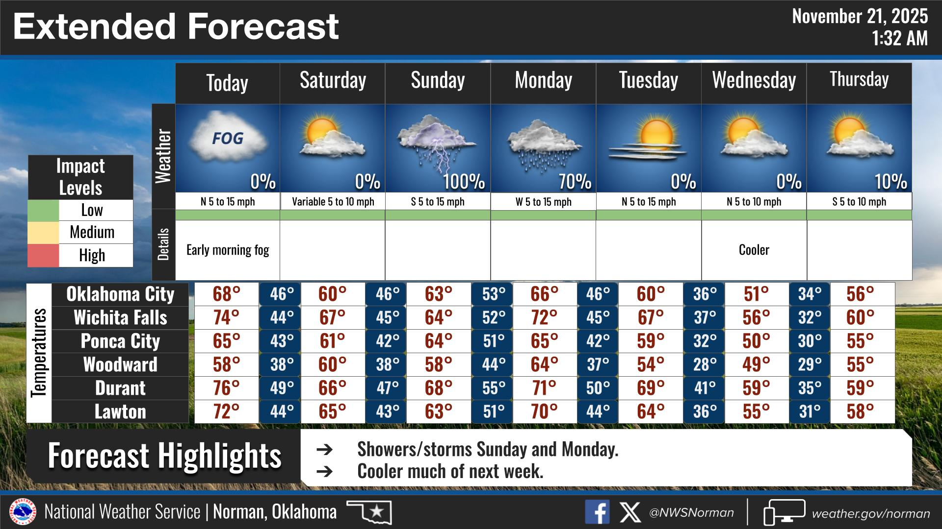
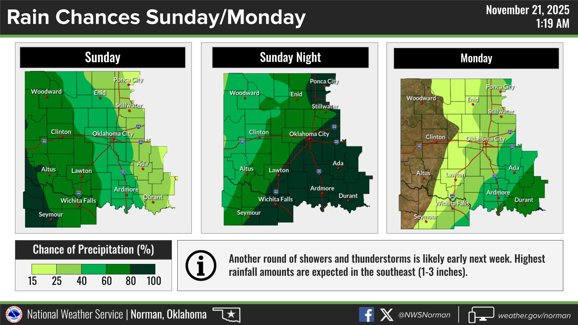
Well, we ended up with around ¼ inch of rainfall which helps but it wouldn’t hurt to see more. We may get that chance again on Sunday evening but the heavier rainfall appears that it may fall in southern and southeastern Oklahoma. We’ll see another front push into the area again later today bringing slightly cooler air. We’ll see what happens.
The graphics that I post are from the NWS. After looking at them and hopefully you reading the info, the graphics will change some during the day and be posted to the NWS/NORMAN webpage here at this link- www.weather.gov/oun It’s important to note that unless we have any major weather issues during the day or night, I won’t post those differences. On the Garfield County EM app, you can get directly to the NWS/NORMAN site by clicking on Local Weather in the upper left corner of the app.
Overall, we’ll be ok, so here is your forecast from the NWS/NORMAN:
Friday- Mostly sunny. Highs in the mid-60s. West winds 10 to 15 mph.
Friday Night- Mostly cloudy. Lows in the lower 40s. Northwest winds 5 to 10 mph.
GARFIELD COUNTY EM is our notification and preparedness app. If you don’t have it, you’re NOT prepared! REMEMBER that each day’s post appears under the GCEM Blog icon on the app.
HAVE A GOOD DAY!