0248L-FRIDAY OUTLOOK FROM GARFIELD COUNTY EMERGENCY MANAGEMENT- 11/7/25
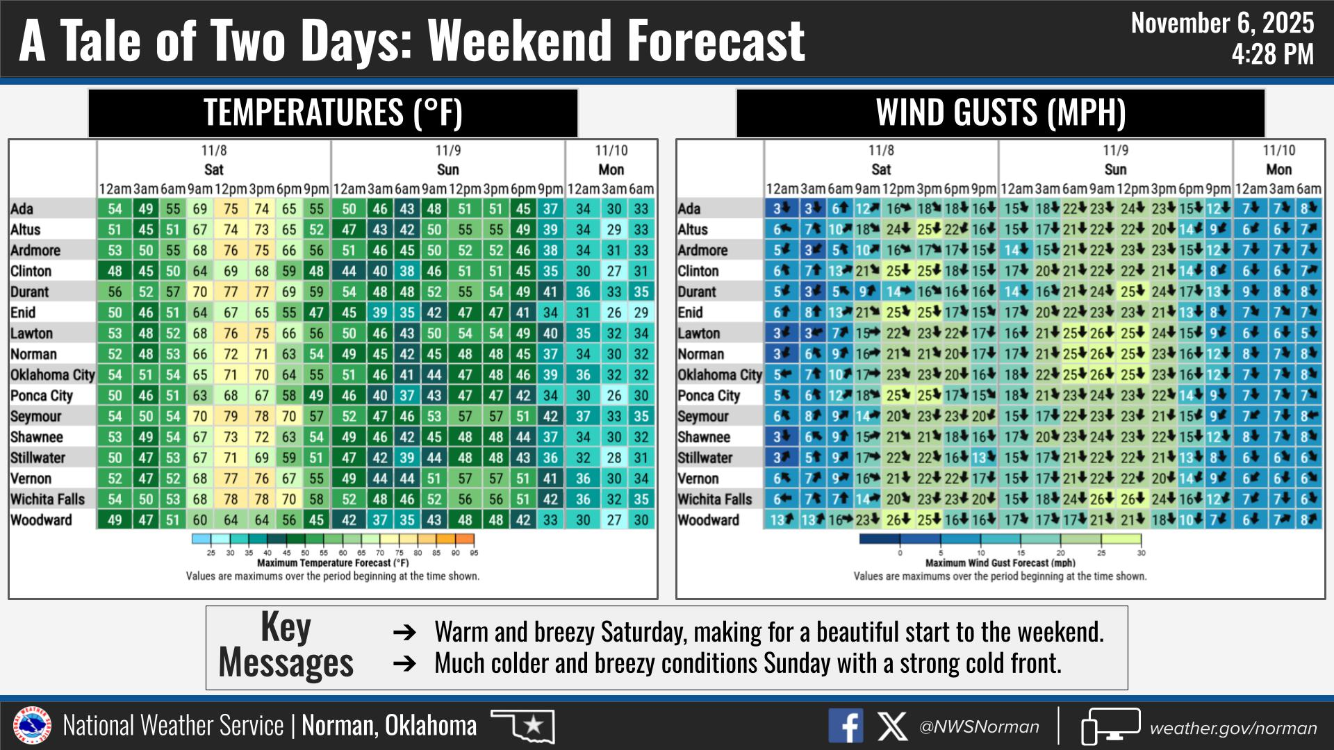
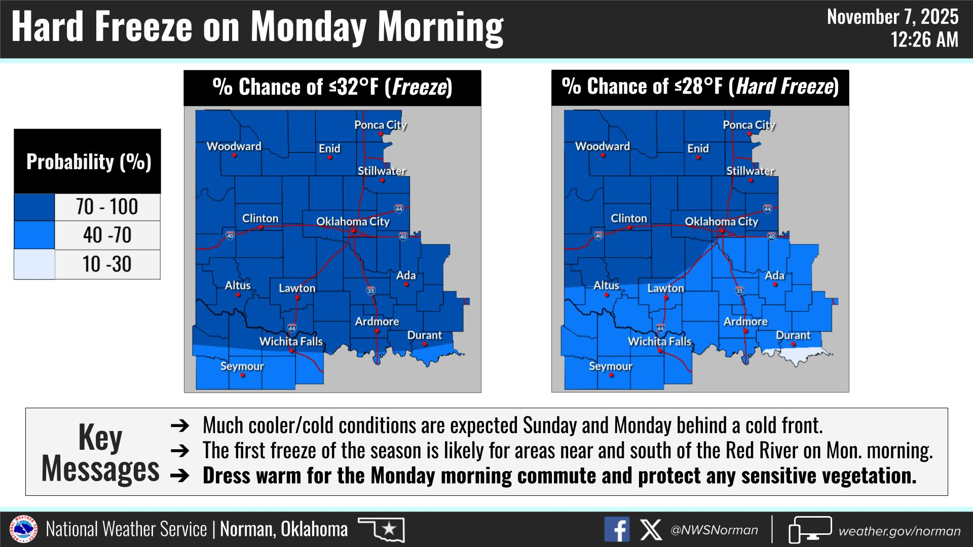
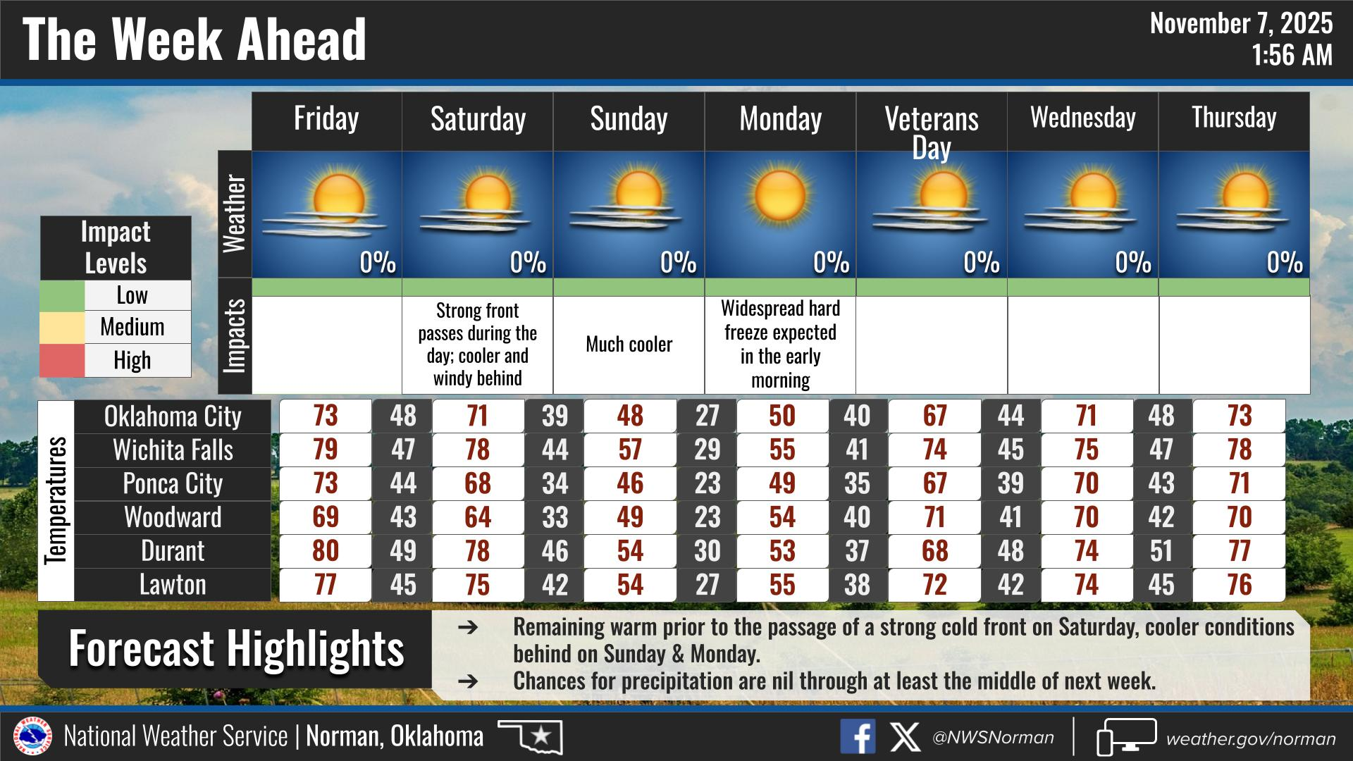
A very weak front pushed thru the area overnight. This has caused a windshift but temps will still climb into the upper 60s to low 70s. Today will be a nice day to get out and get some fresh air. Saturday, we’ll have a cold front move in and it’s downhill from there. Colder air and the windchill temps will definitely drop and it appears that Monday morning we’ll see a hard freeze with temps in the low 20s and colder windchill temps. You have today to make sure you have everything taken care of in bracing for the cold weather.
Foliage is slowly going dormant and most of it is very dry. The fire danger is slowly climbing so use extreme caution if using anything related to fire. Drought conditions are slowly creeping back into the region so keep an eye out for smoke and fire and call 911 if you see any.
Overall, we’ll be ok, so here is your forecast from the NWS/NORMAN:
Friday- Sunny. Highs in the lower 70s. North winds 5 to 10 mph.
Friday Night- Mostly clear. Lows in the lower 40s. West winds around 5 mph, becoming south after midnight.
GARFIELD COUNTY EM is our notification and preparedness app. If you don’t have it, you’re NOT prepared! REMEMBER that each day’s post appears under the GCEM Blog icon on the app.
HAVE A GOOD DAY!