0305L-FRIDAY OUTLOOK FROM GARFIELD COUNTY EMERGENCY MANAGEMENT- 10/17/25
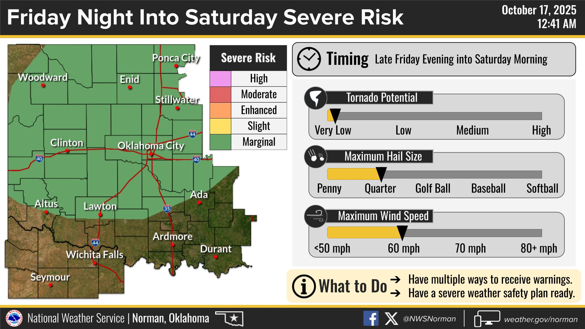
WARM AND WINDY during the day, then showers and thunderstorms this evening and overnight into Saturday. We are in a MARGINAL RISK with winds and hail as the main threats. The tornado risk is very low. See graphics.
Overall, we’ll be ok, so here is your countywide forecast from the NWS/NORMAN:
Friday- Sunny. Highs in the upper 80s. South winds 15 to 20 mph with gusts up to 30 mph.
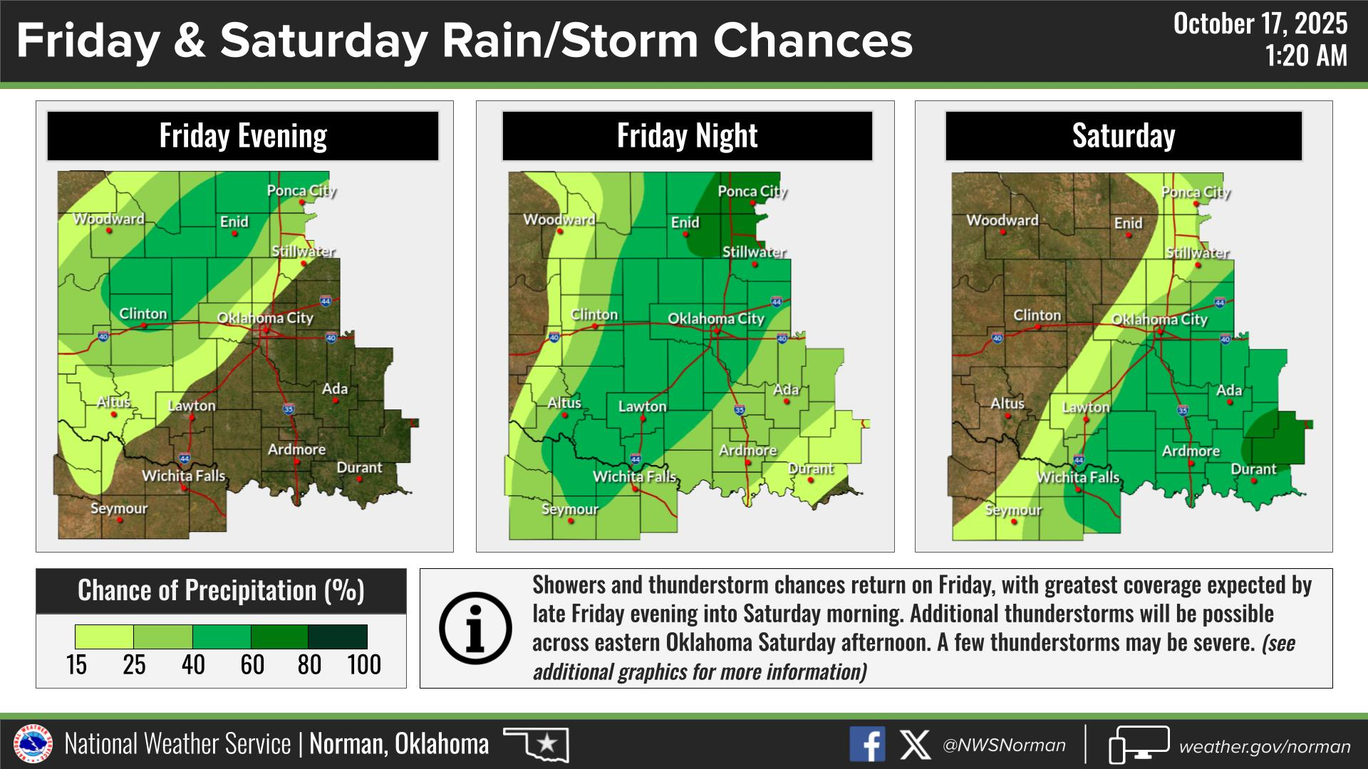
Friday Night- Mostly clear in the evening, then becoming partly cloudy. A chance of thunderstorms. A chance of showers in the evening, then showers likely after midnight. Lows around 60. South winds 10 to 15 mph. Chance of rain 70 percent.
GARFIELD COUNTY EM is our notification and preparedness app. If you don’t have it, you’re NOT prepared! REMEMBER that each day’s post appears under the GCEM Blog icon on the app.
HAVE A GOOD DAY!