0255L-FRIDAY OUTLOOK FROM GARFIELD COUNTY EMERGENCY MANAGEMENT- 10/24/25
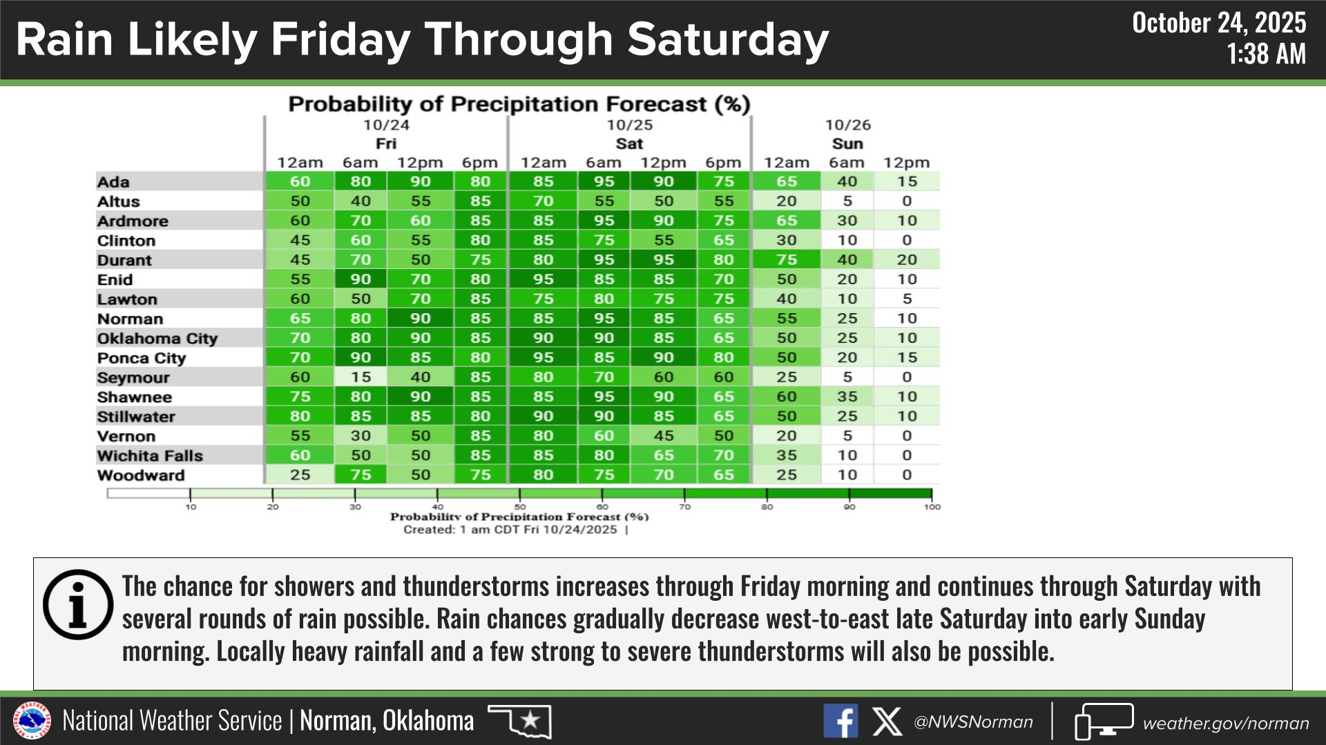
Storms formed in the southern and central portions of the county overnight. They did move out quickly but some much needed rain did fall in an area from Breckinridge to Waukomis to Douglas and Covington. Let me know how much rain you all may have received. We are still under the Flood Watch through Saturday afternoon. Rain probabilities for us are in the 70 to 90 percentile area between now and Saturday afternoon.
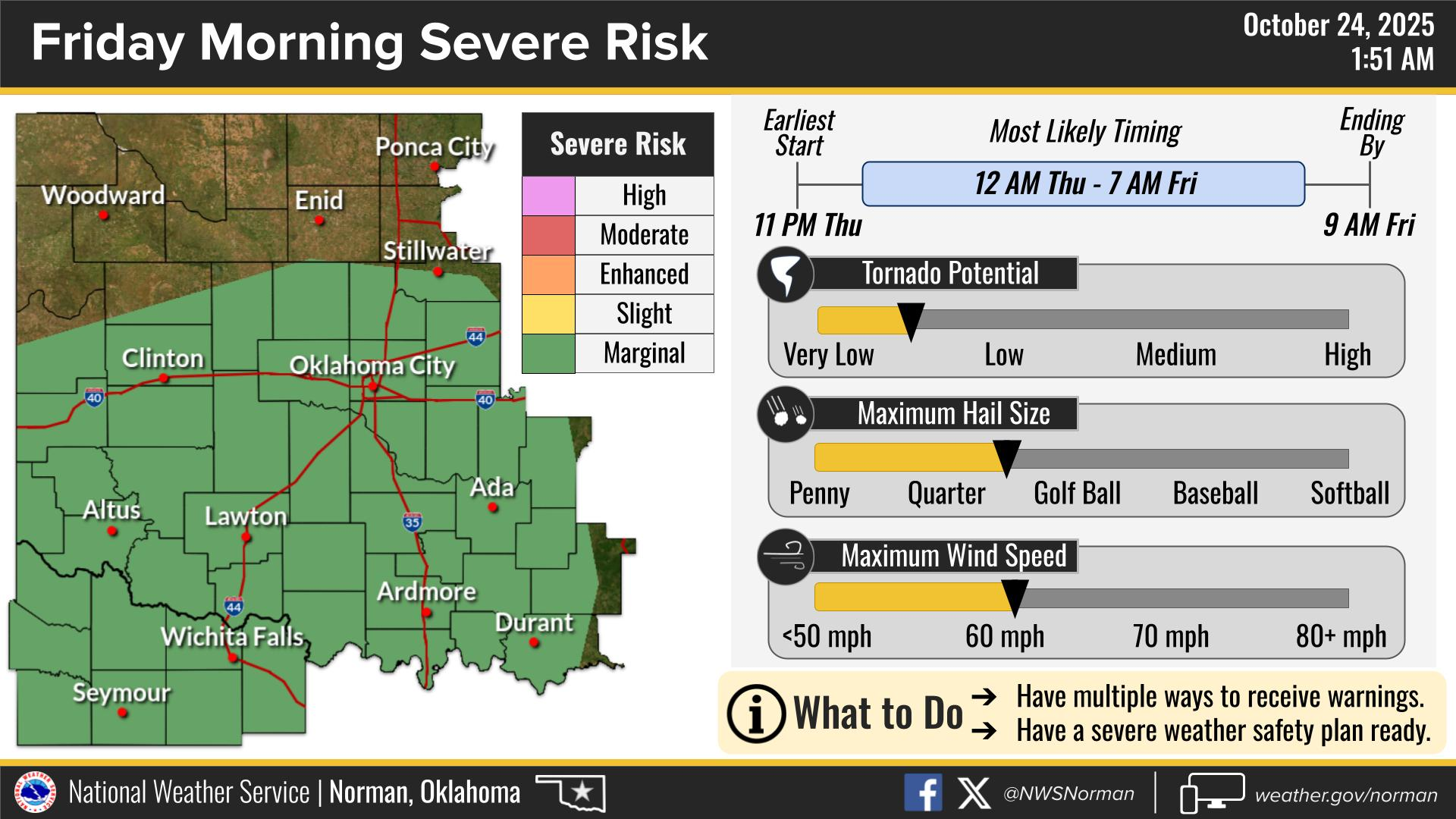
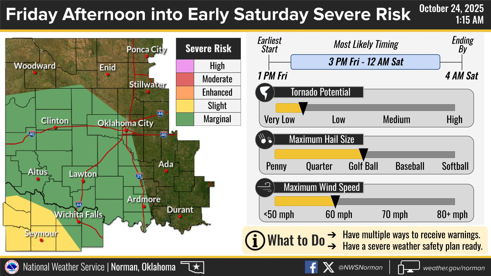
Today’s possibilities for us remain nominal. We are in a GENERAL RISK area for severe weather this afternoon. Again, the SW QUADRANT of the state is where the forecast higher threat will be for large hail, damaging winds, and yes, a tornado threat though very low. We’ll see how this mess continues and maybe we’ll see some rainfall and for others, you may see additional rainfall. JUST FYI: COLDER WEATHER MAY ARRIVE BY MID-WEEK!
Overall, we’ll be ok, so here is your countywide forecast from the NWS/NORMAN:
Friday- Showers with a chance of thunderstorms in the morning, then showers with thunderstorms likely in the afternoon. Some thunderstorms may produce heavy rainfall. Locally heavy rainfall possible in the afternoon. Highs in the mid-60s. Southeast winds 10 to 15 mph with gusts up to 25 mph. Chance of rain 90 percent.
Friday Night-Showers. A chance of thunderstorms, mainly in the evening. Some thunderstorms may produce heavy rainfall in the evening. Some thunderstorms may produce heavy rainfall after midnight. Lows in the mid-50s. Southeast winds 10 to 15 mph. Chance of rain near 100 percent.
GARFIELD COUNTY EM is our notification and preparedness app. If you don’t have it, you’re NOT prepared! REMEMBER that each day’s post appears under the GCEM Blog icon on the app.
HAVE A GOOD DAY!