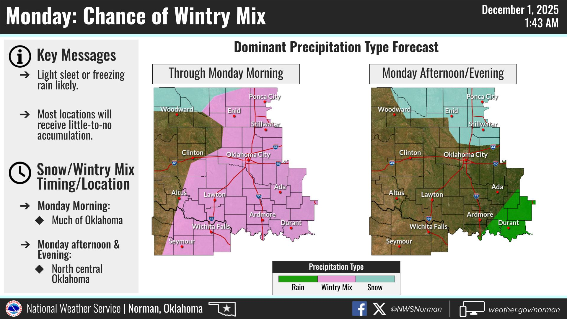
0250L-MONDAY OUTLOOK FROM GARFIELD COUNTY EMERGENCY MANAGEMENT- 12/1/25
Light sleet has been occurring early this morning as of 0230 Local time and will be spotty as the morning moves forward. There may be a chance for light snow but any accumulation will be minimal if at all. The system that is associated with this will move out tonight. REMINDER: even though no accumulation is expected, if there is, bridges and overpasses would be the likely areas where problems may exist. Use extreme caution while driving. Our next chance for wintery precipitation will be Wednesday night into Thursday. We’ll see what happens.
Overall, we’ll be ok so here’s your forecast from the NWS/NORMAN:
Monday- Mostly cloudy. A slight chance of freezing rain in the morning, then a slight chance of snow showers in the afternoon. Highs in the mid-30s. East winds 5 to 10 mph, becoming north in the afternoon. Chance of precipitation 20 percent.
Monday Night- Mostly clear. Cold with lows around 18. Northwest winds around 5 mph, becoming southwest around 5 mph after midnight.
GARFIELD COUNTY EM is our notification and preparedness app. If you don’t have it, you’re NOT prepared! REMEMBER that each day’s post appears under the GCEM Blog icon on the app.
HAVE A GOOD DAY!