MONDAY WEATHER OUTLOOK FROM GARFIELD COUNTY EMERGENCY MANAGEMENT – 3/30/2026
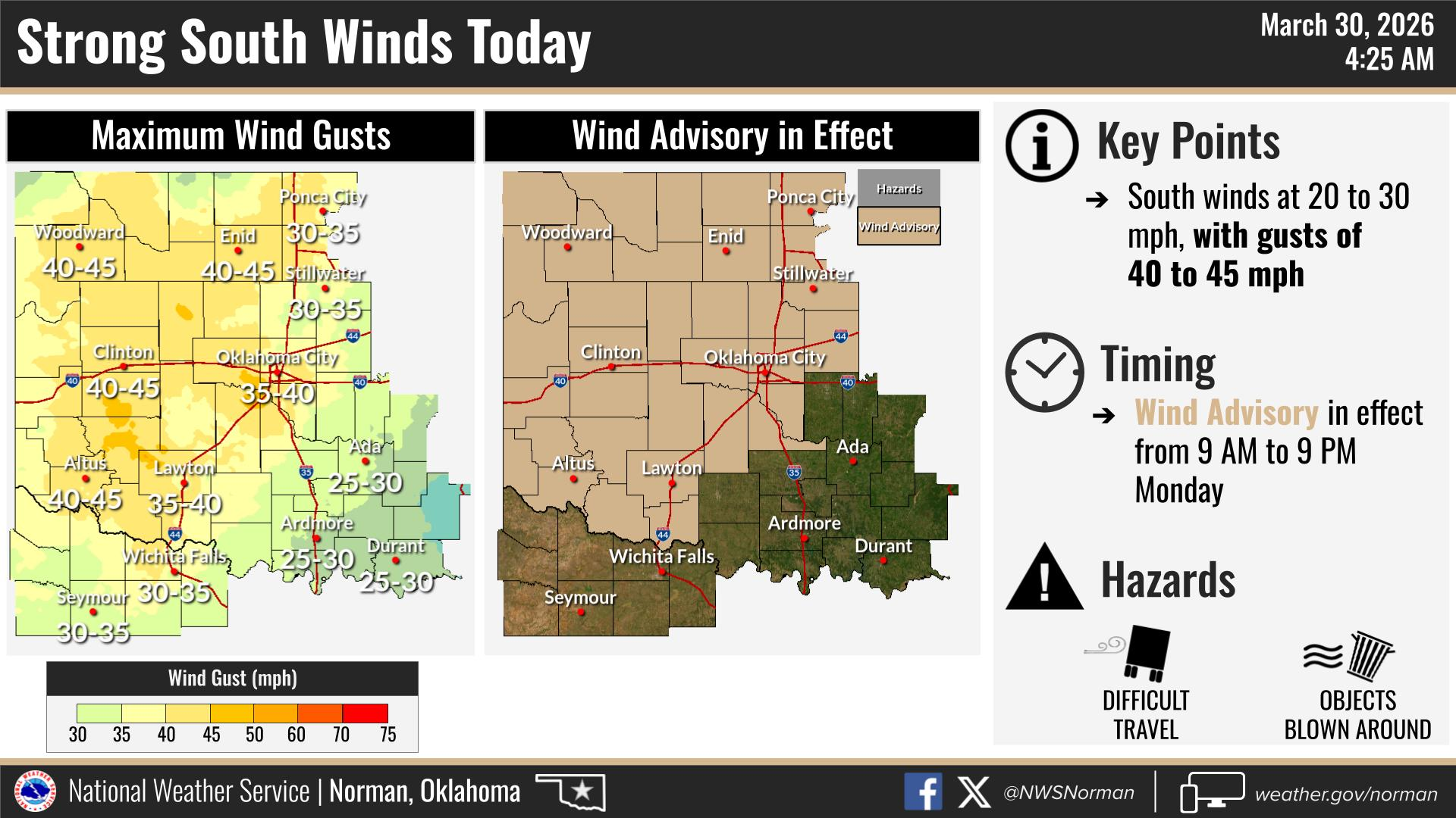
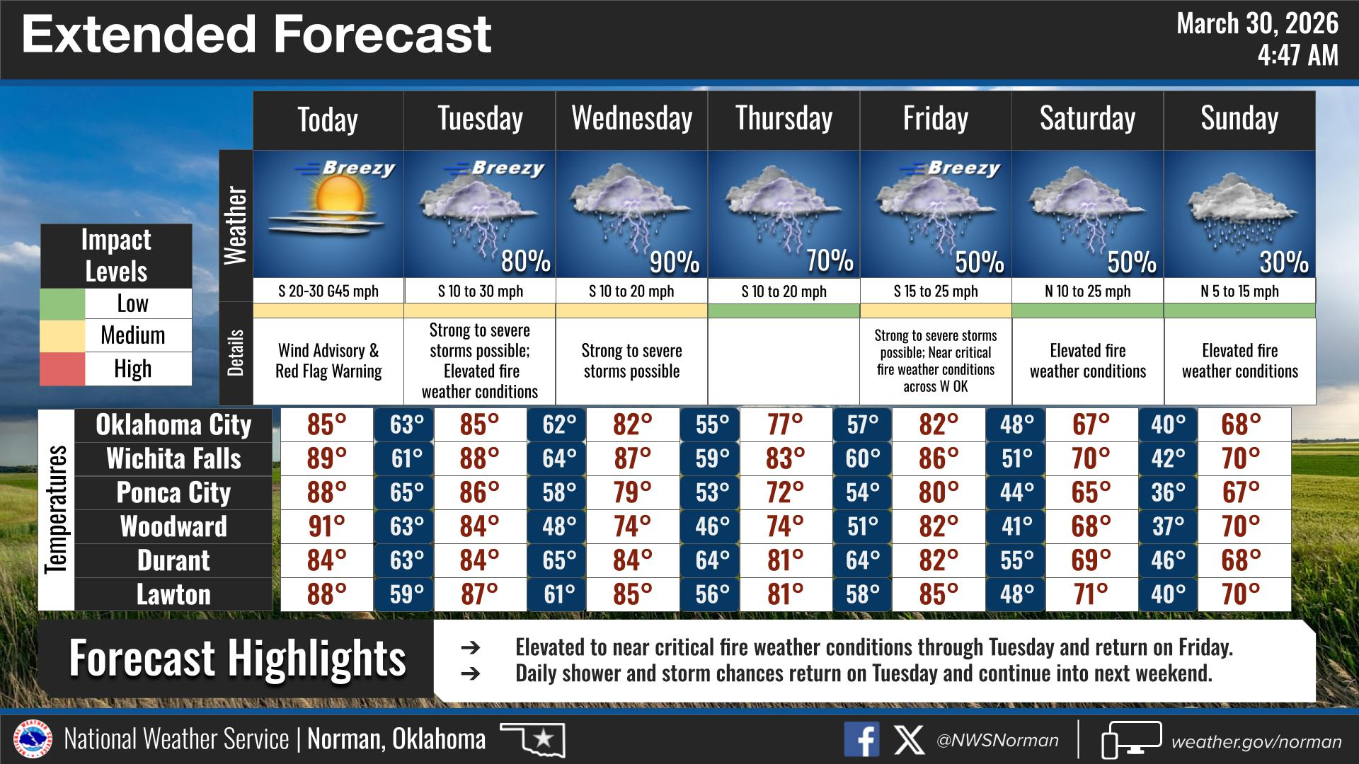
We’ve got a warm and very windy one on tap today across the area, and it comes with a heads up from the National Weather Service Norman a Wind Advisory is in effect from 9:00 AM to 9:00 PM today.
Expect sunny skies through most of the day with highs climbing into the upper 80s. It’s going to feel more like early summer than spring, but that strong south wind is really going to take center stage. Winds will run 15 to 25 mph this morning, increasing to 25 to 30 mph this afternoon, with gusts pushing up near 45 mph at times. It’s one of those days where anything not tied down could end up in your neighbor’s yard, so you might want to secure loose items early.
As we head into tonight, clouds will start to build in, especially later on. It’ll stay breezy and windy overnight with south winds continuing at 20 to 30 mph and gusts still around 45 mph. Temperatures won’t fall much either, only dropping into the mid-60s, so it’s going to be a mild night overall.
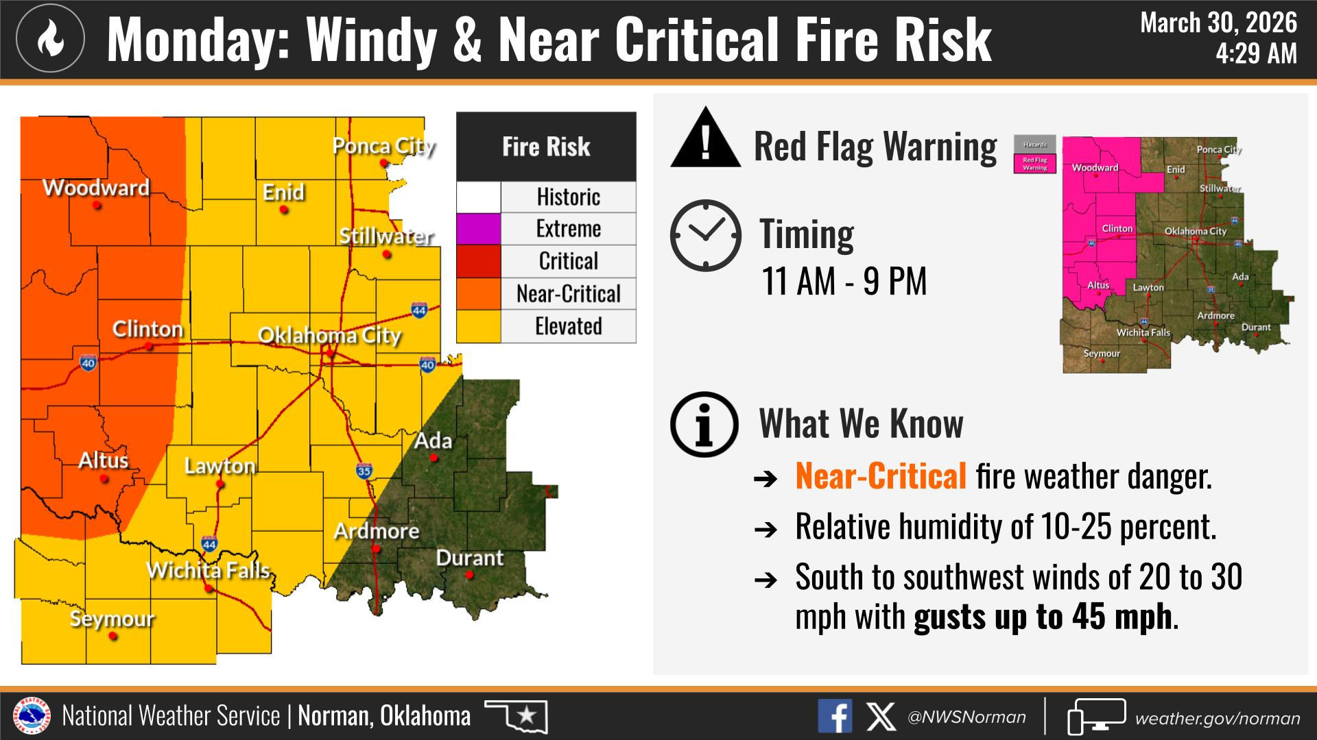
With these strong winds and warm temperatures, we’ll also be dealing with elevated fire weather conditions across the area. Just be mindful about anything that could spark a fire today.
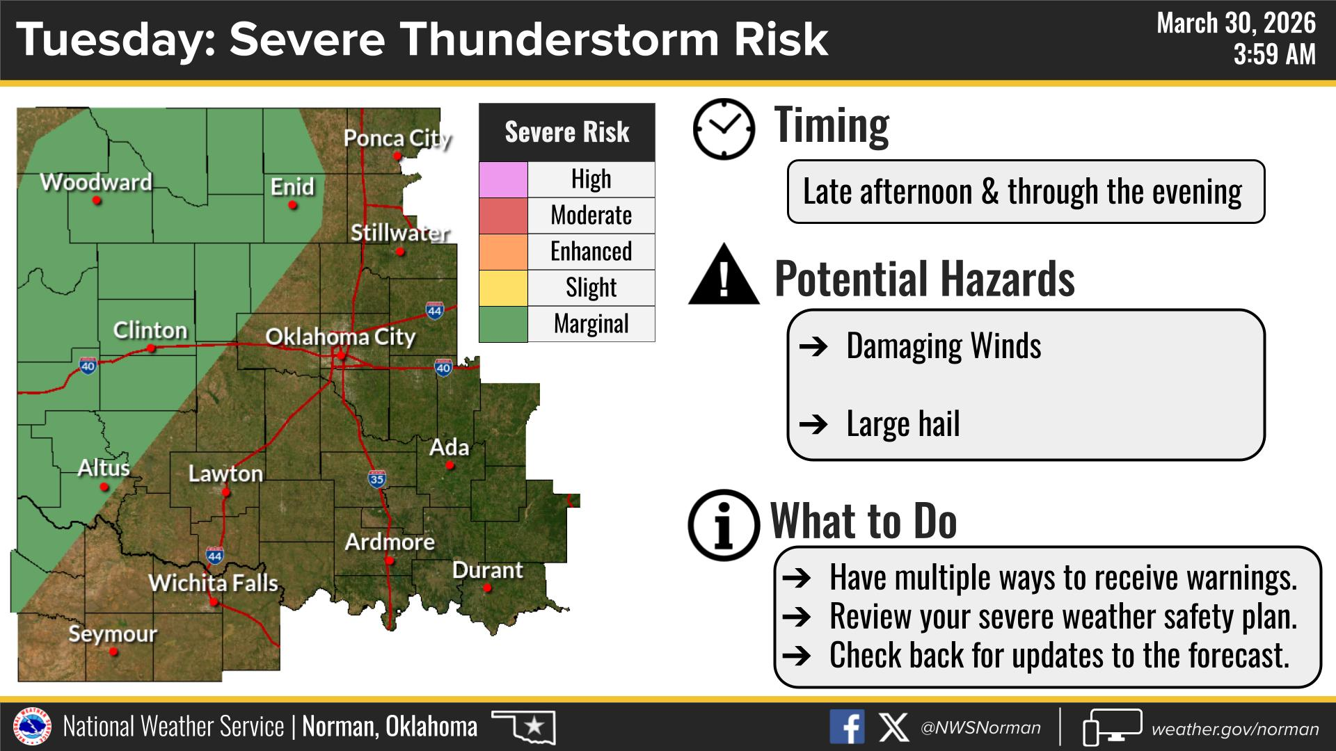
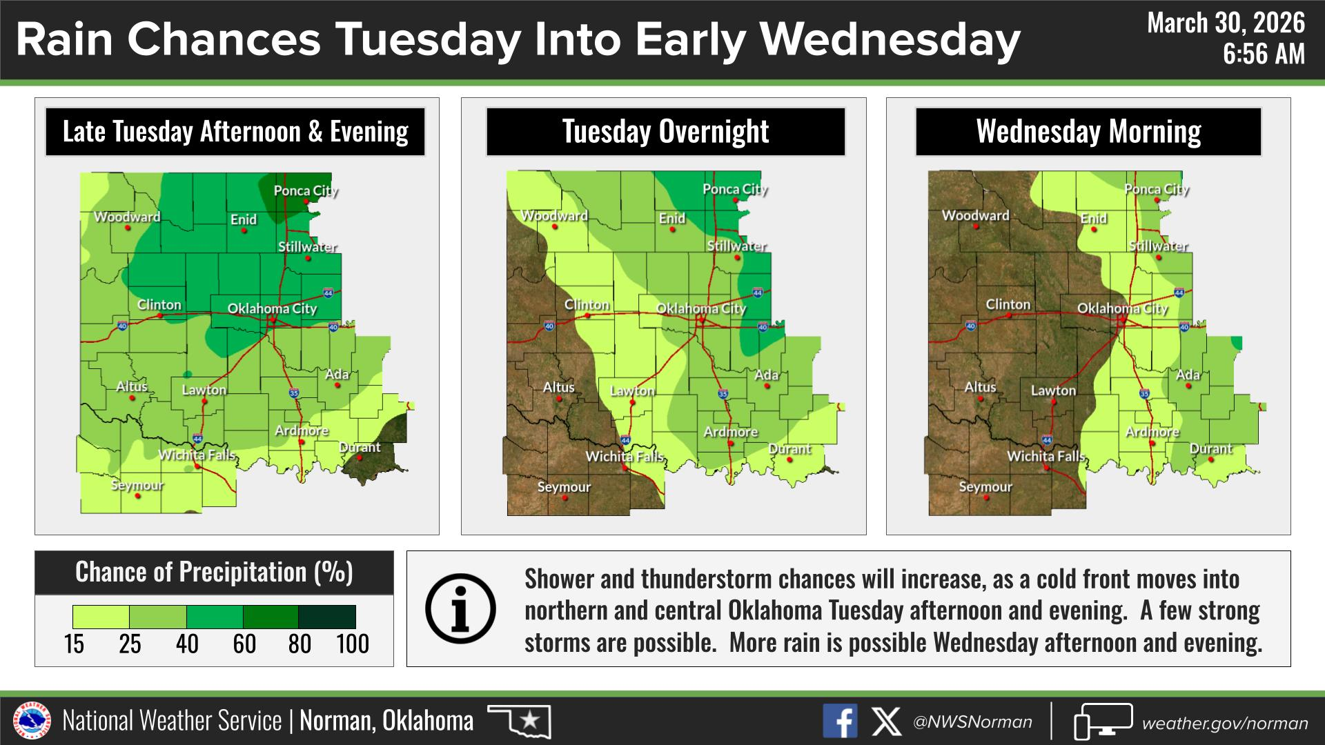
We do have a marginal risk for severe weather tomorrow afternoon into the evening. The main threats will be damaging winds and large hail. We will hopefully see much-needed rain with these systems.
Stay safe, stay weather aware, and hang onto your hats, and we will advise as needed.
Have a Great Day!
Jacob Price EM-1