0305L-MONDAY OUTLOOK FROM GARFIELD COUNTY EMERGENCY MANAGEMENT- 11/10/25
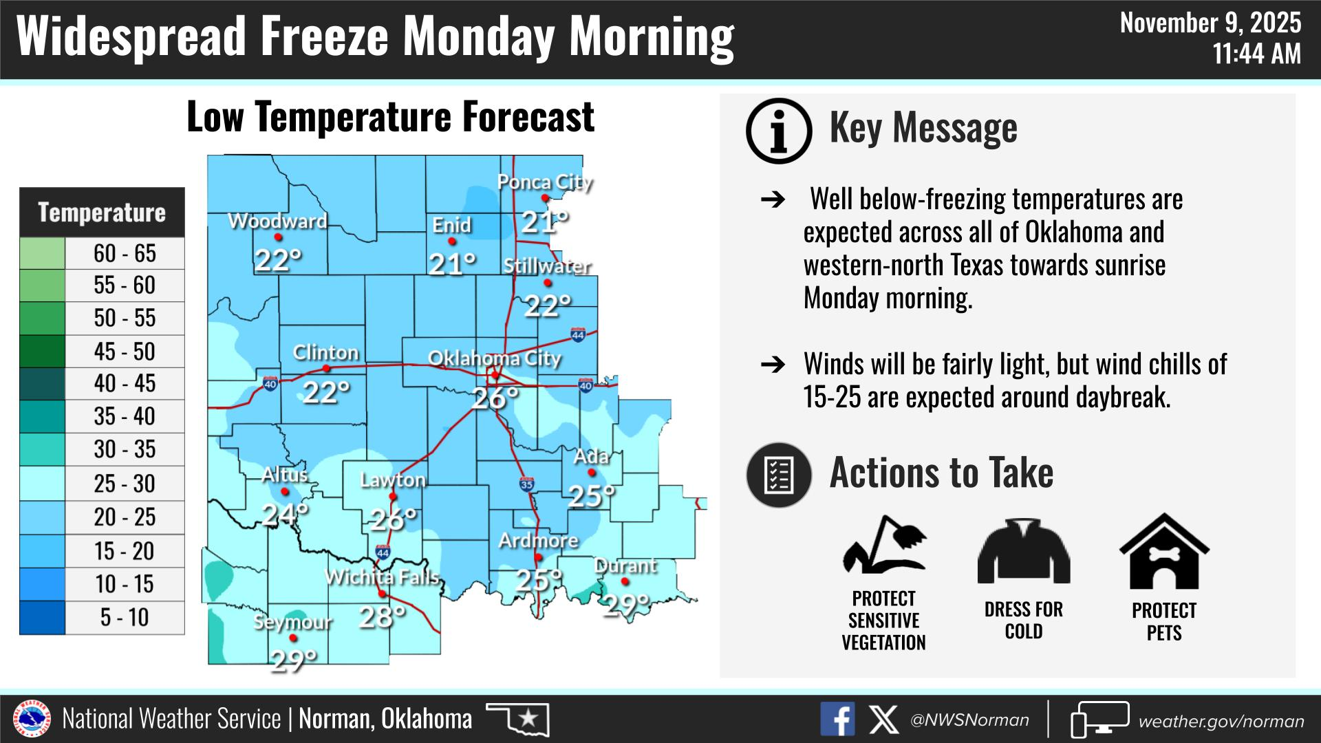
FREEZE WARNING IN EFFECT UNTIL 9 AM THIS MORNING.
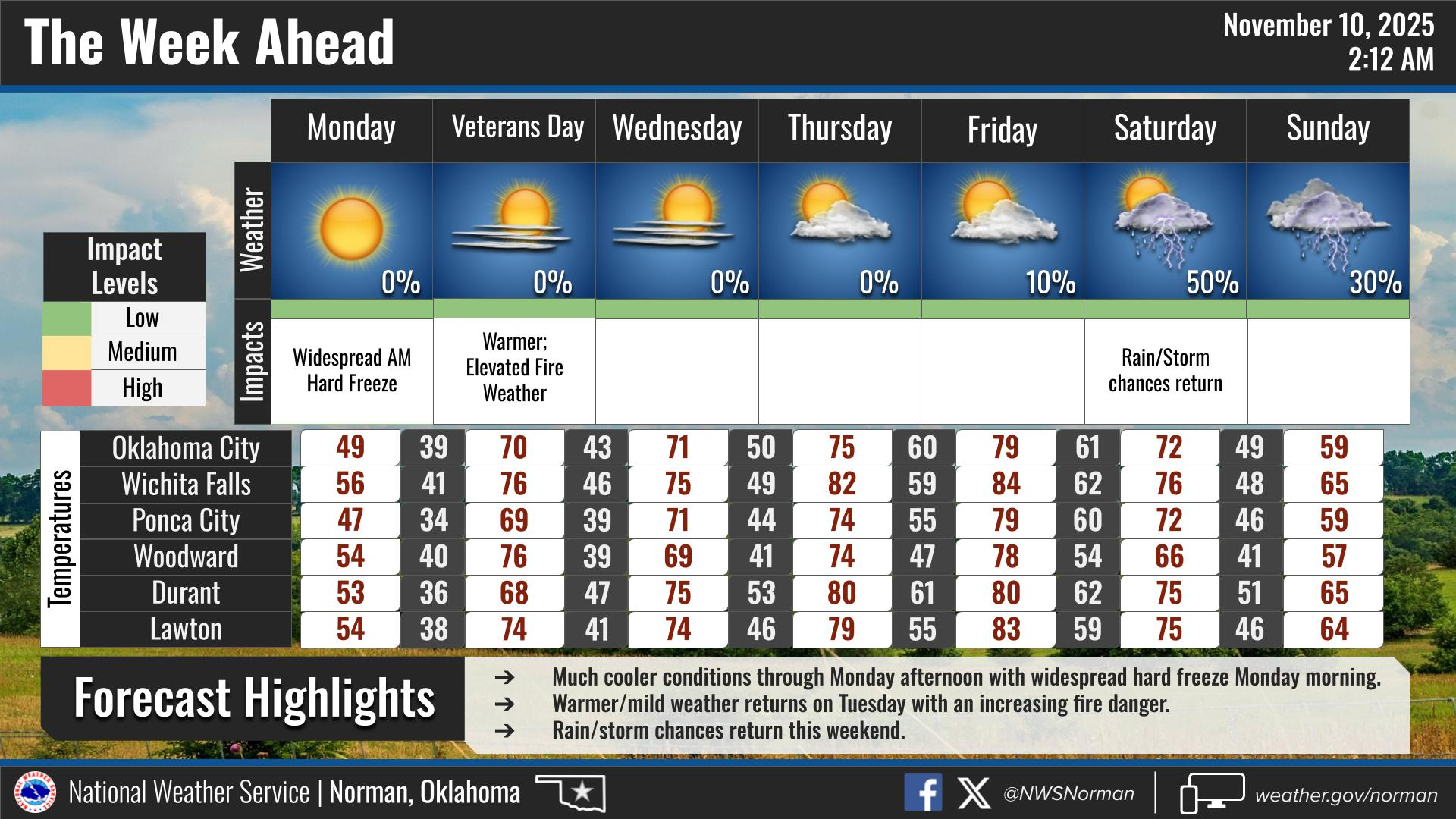
We have dropped into the mid 20’s this morning. Winds around 2 mph is the average right now. Our high today in the 40s will be the coolest day this week as we look to be back up into the upper 60s to low 70s tomorrow along with fairly strong winds. We will have several fronts/troughs move through the area periodically during the week but nothing drastic other than the winds. We will also see moisture return this week as these features verify and we should have enough moisture in the area for a chance for thunderstorms this weekend.
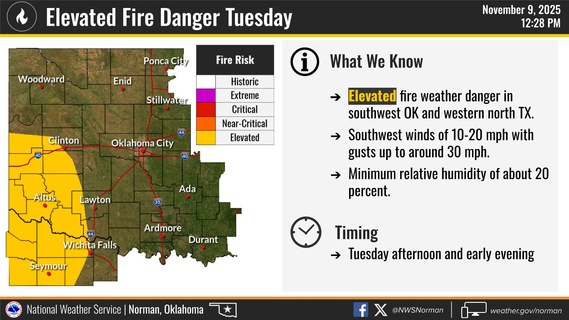
The fire danger continues to increase so keep an eye out for smoke and or fire and call 911 if you see any.
Overall, we’ll be ok, so here is your forecast from the NWS/NORMAN:
Today- Sunny. Highs in the upper 40s. North winds around 5 mph, becoming southwest in the afternoon.
Tonight- Mostly clear. Lows in the mid-30s. South winds 15 to 20 mph.
GARFIELD COUNTY EM is our notification and preparedness app. If you don’t have it, you’re NOT prepared! REMEMBER that each day’s post appears under the GCEM Blog icon on the app.
HAVE A GOOD DAY!