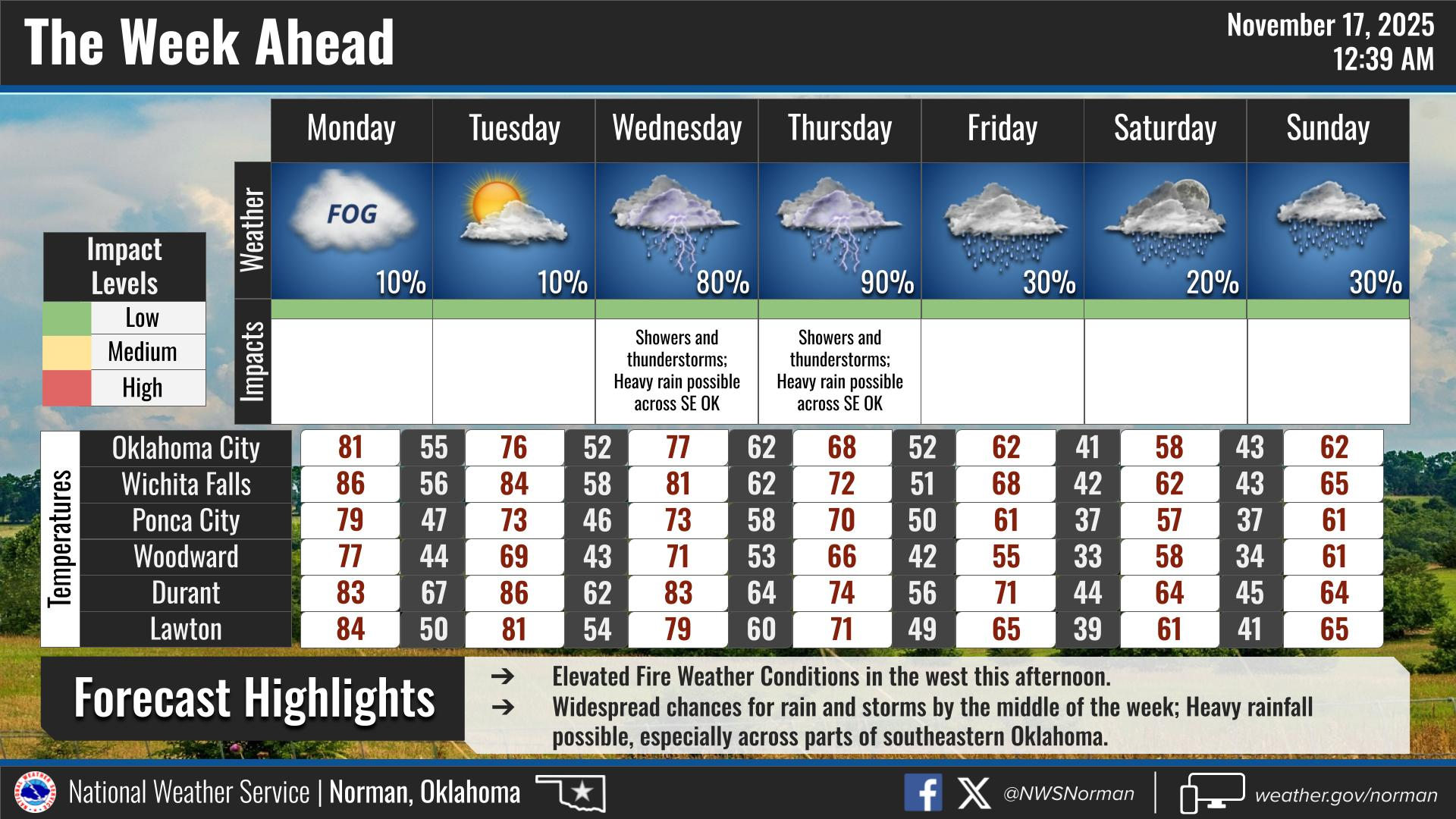
0320L-MONDAY OUTLOOK FROM GARFIELD COUNTY EMERGENCY MANAGEMENT- 11/17/25
It appears we will be cloudy this morning for a bit and then the winds ramp up. We could see wind gusts upwards of 35 mph or higher during the day. We do have a storm system that is heading our way and depending on exact tracking, we MIGHT see some rainfall around mid-week. We’ll have to wait and see. We are dry so any precip at this time would be good.
Talking about PREPAREDNESS- I am always giving talks on preparedness and have for just over 30 years. They have mostly been for storm related issues. Yesterday, a 3 phase underground line failed and put an internet provider out of power. I received many a call concerning this and I have the following to state: During ANY EVENT, storm related or not, you should always be prepared for outages. They happen due to stress on systems, accidents, weather, birds, and animals. When they do occur, don’t get mad, go to Plan B. What is Plan B? If you stream TV services, this may be an issue but if you don’t, take your phones off of WI-FI and utilize your provider services. At least you’ll have that for a while. I will probably do a short video on this part in a week or two. There are several things that could help in these situations so I’ll point some of those out before I retire, which isn’t until the end of the year. Until then, hang in there and go over the “what will I do if we lose power or internet question, there at home or even at work.”
Overall, we’ll be ok, so here is your forecast from the NWS/NORMAN:
Monday- Partly sunny in the morning, then clearing. Areas of fog in the morning. Highs in the upper 70s. South winds 15 to 20 mph. Gusts up to 35 mph in the afternoon.
Monday Night- Mostly clear. Lows in the mid-40s. Southwest winds 5 to 10 mph.
GARFIELD COUNTY EM is our notification and preparedness app. If you don’t have it, you’re NOT prepared! REMEMBER that each day’s post appears under the GCEM Blog icon on the app.
HAVE A GOOD DAY!