0300L-MONDAY OUTLOOK FROM GARFIELD COUNTY EMERGENCY MANAGEMENT- 11/24/25
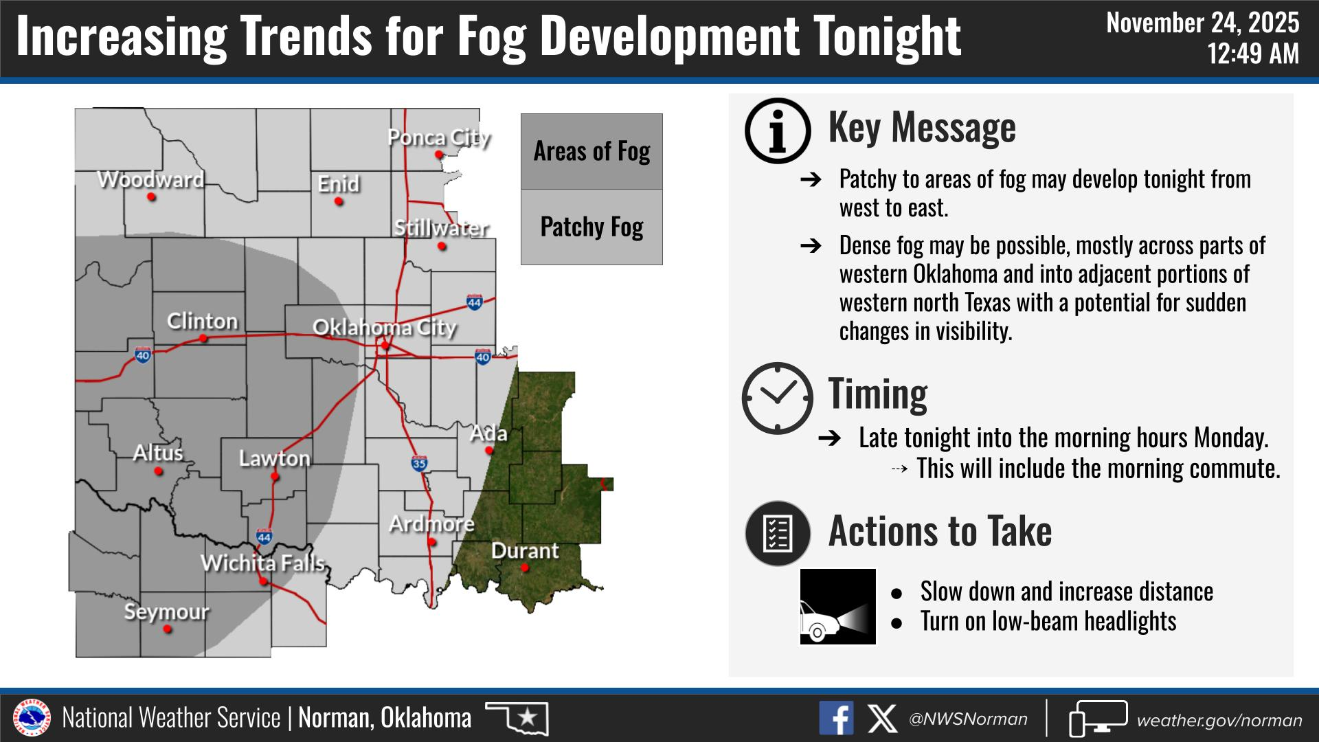
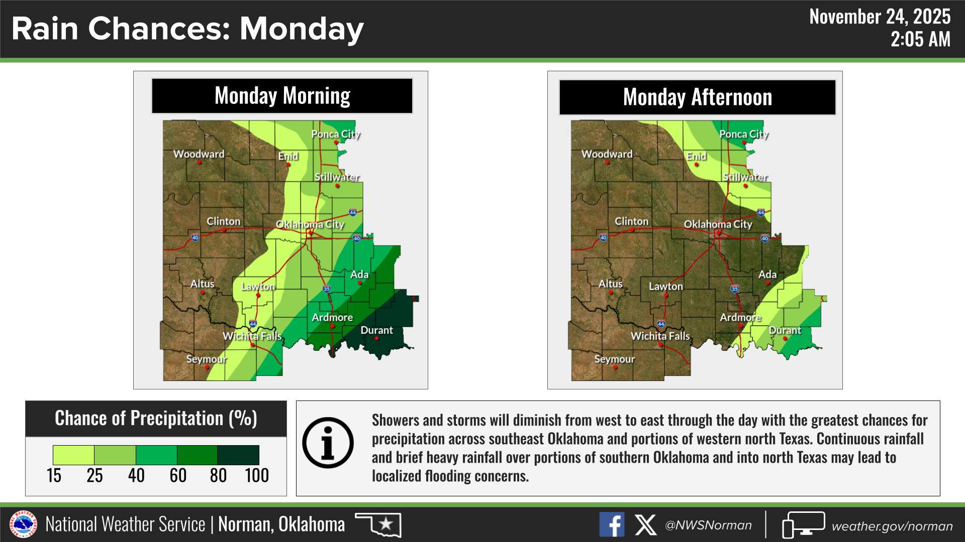
There is a possibility we may see a fog advisory in effect sometime this morning. Even if we don’t, there will be areas of fog around so use caution while driving and don’t overdrive conditions. There is a chance we’ll see some additional rainfall this morning. It shouldn’t amount to too much due to wraparound rainfall from this system that is moving through the area. That chance is around 20% or so.
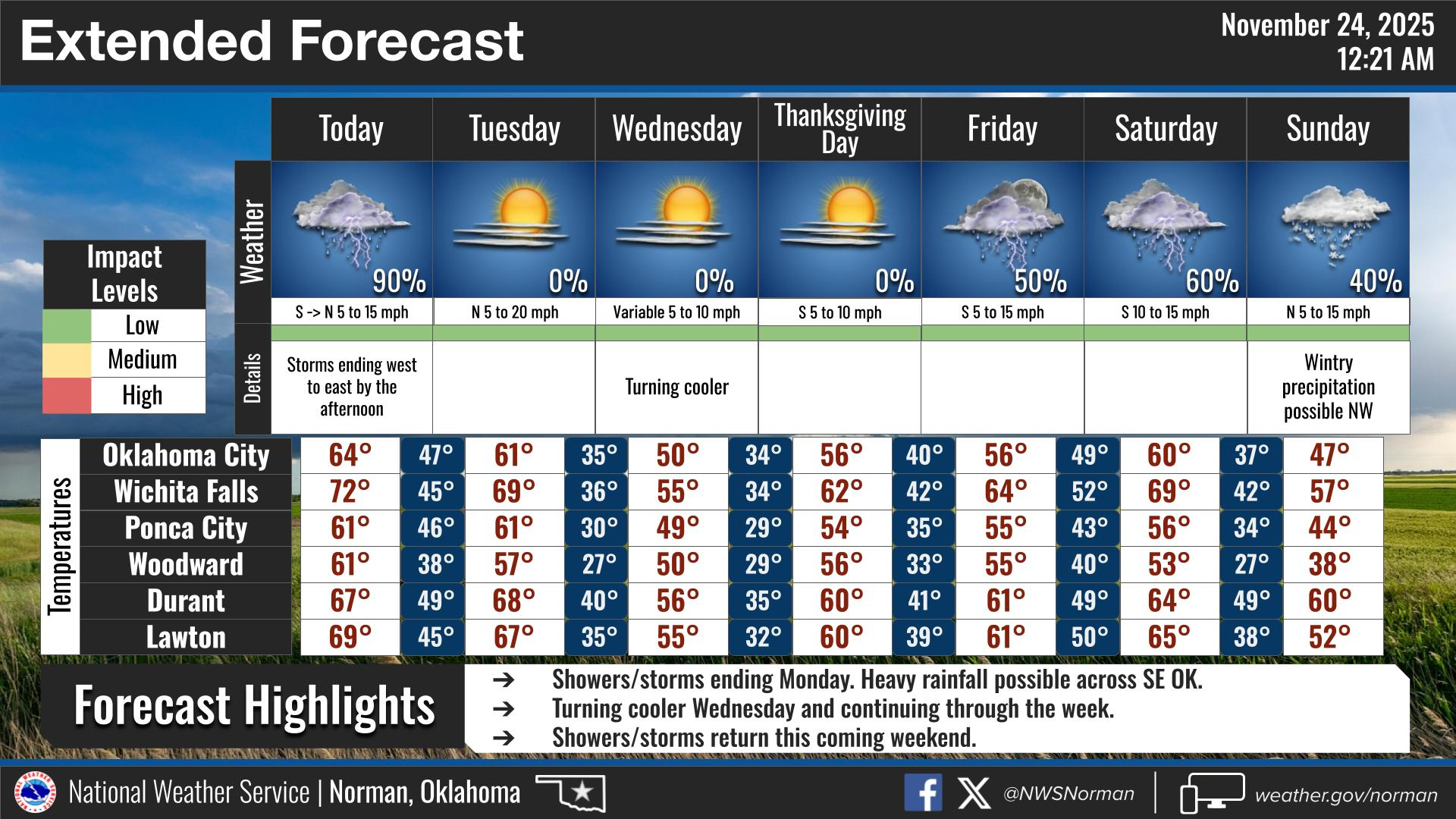
There is a good chance we’ll see overnight freezing temps starting Wednesday, Thursday, and possibly Friday mornings so be prepared for those colder mornings.
Overall, we’ll be ok, so here is your forecast from the NWS/NORMAN:
Monday- Patchy fog in the morning. Mostly cloudy with a 20 percent chance of showers. Highs in the lower 60s. South winds around 10 mph, becoming southwest in the afternoon.
Monday Night- Partly cloudy in the evening, then becoming mostly cloudy. Lows in the mid-40s. Northwest winds around 5 mph.
GARFIELD COUNTY EM is our notification and preparedness app. If you don’t have it, you’re NOT prepared! REMEMBER that each day’s post appears under the GCEM Blog icon on the app.
HAVE A GOOD DAY!