TODAY’S WEATHER OUTLOOK FROM GARFIELD COUNTY EMERGENCY MANAGEMENT – 2/14/2026
Good morning, Garfield County!
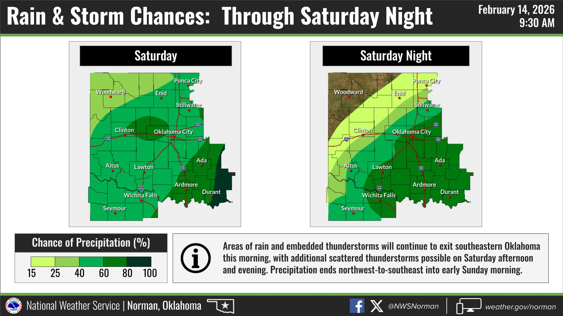
We’re waking up to light rain across the area, and that’s going to set the tone for much of the day. According to the National Weather Service Norman, we’ll stay breezy with periods of rain through the afternoon. Highs are expected to climb into the upper 60s, so it’ll be mild for mid-February.
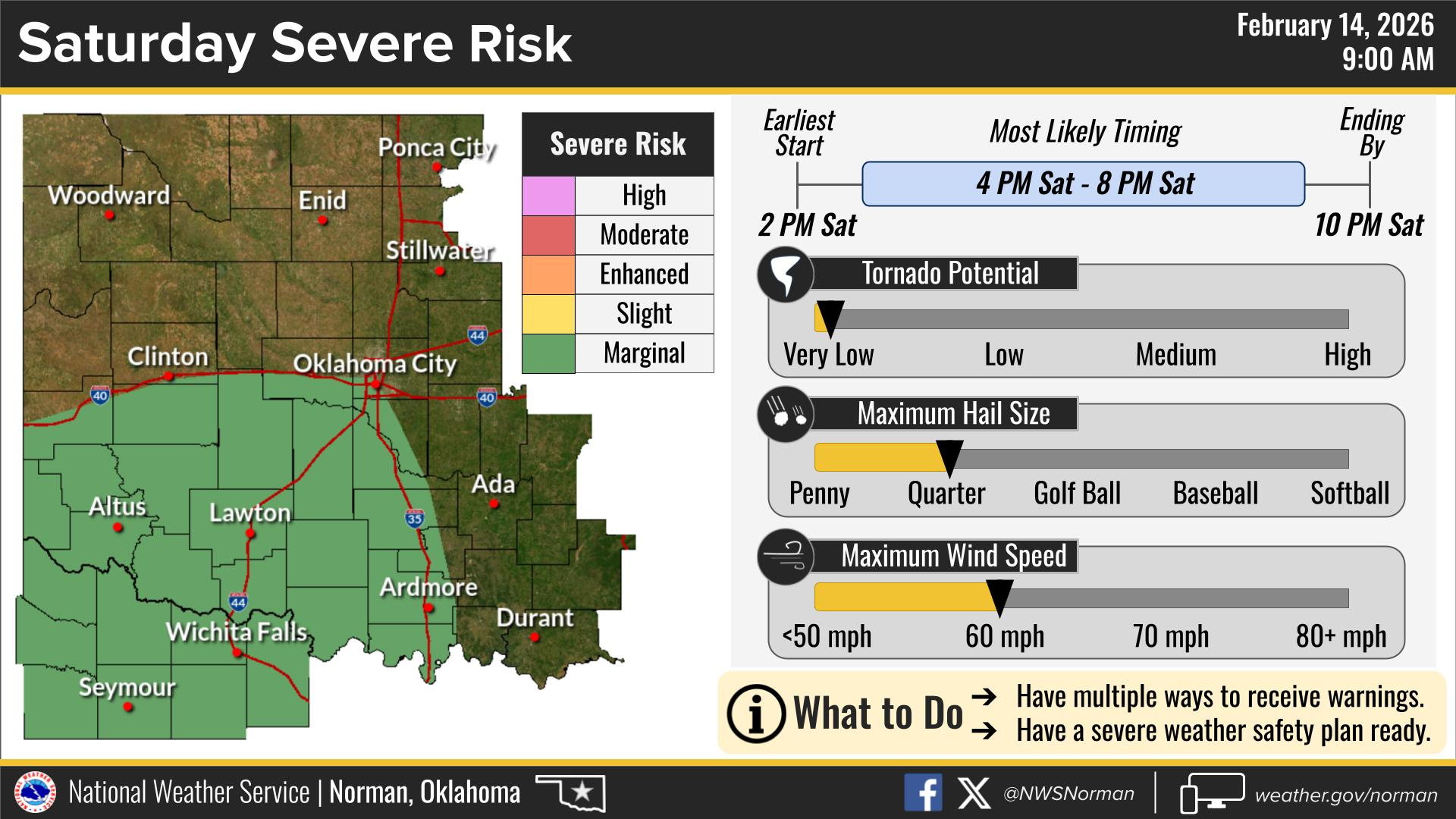
Rain chances will be on and off through the day, and a few rumbles of thunder can’t be ruled out at times. Nothing severe is expected right now, but we could see some steadier pockets of rain that briefly reduce visibility and create ponding on roads. If you’re traveling, give yourself a little extra time, and don’t forget the umbrella!
Rain will gradually taper off late, setting us up for a much nicer Sunday with sunshine returning and highs right back into the 60s.
HERE IS TODAY’S FORECAST FROM THE NWS/NORMAN:
TODAY – A chance of thunderstorms. Showers. Highs in the upper 60s. South winds around 10 mph, becoming west this afternoon. Chance of rain 80 percent.
TONIGHT – Mostly cloudy. A chance of showers in the evening. Lows in the mid 40s. North winds 10 to 15 mph. Chance of rain 40 percent.
I’ll keep you updated if anything changes.
Stay safe and have a great Valentine’s Day!
Jacob Price GCEM-1