SATURDAY WEATHER OUTLOOK FROM GARFIELD COUNTY EMERGENCY MANAGEMENT – 01/31/2026
Good morning, Garfield County!
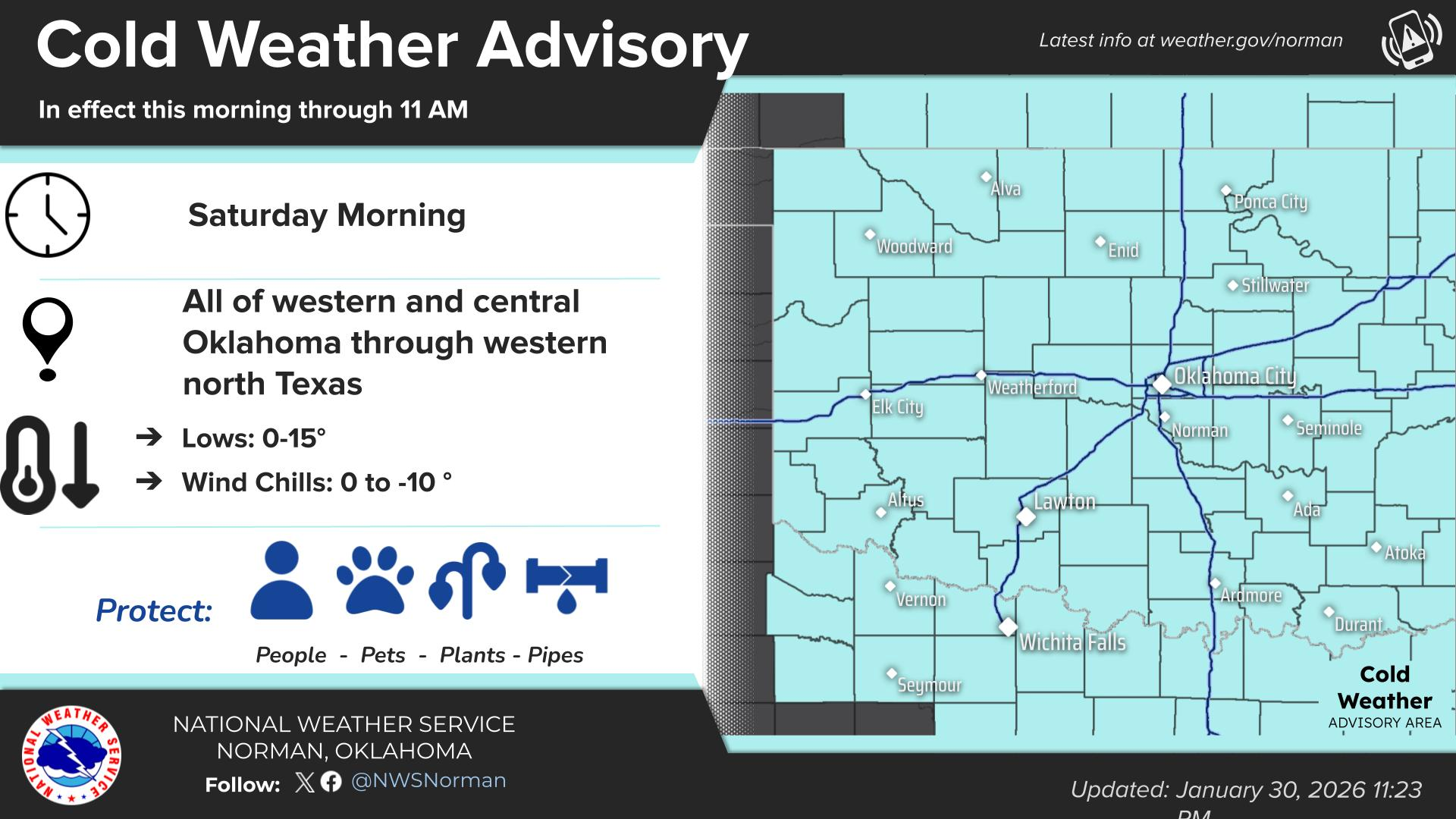
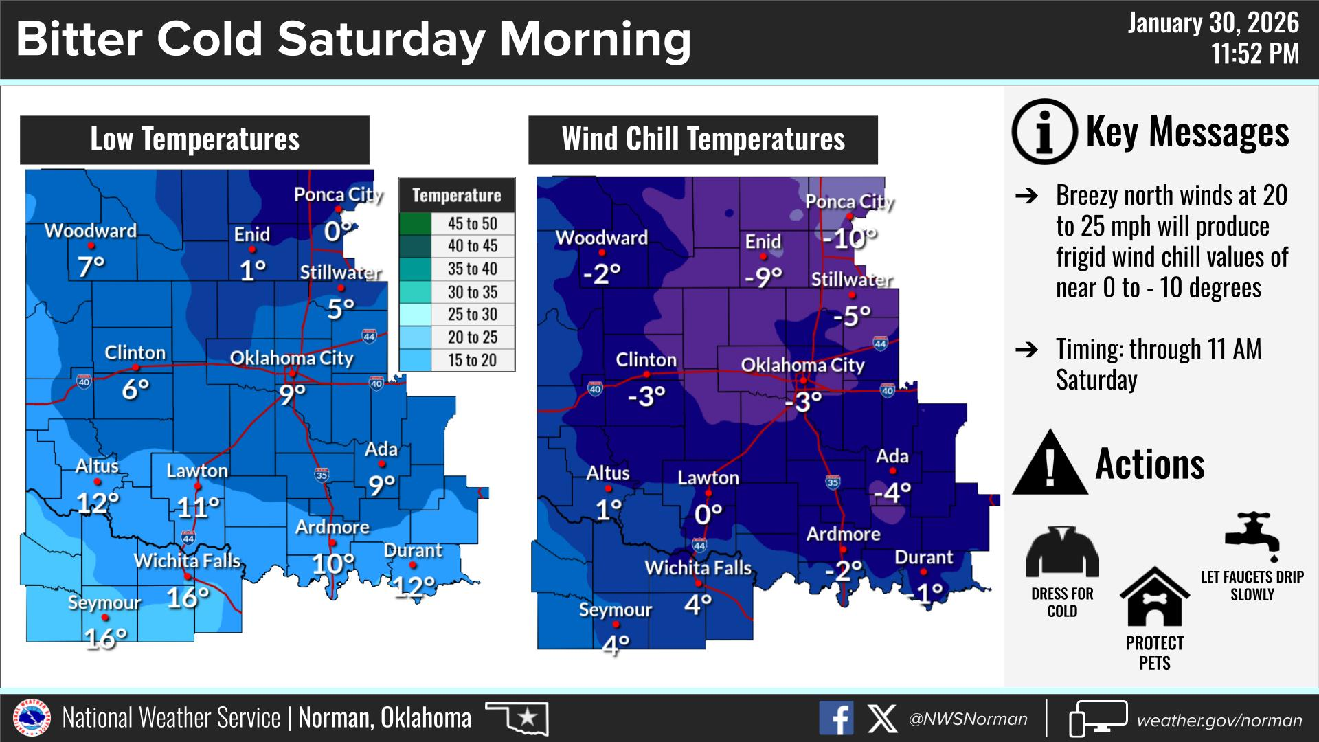
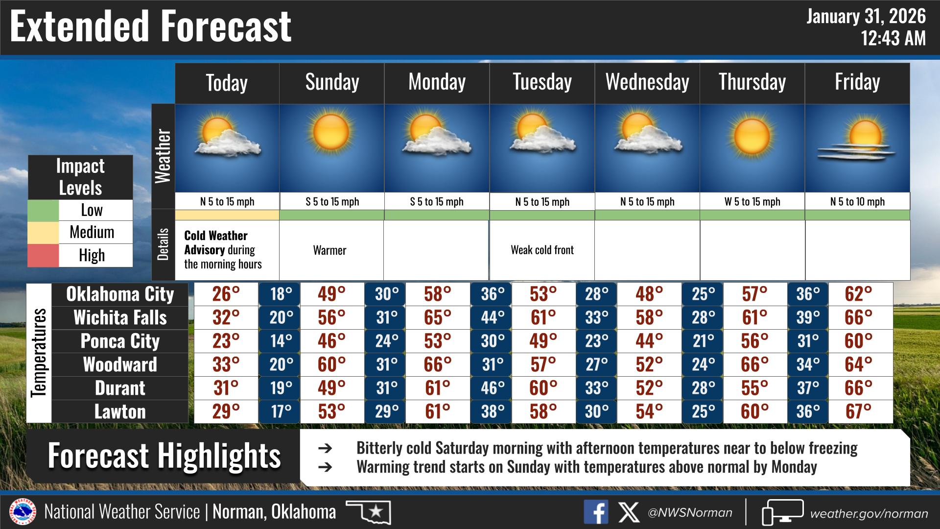
Bundle up because it is a bitterly cold start to our Saturday. We’ve got a Cold Weather Advisory in effect until 11:00 AM this morning, as those north winds are pushing wind chills down between 0 and -10 degrees. We might see a few light snow flurries drifting around early today, but don’t expect any real accumulation. The good news is we just have to get through today’s highs in the 20s and one more frigid night before a nice warming trend kicks in tomorrow. We’ll be back in the 40s and 50s by the first of the week!
Here is your forecast from the NWS/Norman:
TODAY – Mostly sunny. Cold with highs in the lower 20s. North winds 5 to 10 mph, becoming south this afternoon. Wind chill values as low as 10 below this morning.
TONIGHT – Mostly cloudy in the evening, then clearing. Cold with lows around 14. South winds 5 to 10 mph.
Safety Tips:
- Cold Safety: With wind chills below zero this morning, frostbite can happen fast. Wear your heavy coat, gloves, and a hat if you’re heading out. Dress in layers!
- Home Safety: Leave your cabinets open and let your indoor faucets drip tonight to keep those pipes from freezing.
- Preparedness: Remember to stay prepared and informed by downloading the Garfield County EM App!
Have a great Saturday!
Jacob Price GCEM-1