SATURDAY WEATHER OUTLOOK FROM GARFIELD COUNTY EMERGENCY MANAGEMENT – 3/28/2026
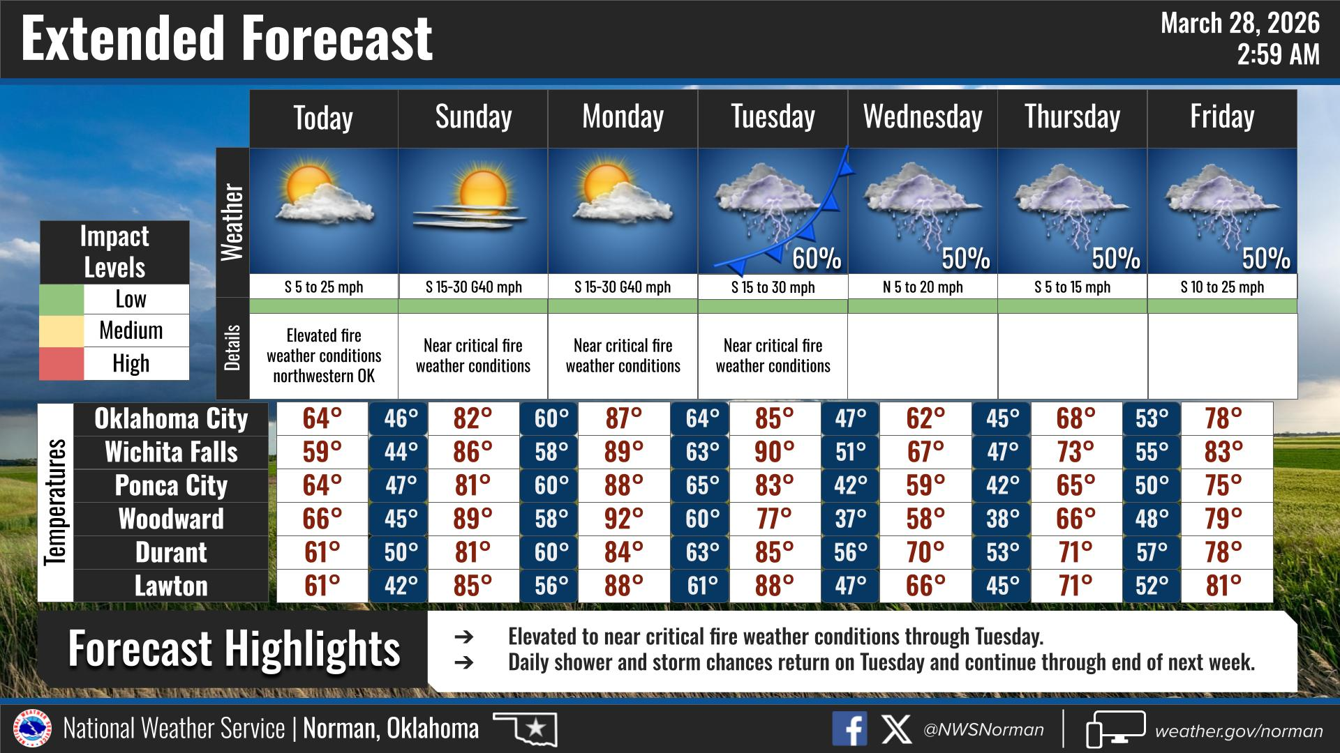
We’ve got a little bit of cloud cover hanging around this morning, but that’ll clear out as we go through the day and we should end up with a nice afternoon. Highs will make it into the mid-60s, so overall not bad at all.
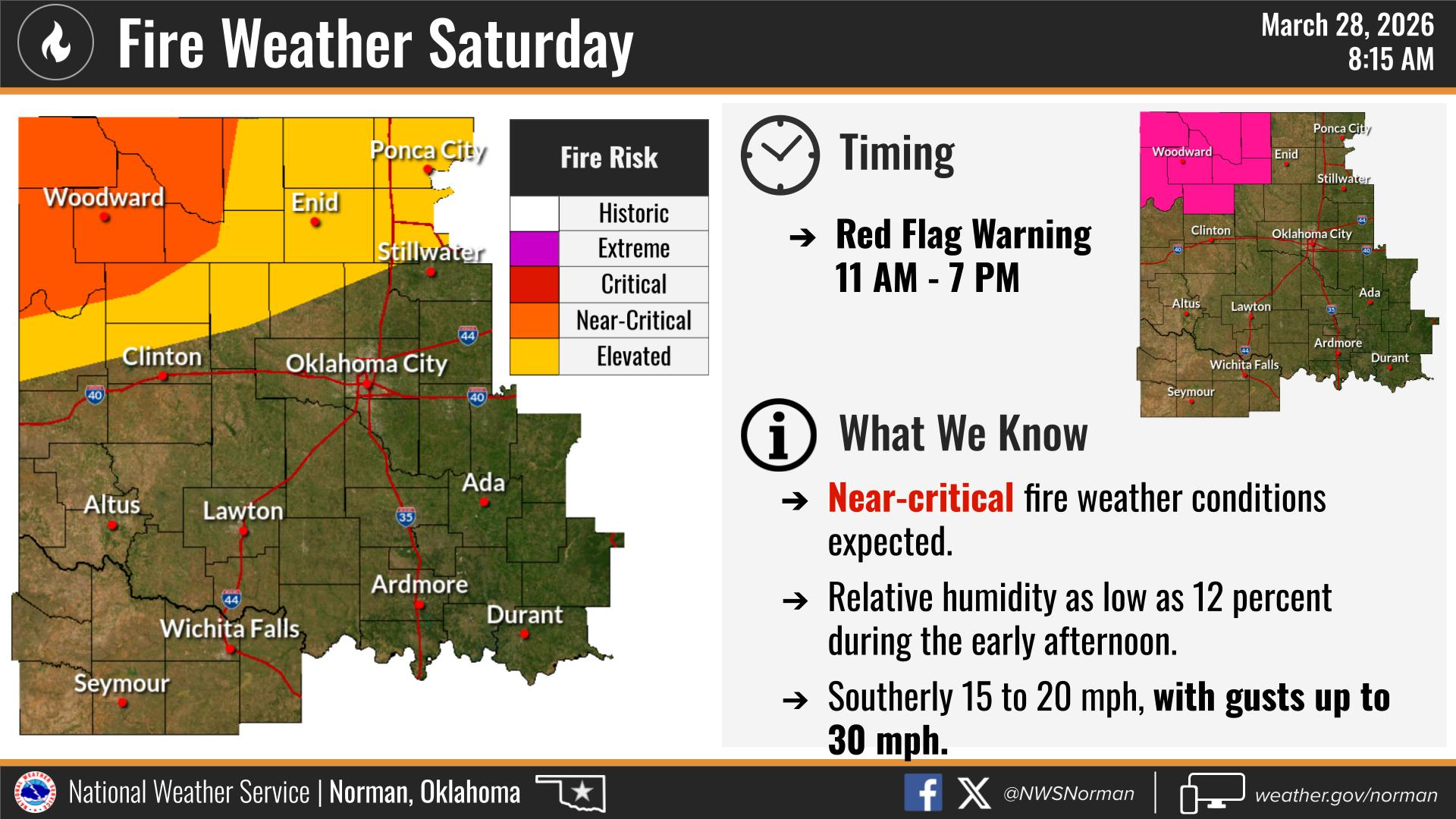
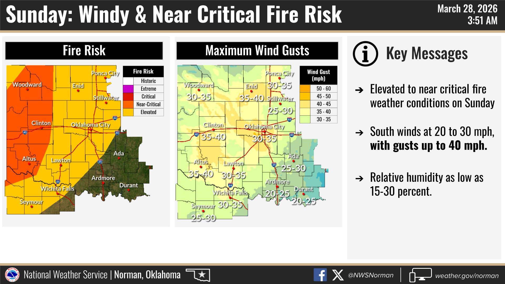
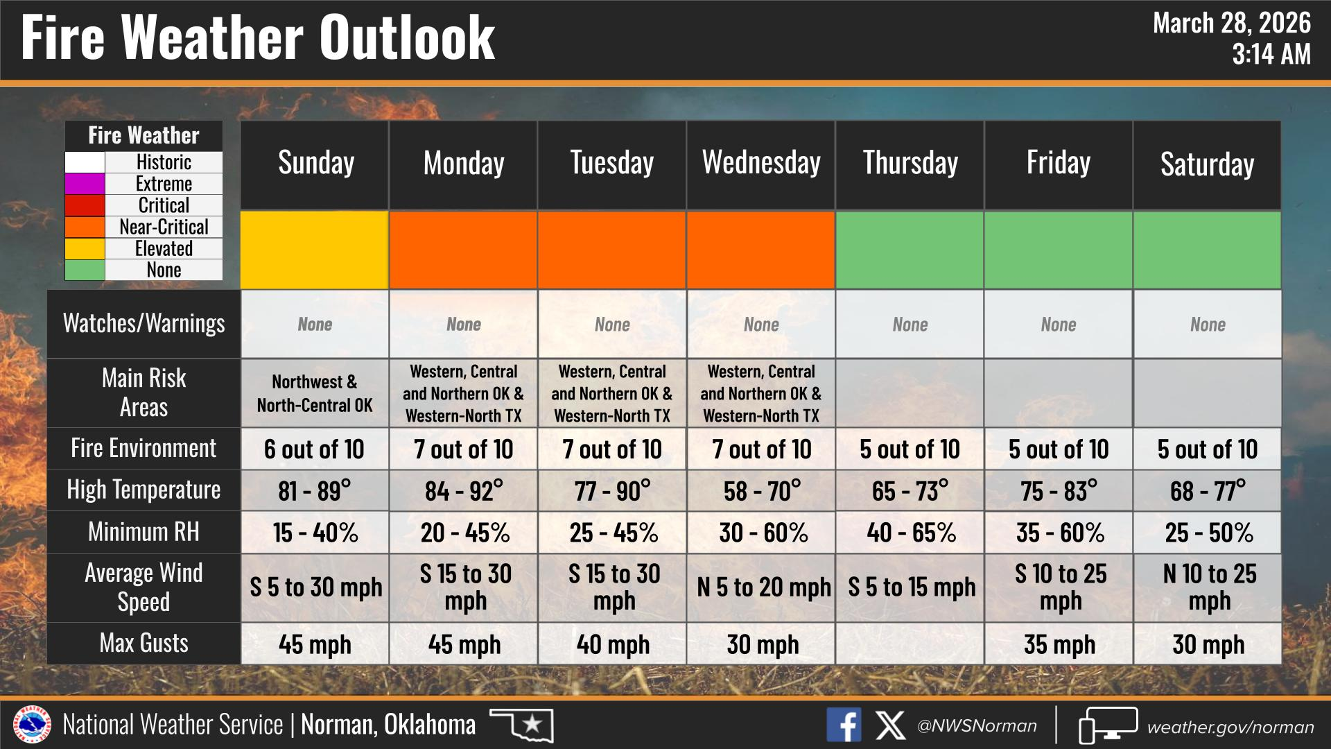
Wind is going to be the main thing to keep in mind today. We start out with an east wind around 10 to 15 mph, then it shifts to the south and picks up to about 15 to 20 mph with gusts up around 30 mph. There are no wind advisories or Red Flag warnings for our county currently. However, we are still under an elevated fire threat today, and that pattern will continue throughout this next week. I discourage any outdoor burning at this time.
Tonight stays quiet with mostly clear skies and lows in the mid-40s. Winds don’t really let up much either, still out of the south at 15 to 20 mph with gusts near 30 mph, so it’ll stay a little breezy overnight.
On the bright side there are some chances for showers and thunderstorms starting mid-week. We will just have to wait and see how things line up. Hopefully we will see much-needed moisture!
Have a great Saturday!
Jacob Price EM-1