0312L-SUNDAY OUTLOOK FROM GARFIELD COUNTY EMERGENCY MANAGEMENT- 8/3/25
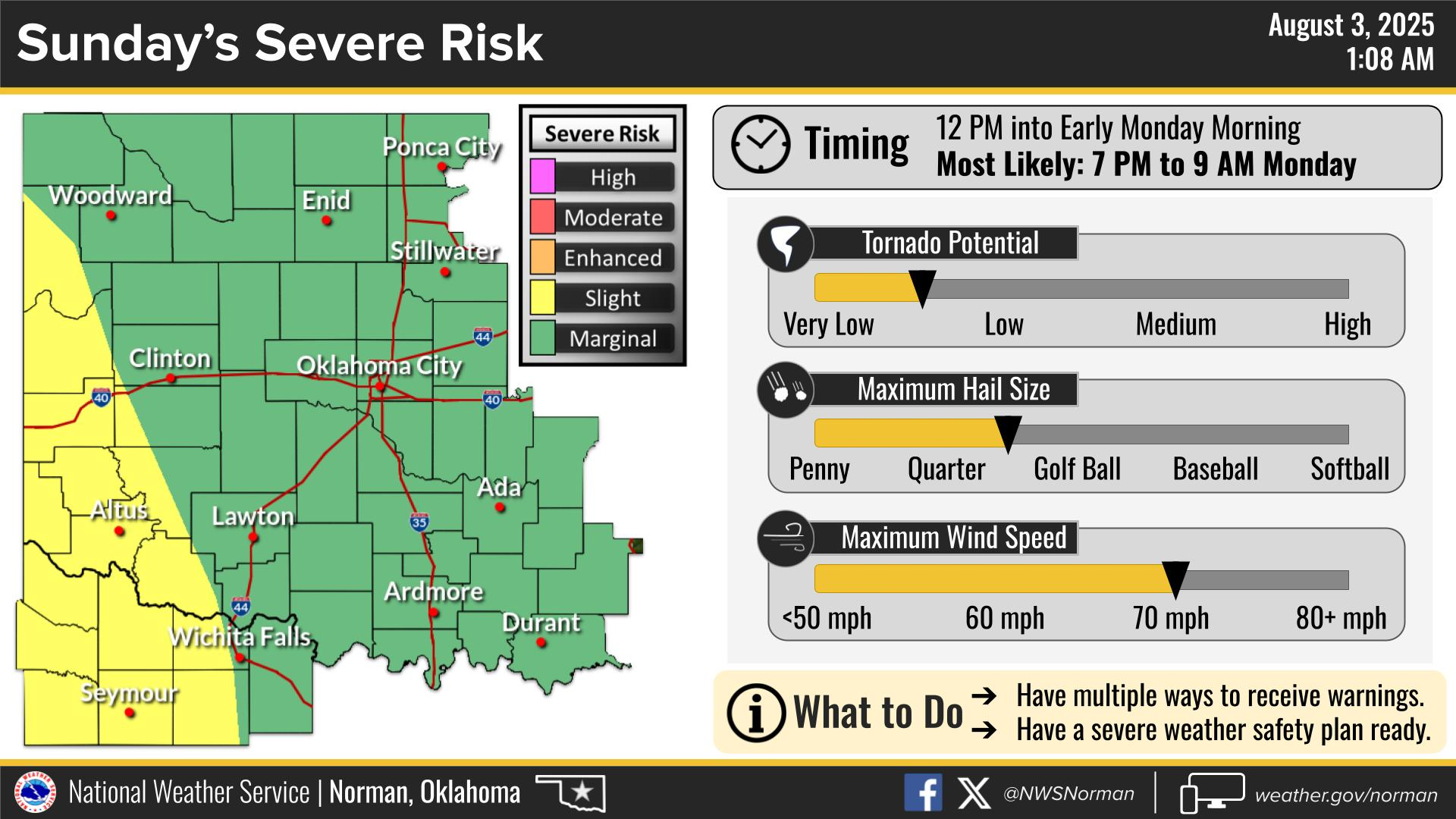
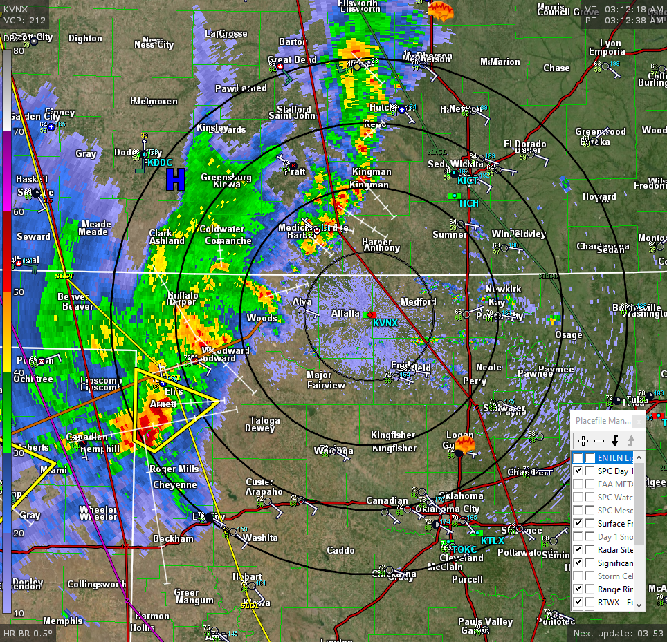
We are in a MARGINAL RISK for severe weather early this morning and later today into tonight. Storms to our northwest should begin to affect the area within the next few hours. See radar pic as of 0312L. This line varies in speed so we’ll see how timing works out. On average, you can expect heavy rainfall, lightning, and wind gusts upwards of 50 mph as of this typing. We’ll wait and see what happens. If you happen to be up early, I would secure anything that could take flight around the house or at work.
Overall, we’ll be ok, so here is your forecast from the NWS/NORMAN:
Sunday- Mostly cloudy. A chance of showers with a slight chance of thunderstorms in the morning, then an additional chance in the afternoon. Highs in the mid-80s. Southeast winds 5 to 10 mph. Chance of rain 50 percent.
Sunday Night-Showers & Thunderstorms likely, mainly in the evening. Lows in the mid-60s. East winds 5 to 10 mph. Chance of rain 70 percent.
GARFIELD COUNTY EM is our warning and preparedness app. If you don’t have it, you’re NOT prepared!
HAVE A GOOD DAY!