0258L-SUNDAY OUTLOOK FROM GARFIELD COUNTY EMERGENCY MANAGEMENT- 12/7/25
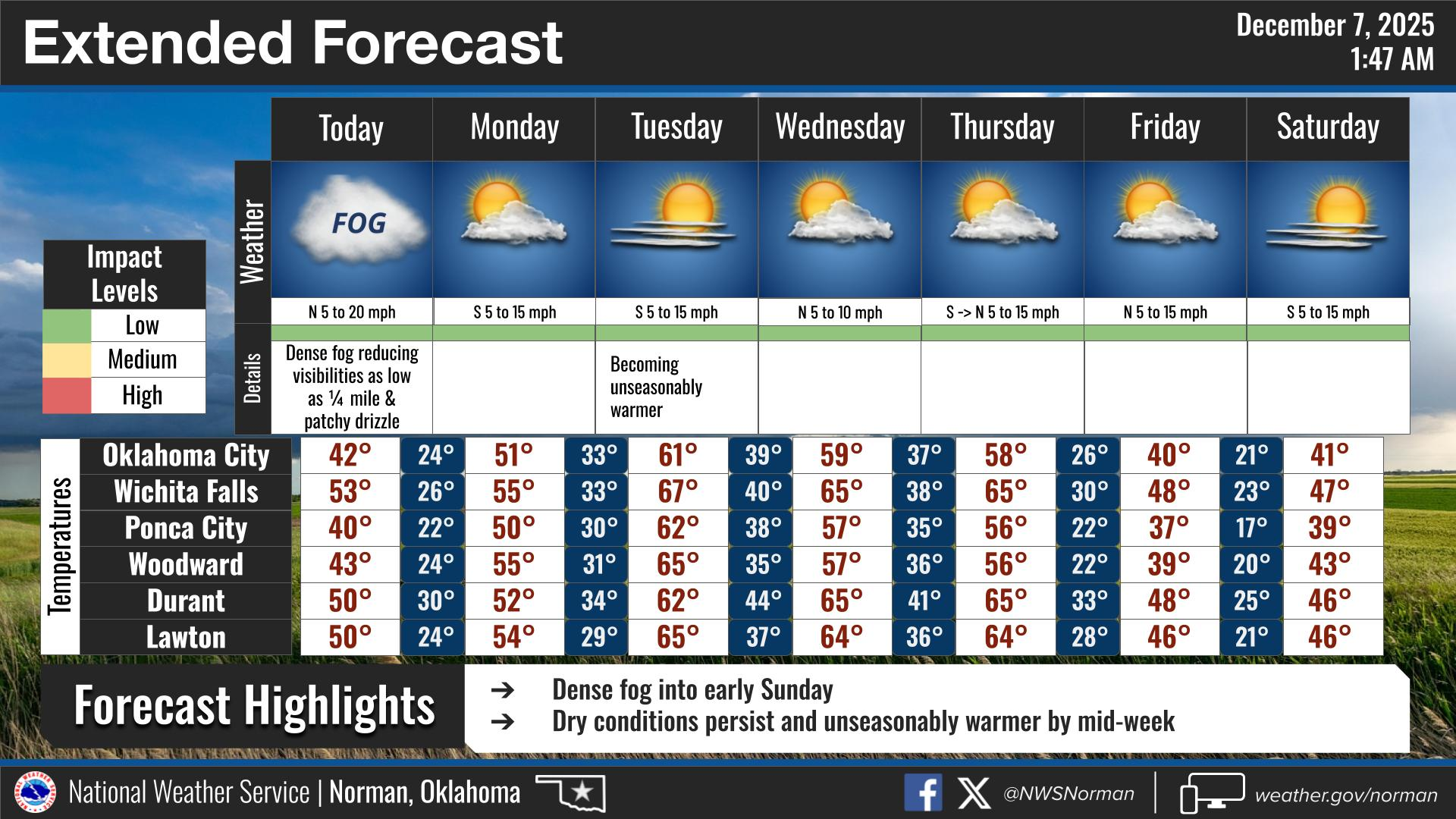
A cold front will traverse the area this morning taking the clouds and fog away. Highs will be cool in the low 40s and winds will be gusty out of the north with some gusts around 25 mph. Pretty nice day, though cool and windy but at least visibilities will be ok. Temps this week will average in the mid-50s and it appears we’ll have a cooldown by late week. Until then, everything looks good.
Overall, we’ll be ok so here’s your forecast from the NWS/NORMAN:
Sunday- Partly sunny in the morning, then clearing. Highs in the lower 40s. North winds 10 to 15 mph with gusts up to 25 mph.
Sunday Night- Mostly clear. Cold with lows in the lower 20s. Northeast winds around 5 mph, becoming southeast after midnight.
GARFIELD COUNTY EM is our notification and preparedness app. If you don’t have it, you’re NOT prepared! REMEMBER that each day’s post appears under the GCEM Blog icon on the app.
HAVE A GOOD DAY!