TODAY’S WEATHER OUTLOOK FROM GARFIELD COUNTY EMERGENCY MANAGEMENT – 02/08/2026
Good morning, Garfield County!
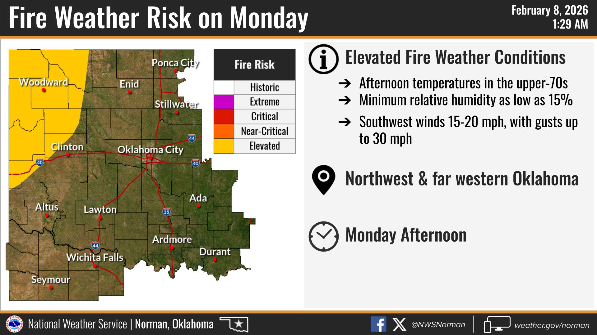
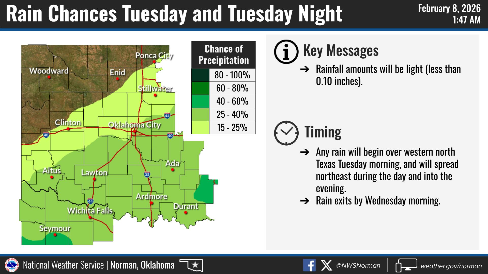
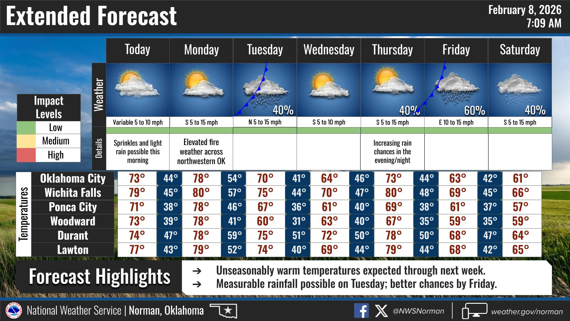
Yesterday’s spring-like warmth was just a preview—today is going to be a little warmer with highs in the low 70s. While we started the morning with some passing clouds and temperatures in the low 50s, the sun will take over by this afternoon, pushing us toward a record-challenging high. We are seeing an elevated fire danger just out to our west for Monday. With temps in the low 70s, low relative humidity values, and winds 15-20 mph. The fire threat will once again become a concern. There is still a slight chance of rain on Tuesday afternoon into the evening, but as of now it’s not looking really promising. However, by the end of the week rain chances are continuing to increase for the area. We will just have to wait and see how it pans out.
YOUR AREA FORECAST FROM THE NWS/NORMAN:
TODAY – Mostly cloudy this morning, then clearing. Highs in the lower 70s. West winds around 5 mph, becoming north this afternoon.
TONIGHT – Clear. Lows in the upper 30s. North winds around 5 mph, becoming southwest after midnight.
Safety/Preparedness Guidelines:
- Shelter Check: With the warm-up serving as a reminder that spring storm season is near, ensure your storm shelter is cleaned out and your supplies are stocked.
- Stay Informed: Download the Garfield County Emergency Management APP for direct alerts from the NWS/Norman.
- Follow Us: Keep up with daily updates on our Facebook page.
Have a wonderful Sunday!
Jacob Price GCEM-1