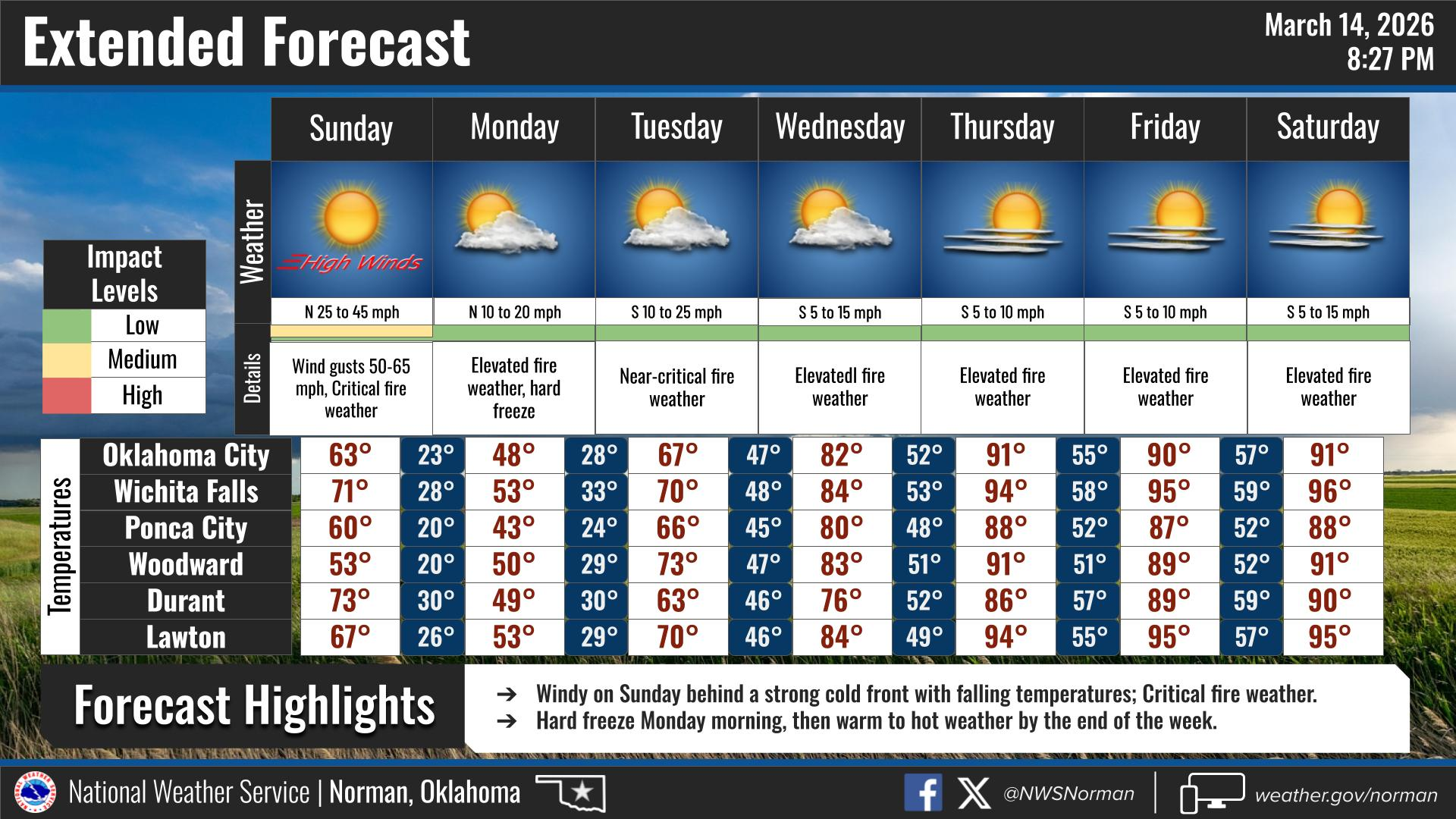
SUNDAY WEATHER OUTLOOK FROM GARFIELD COUNTY EMERGENCY MANAGEMENT – 3/15/2026
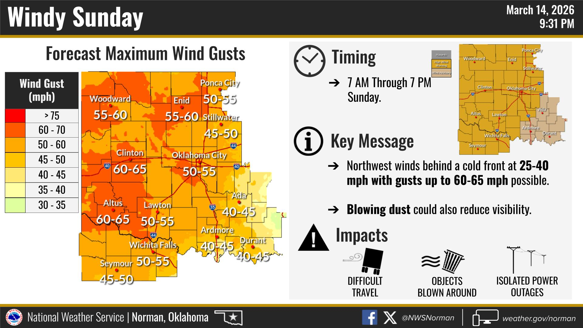
- High Wind Warning in effect from March 15, 07:00 AM CDT until March 15, 07:00 PM CDT
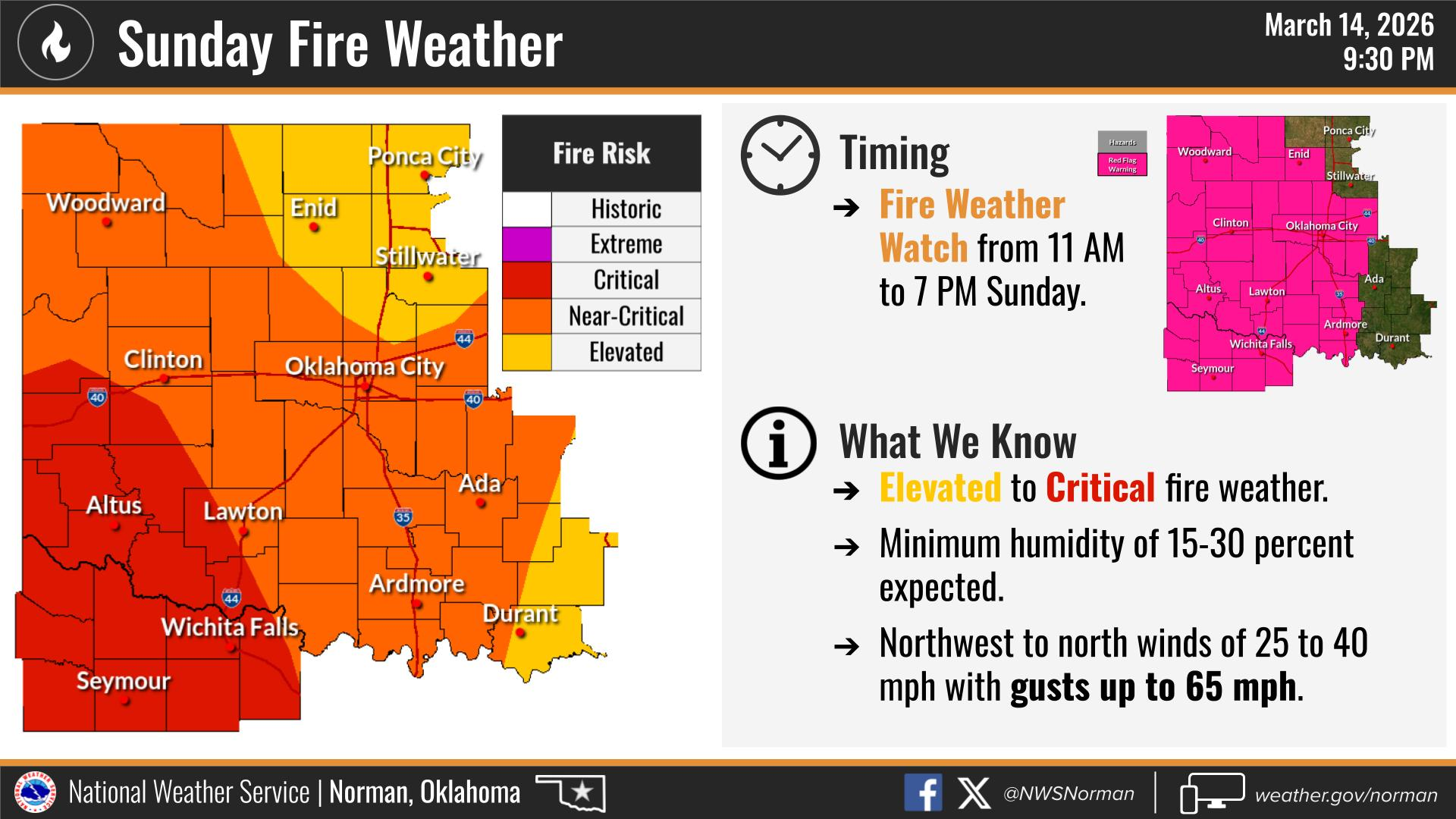
- Red Flag Warning in effect from March 15, 12:00 PM CDT until March 15, 07:00 PM CDT
Good evening, everyone. Here’s a quick look at what we’re expecting on Sunday!
We should see partly sunny skies through the day with temperatures starting out mild in the morning but falling into the mid-40s by late afternoon as a strong cold front pushes through the area.
The biggest story tomorrow will be the wind. Winds will shift to the northwest during the day and increase significantly. Sustained winds around 33 to 43 mph with gusts possibly reaching 65 mph will be possible across parts of northern Oklahoma, including our area. These strong winds could create blowing dust and difficult travel for high-profile vehicles, especially on east-west roads.
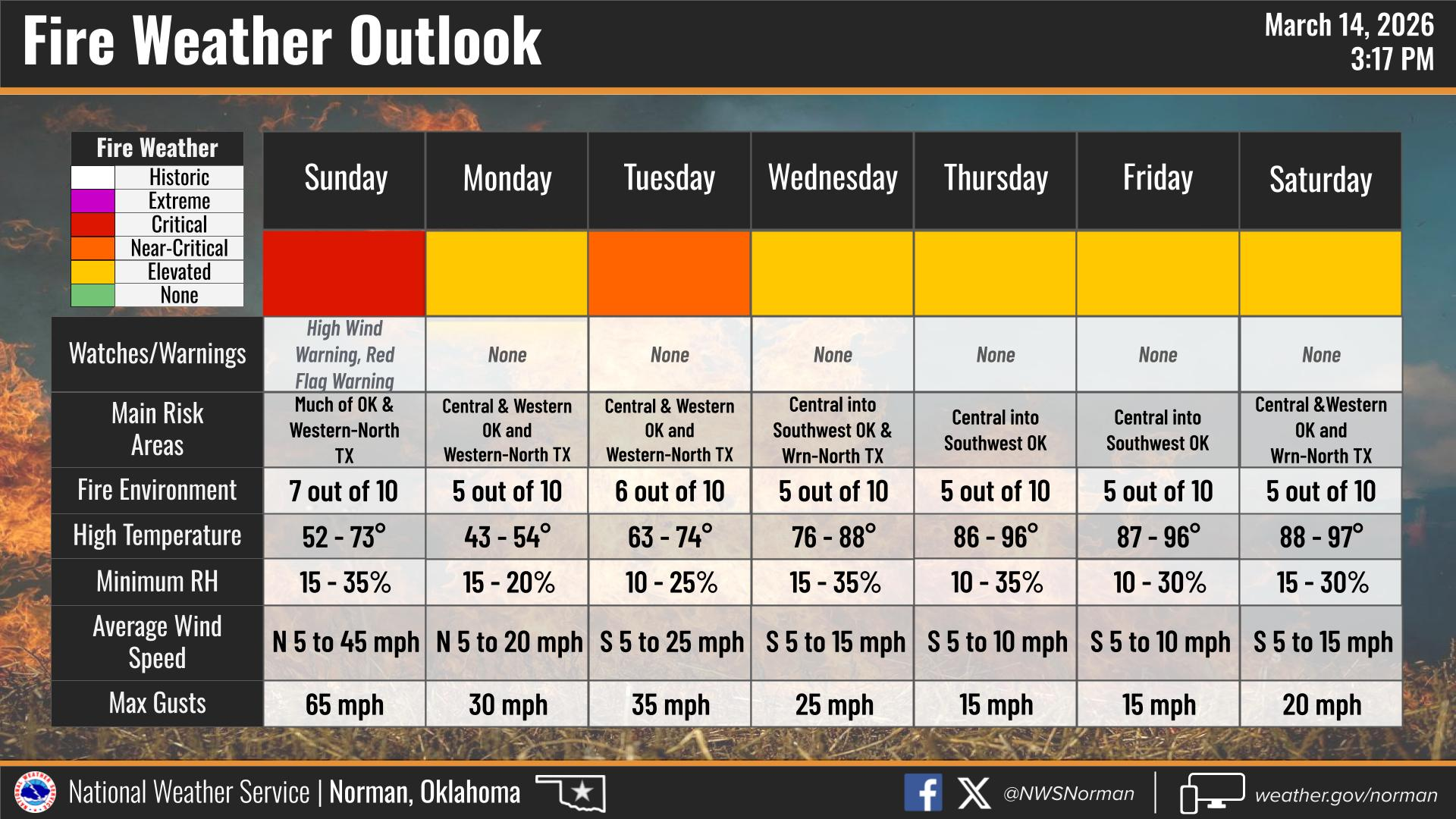
With the strong winds and dry air moving in behind the front, fire weather will also be a concern across western and central Oklahoma. The National Weather Service has noted that several days of elevated to near-critical fire weather conditions are possible across western Oklahoma due to dry conditions and gusty winds.
That means any fire that starts could spread quickly. Please AVOID outdoor burning, properly secure trailer chains, and use caution with anything that could create sparks.
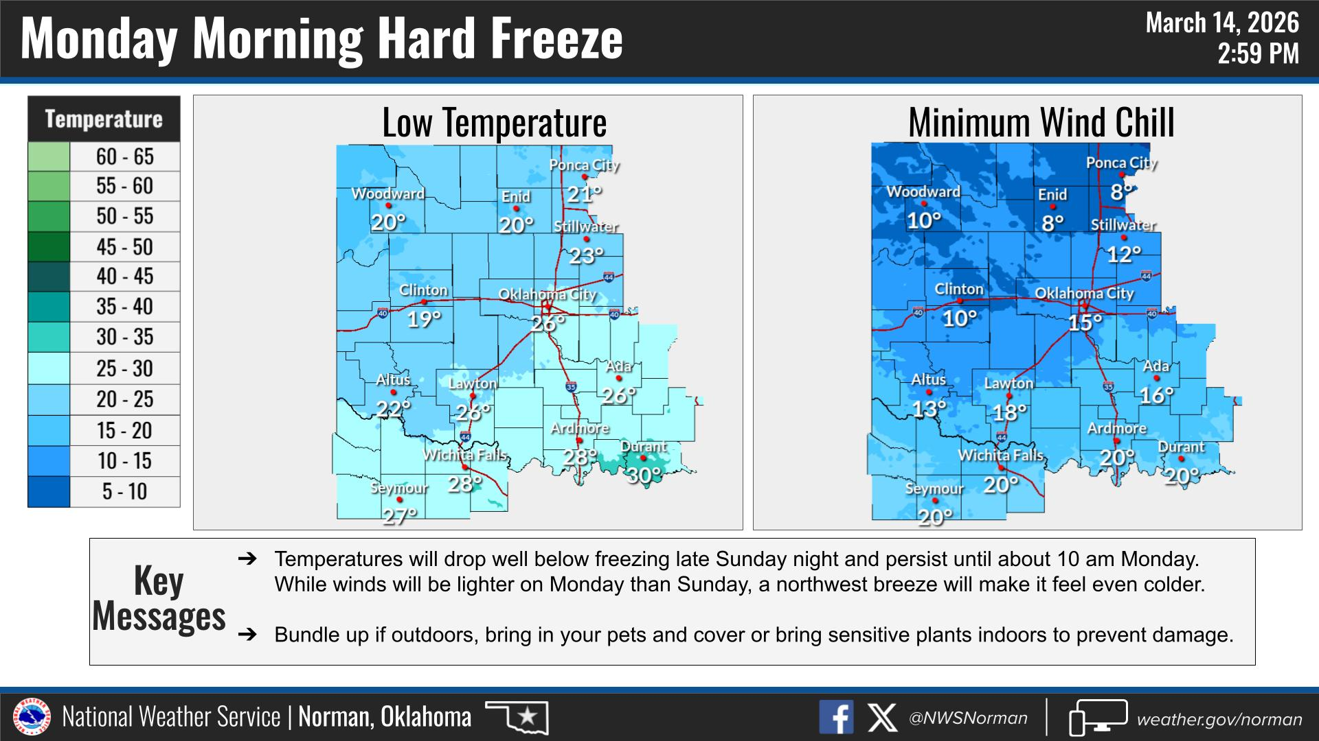
Looking ahead to Sunday night, temperatures will drop quickly with lows falling into the lower 20s, and it will remain breezy into the overnight hours.
HERE IS YOUR OFFICIAL FORECAST FROM THE NWS/NORMAN:
TONIGHT –Mostly cloudy, with a steady temperature around 65. South wind 15 to 20 mph, with gusts as high as 26 mph.
SUNDAY – Patchy blowing dust after 10am. Partly sunny, with a temperature falling to around 45 by 5pm. Windy, with a north northwest wind 14 to 24 mph increasing to 33 to 43 mph. Winds could gust as high as 65 mph.
SUNDAY NIGHT – Mostly cloudy, then gradually becoming clear, with a low around 20. Windy, with a north northwest wind 26 to 31 mph decreasing to 15 to 20 mph after midnight. Winds could gust as high as 47 mph.
We’ll continue to monitor conditions and pass along updates as needed!
J. Price EM-1