THURSDAY WEATHER OUTLOOK FROM GARFIELD COUNTY EMERGENCY MANAGEMENT – 01/15/2026
Good morning, Garfield County!
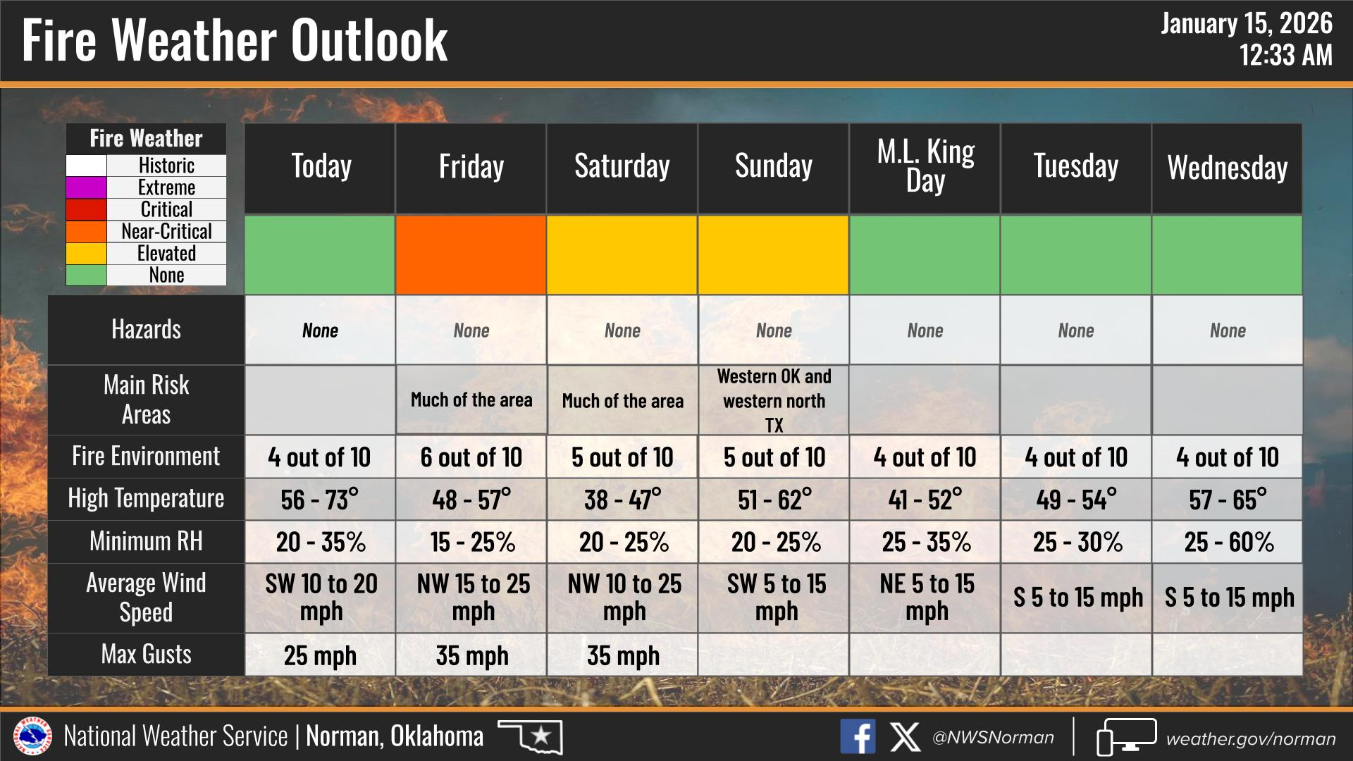
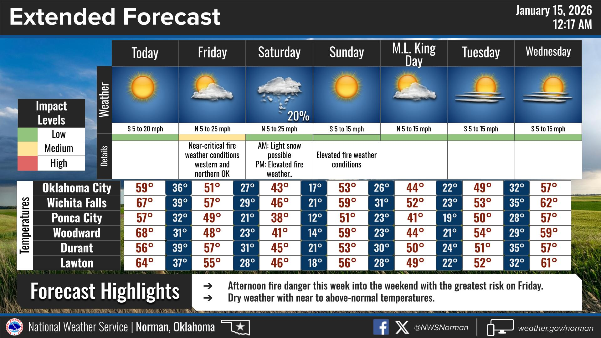
After a chilly and windy Wednesday, we are looking at a nice temperature rebound for today. While the winds won’t be quite as intense as yesterday, they will shift out of the southwest, helping us warm up significantly before our next cold front arrives on Friday.
Here is your forecast from the NWS/Norman:
- Today – Sunny. Highs in the lower 60s. Southwest winds 10 to 15 mph with gusts up to 25 mph.
- Tonight – Mostly clear. Lows in the lower 30s. West winds 5 to 10 mph, becoming northwest 10 to 15 mph after midnight.
Safety Tips
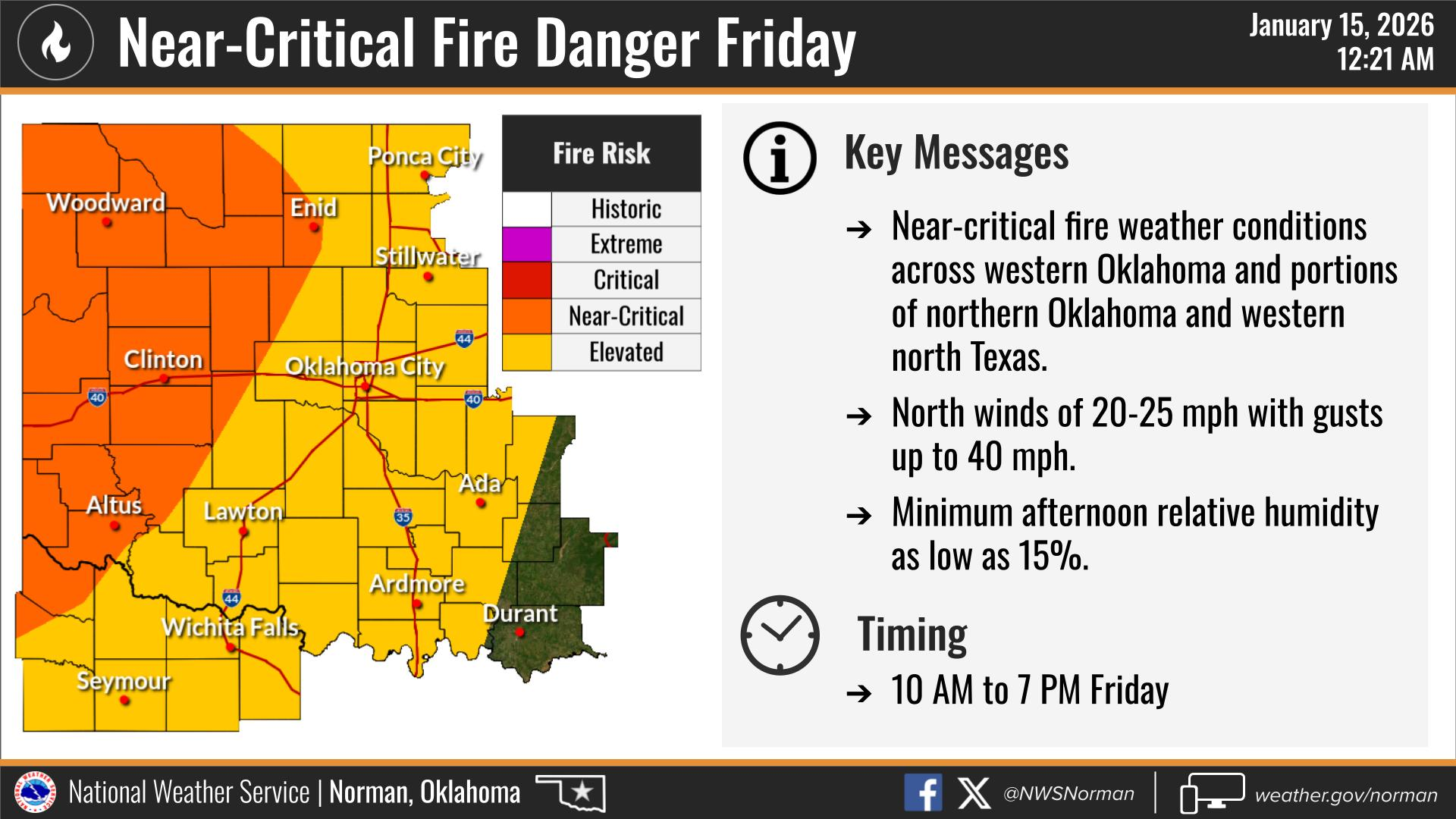
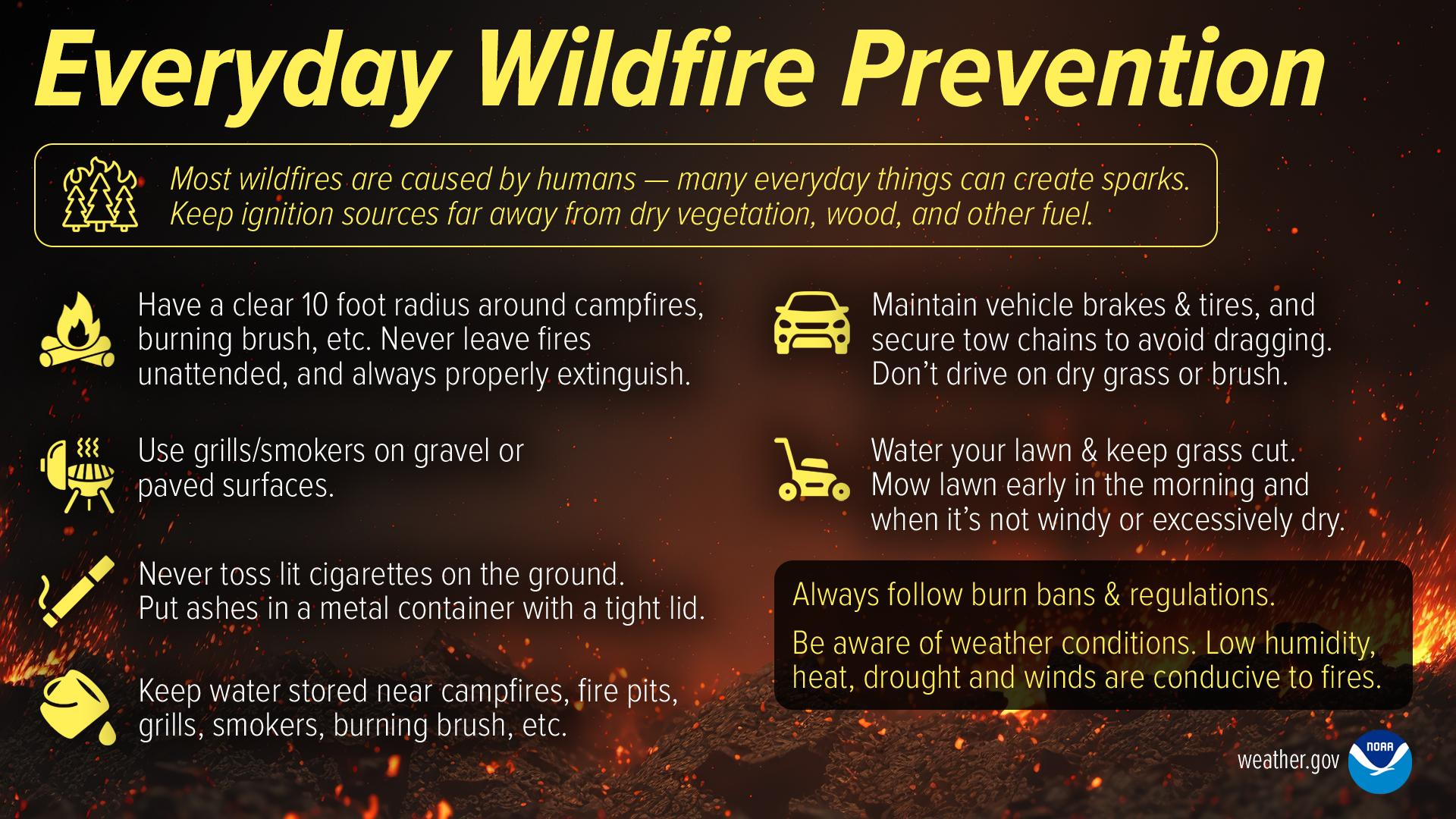
- Fire Safety: The air remains very dry. Southwest gusts up to 25 mph will keep fire danger elevated. Please continue to avoid any controlled burning.
- Fluctuating Temps: We are on a weather rollercoaster! Enjoy the 50s – 60s today but keep the heavy coats ready—another blast of north wind and cooler air arrives Friday.
- Stay Informed: Keep your alerts turned on! Download the Garfield County EM app to get the latest updates directly to your phone.
Have a great day!
Jacob Price GCEM-1