THURSDAY WEATHER OUTLOOK FROM GARFIELD COUNTY EMERGENCY MANAGEMENT – 01/22/2026
Good morning, Garfield County
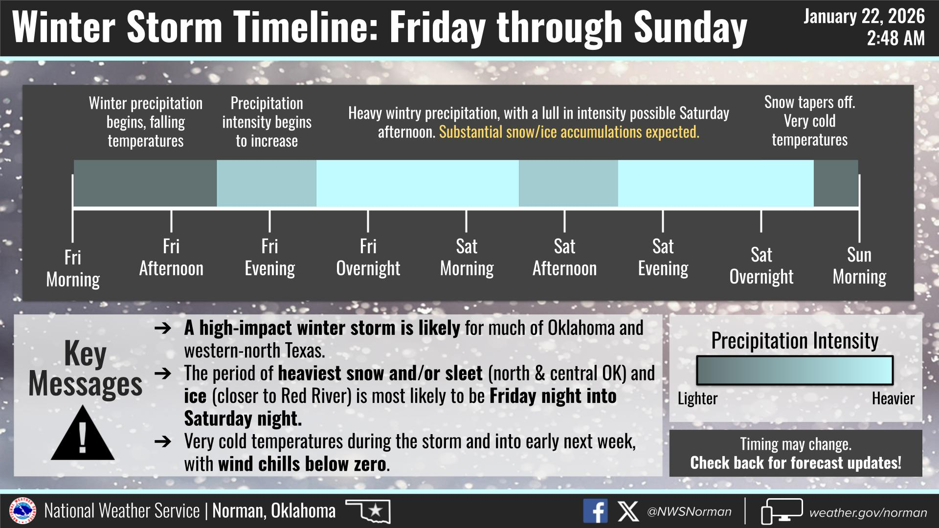
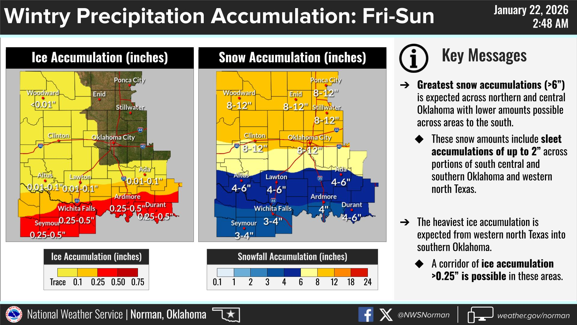
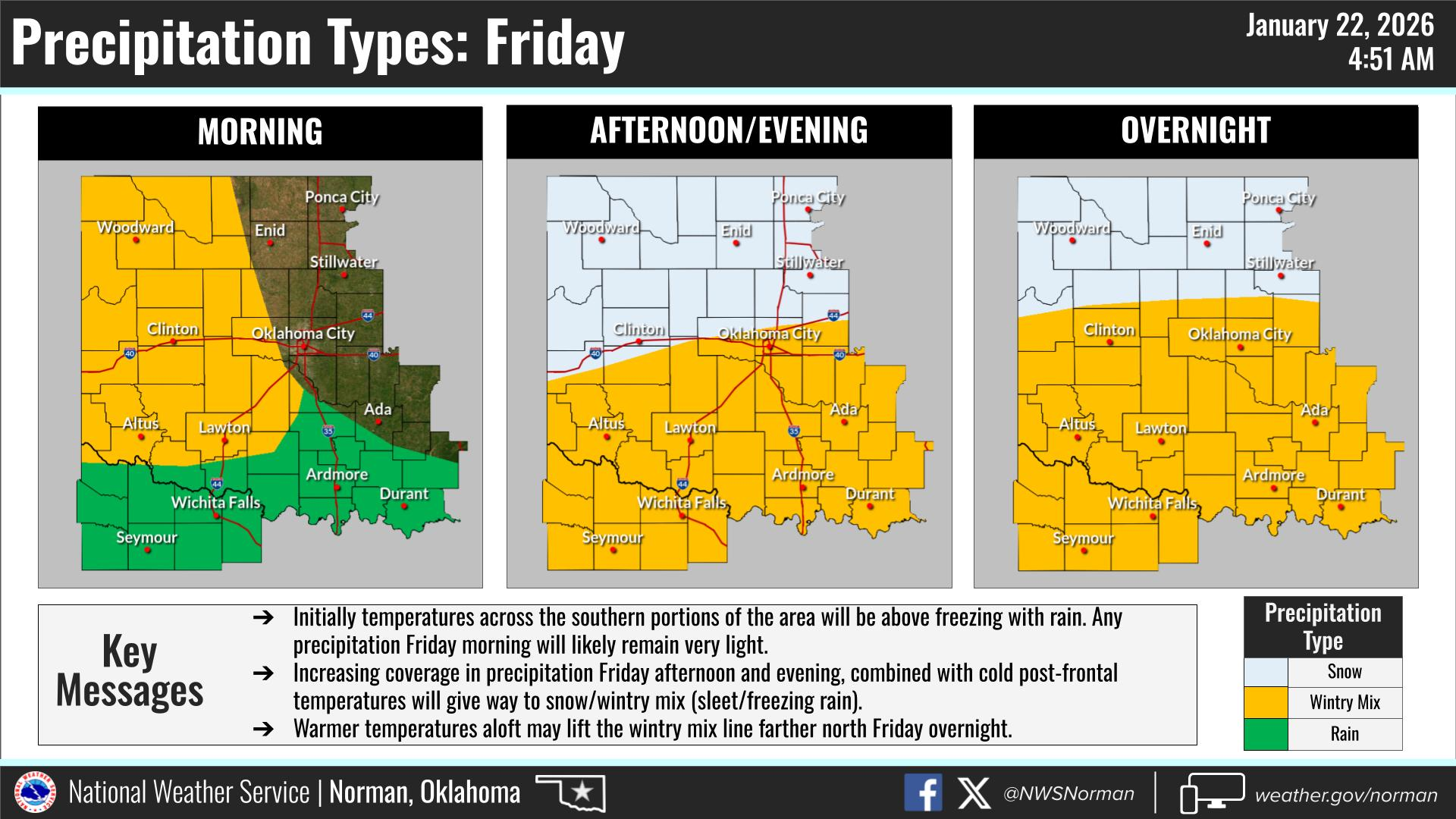
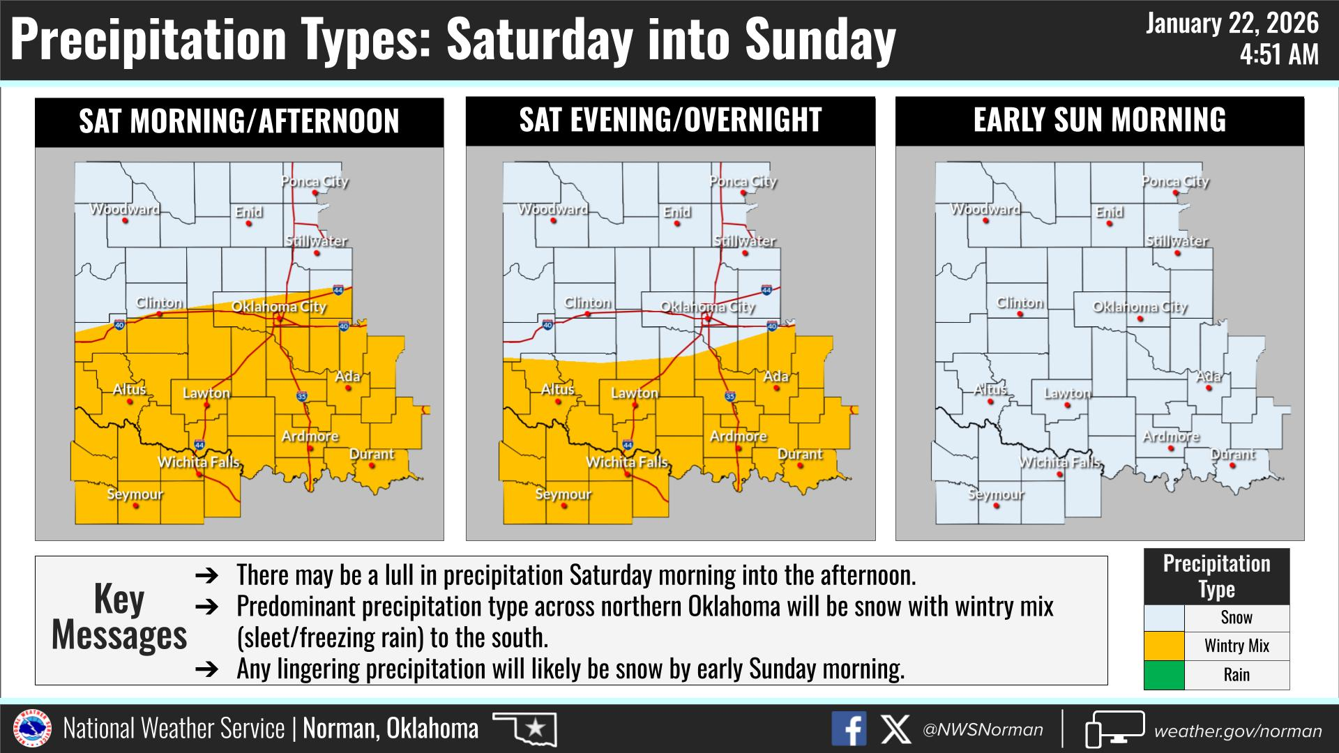
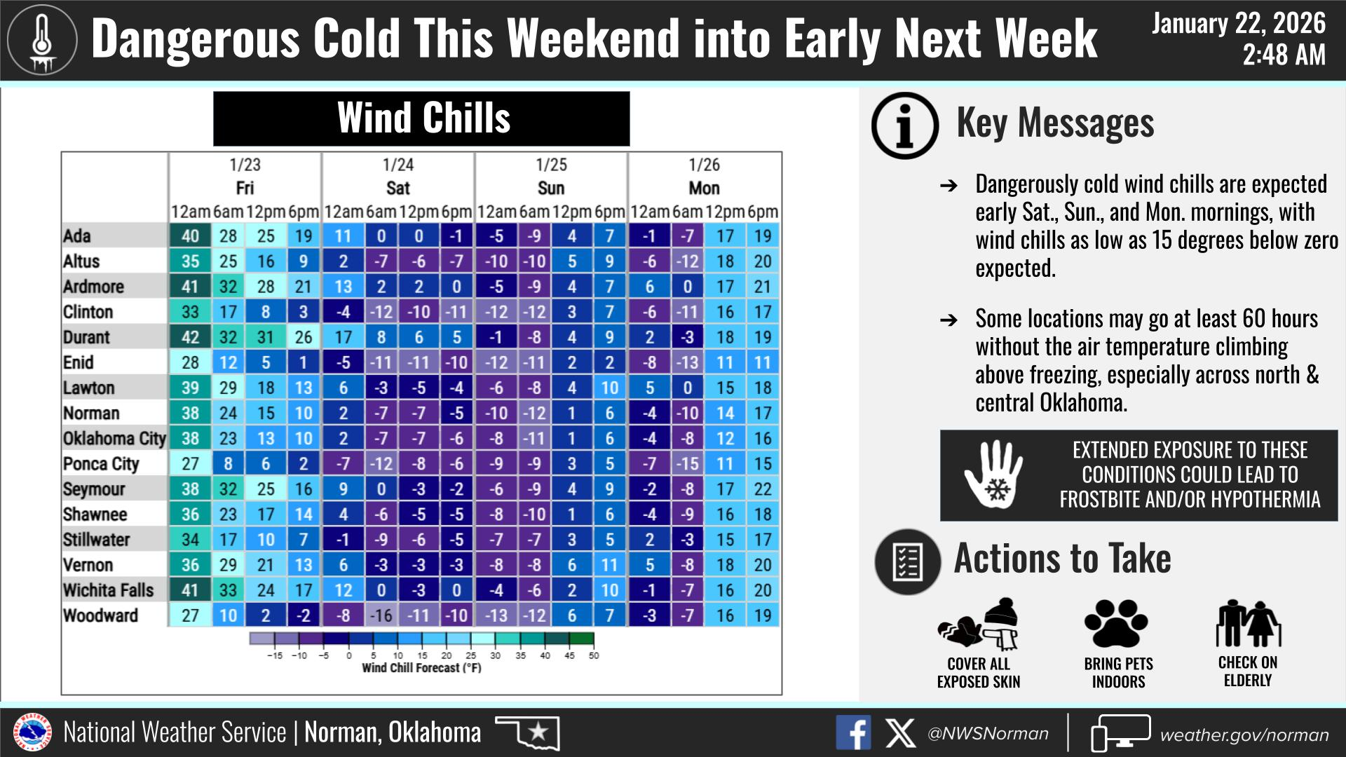
Looking at the newest data from the NWS/Norman it appears that the snow totals are trending a little higher at the moment. We could see anywhere between 8-12” of snow accumulation from Friday – Sunday. My biggest concern is the dangerous cold temperatures that are about to settle in for several days. We could see wind chills as low as -15 degrees. If you must be outdoors, dress in layers, take frequent warming breaks, and remember hypothermia and frostbite can settle in very quickly. Today is our last decent day to finish up any preparations. Will advise as needed.
Here is today’s forecast from the NWS/Norman:
Today – Mostly sunny. Highs around 50. Southeast winds 5 to 10 mph.
Tonight – Mostly cloudy. Cold with lows around 20. East winds 5 to 10 mph, increasing to northeast 15 to 20 mph with gusts up to 30 mph after midnight.
Have a Great Day!
Jacob Price GCEM-1