0315L-TUESDAY OUTLOOK FROM GARFIELD COUNTY EMERGENCY MANAGEMENT- 12/9/25
PATCHY FOG IS POSSIBLE THIS MORNING. IF IT OCCURS, USE CAUTION, ESPECIALLY ON BRIDGES AND OVERPASSES.
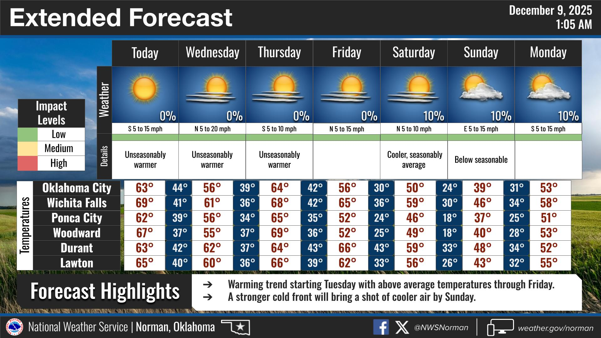
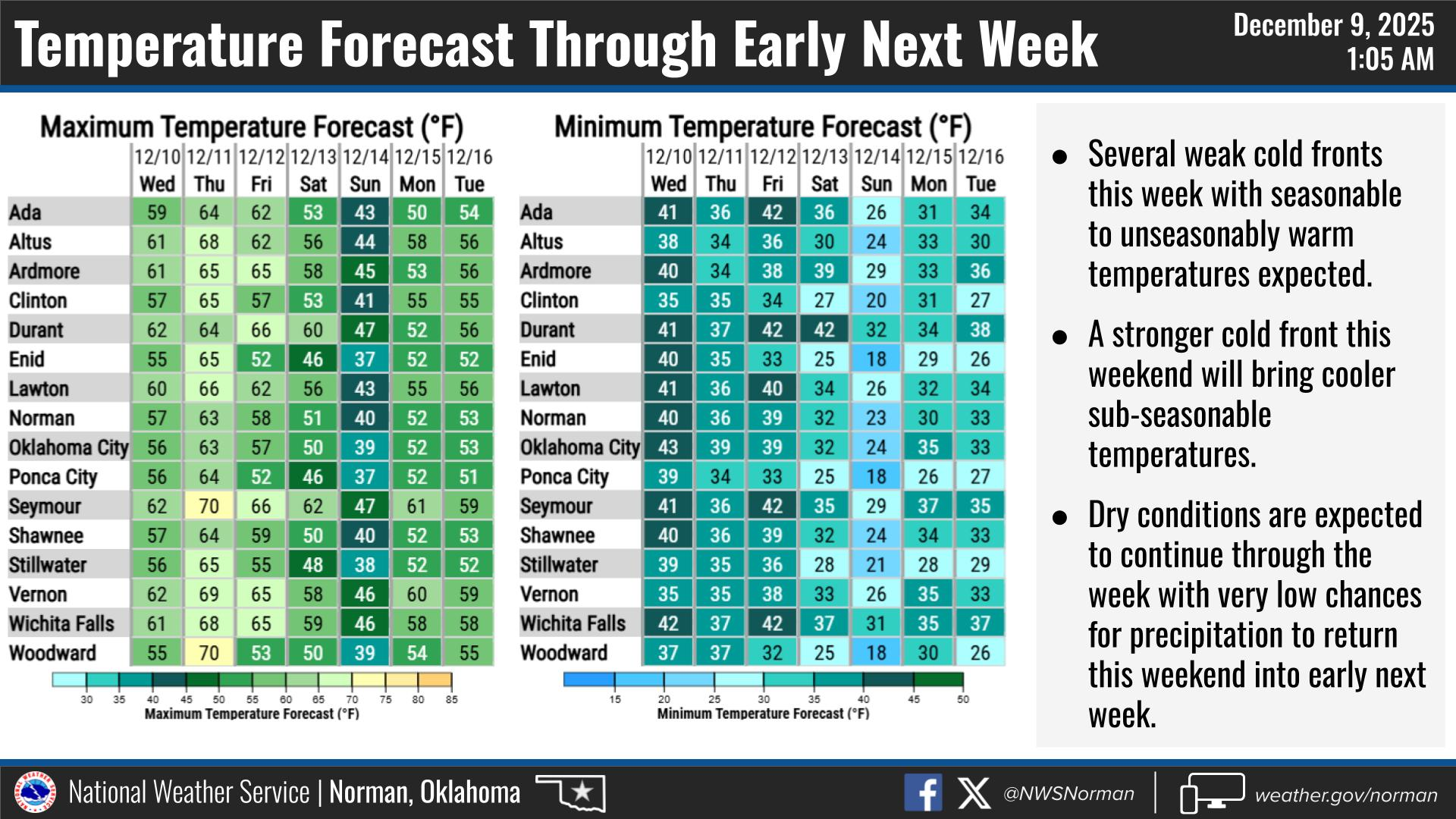
With Temps looking to reach the 60s and winds being a little gusty, we’ll seem cooler than it really will be. 60’s look good and we’ll feel that a little better on the north side of any building while standing in the sun and out of the wind. We’ll have several fronts push through the area this week but all should be dry. At this time per guidance, this weekend looks ok for Saturday and then a strong front pushes in for Sunday when temps will take a nosedive. No precip is expected through early next week. We’ll see what happens.
Overall, we’ll be ok so here’s your forecast from the NWS/NORMAN:
Tuesday- Sunny. Not as cool with highs in the mid-60s. Southwest winds 10 to 15 mph with gusts up to 25 mph.
Tuesday Night- Mostly clear in the evening, then becoming partly cloudy. Lows in the upper 30s. Southwest winds 5 to 10 mph, becoming northwest 10 to 15 mph after midnight.
GARFIELD COUNTY EM is our notification and preparedness app. If you don’t have it, you’re NOT prepared! REMEMBER that each day’s post appears under the GCEM Blog icon on the app.
HAVE A GOOD DAY!