TODAY’S WEATHER OUTLOOK FROM GARFIELD COUNTY EMERGENCY MANAGEMENT – 02/10/2026
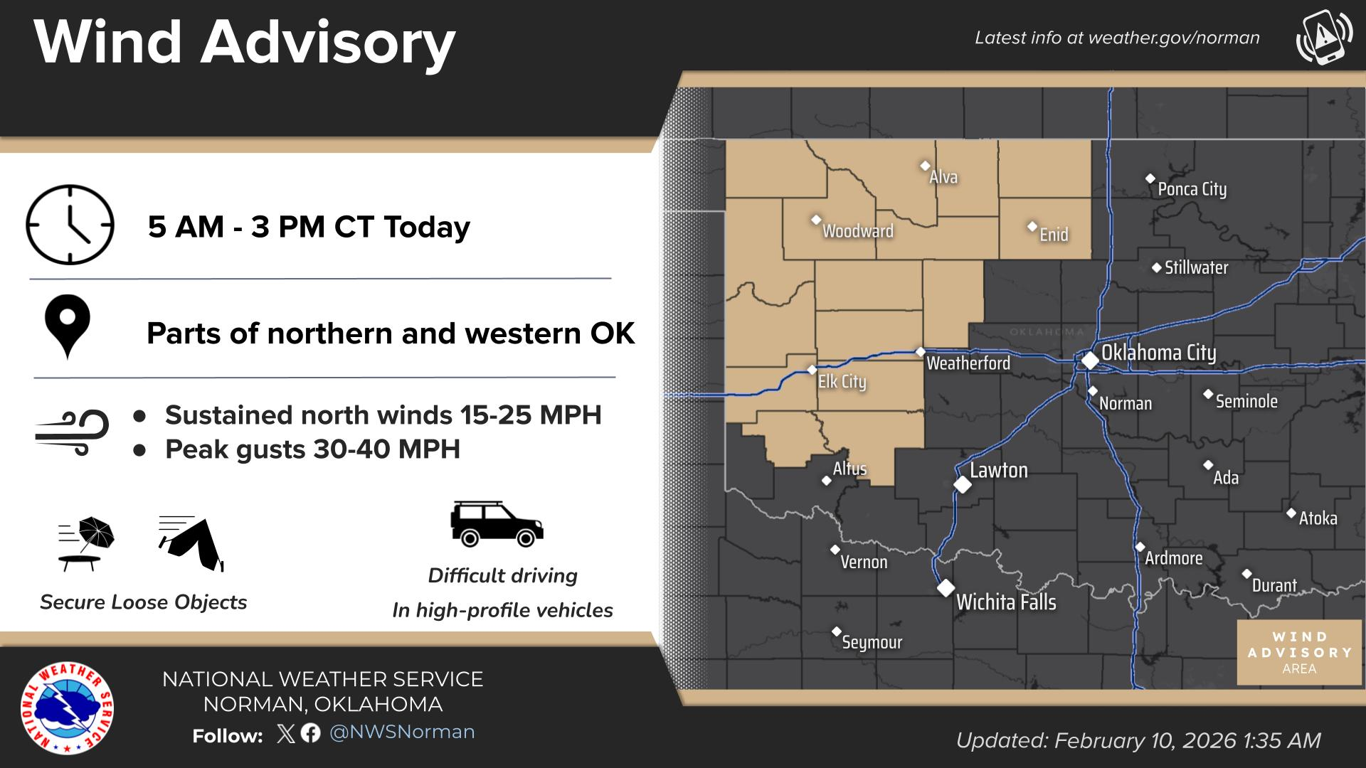
Wind Advisory in effect from February 10, 05:00 AM CST until February 10, 03:00 PM CST
Good morning, Garfield County!
The warmth yesterday was nice while it lasted, but reality is moving back in today. We’re starting the morning with cloudy skies and temperatures around 52°F, and while we’ll still see a high in the upper 50s, the wind is going to be the main story. Outdoor burning is NOT a good idea today!
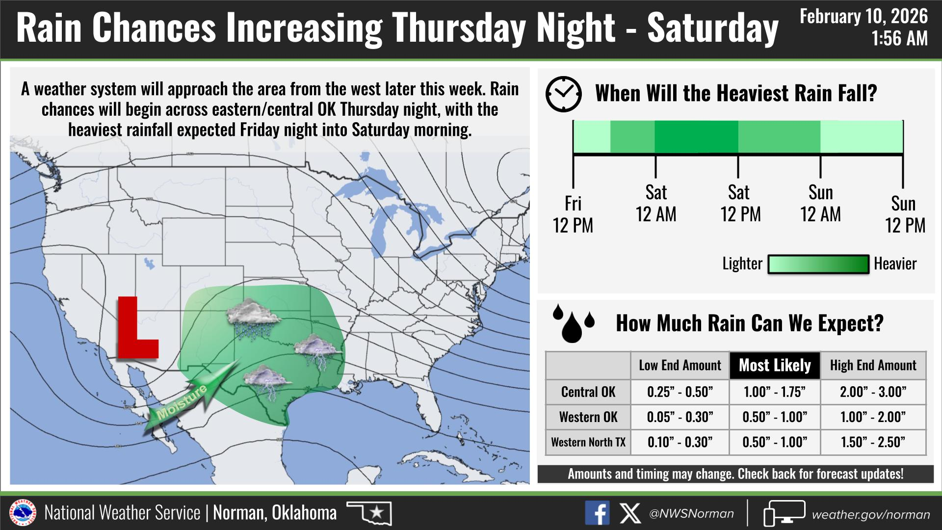
A cold front is pushing through this morning, bringing strong north winds behind it. We’re looking at sustained winds around 15-25 mph, with gusts up to 40mph. Rain chances today are not looking very promising for any real moisture. We’ll keep an eye on the end of the week, as rain chances still look better for Friday and Saturday.
YOUR AREA FORECAST FROM THE NWS/NORMAN:
- TODAY: Mostly cloudy this morning, then becoming partly sunny. Breezy and much cooler with highs in the upper 50s. North winds 15 to 25 mph with gusts up to 40 mph.
- TONIGHT: Partly cloudy in the evening, then clearing. Colder with lows around 30. North winds 10 to 15 mph.
Safety/Preparedness Guidelines:
- Fire Danger: Even with the cooler temps, the north winds are going to be aggressive. Any spark could get out of hand fast in these conditions, so please avoid any outdoor burning today.
- Secure Loose Outdoor Items: With gusts hitting 40 mph, make sure your trash cans, patio furniture, and trampolines are secured so they don’t end up in your neighbor’s yard.
- Stay Informed: Keep the Garfield County Emergency Management APP handy for any sudden updates or alerts from the NWS/Norman.
Have a safe Tuesday and hang onto your hats!
Jacob Price GCEM-1