TUESDAY WEATHER OUTLOOK FROM GARFIELD COUNTY EMERGENCY MANAGEMENT – 01/20/2026
Good morning, Garfield County!
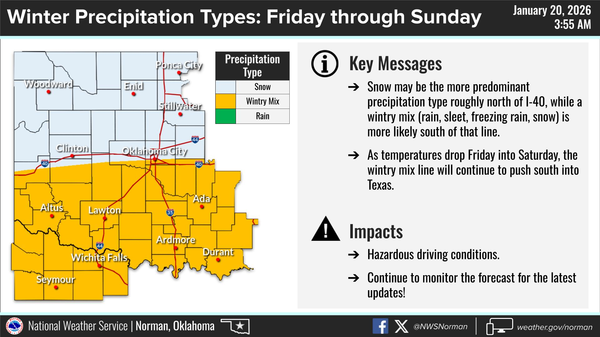
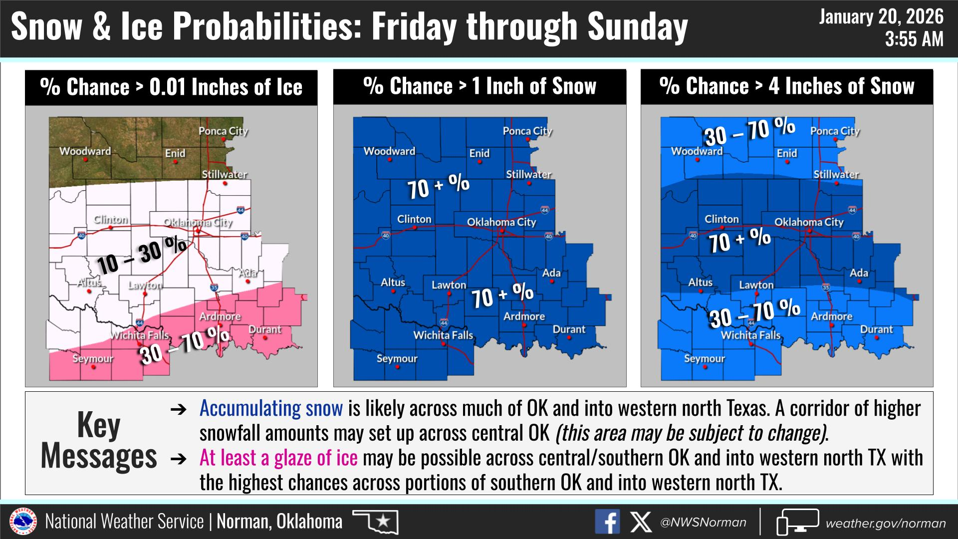
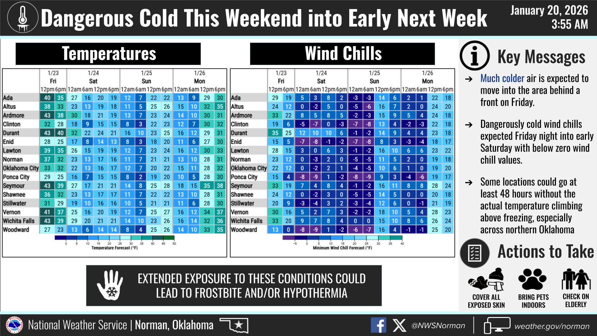
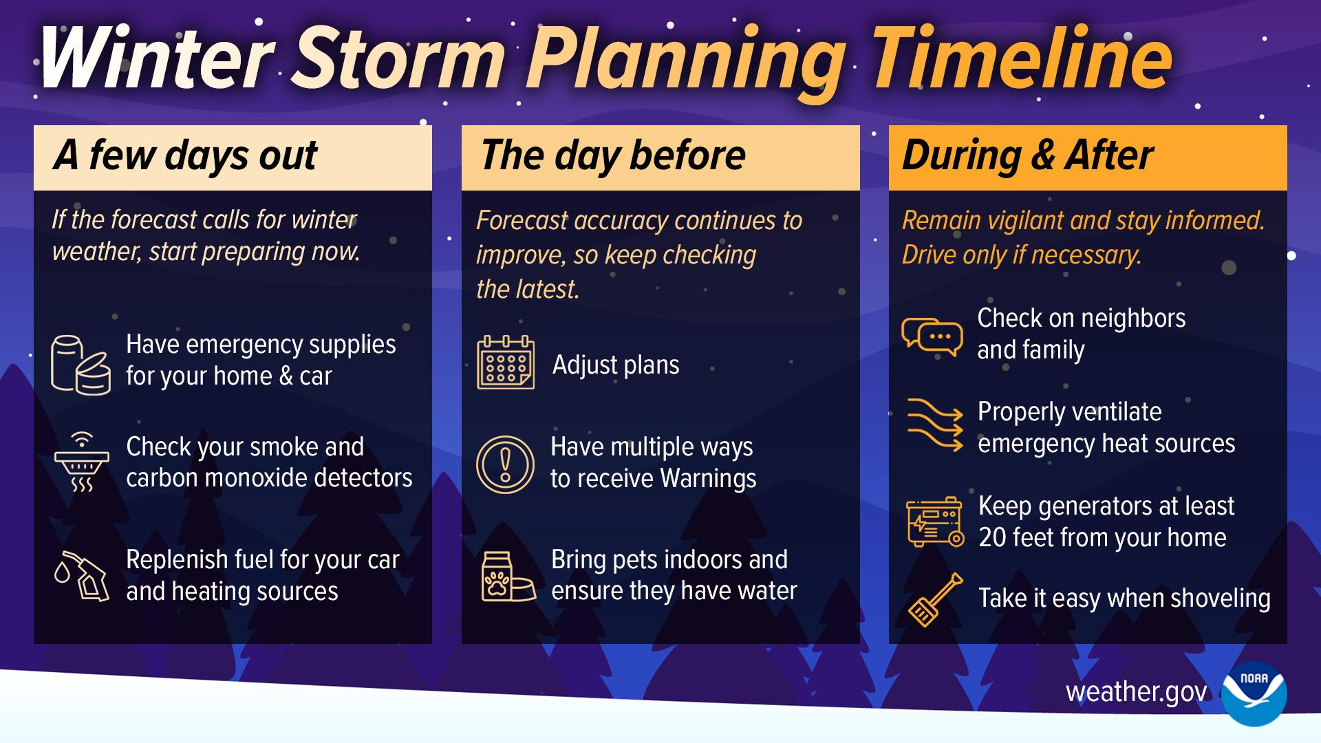
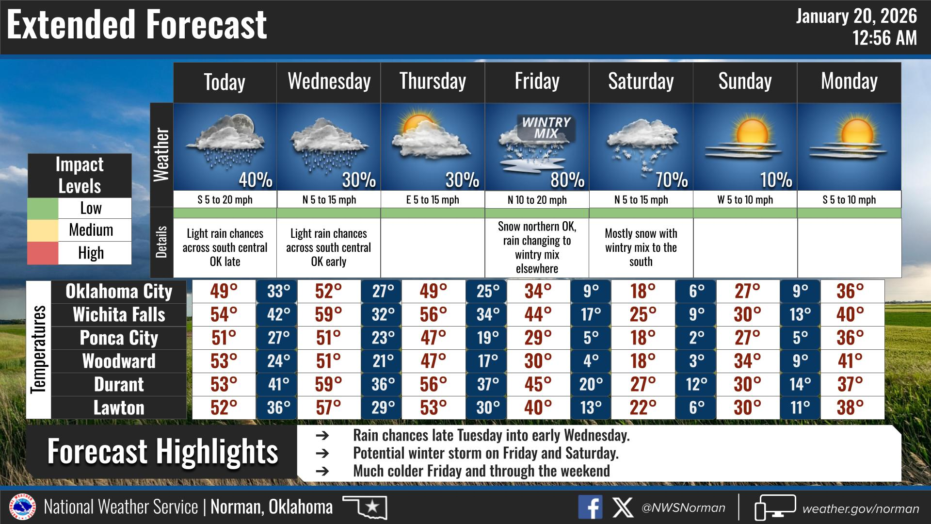
We are seeing a cold start this morning, but a significant warmup is on the way as winds shift to the south. After yesterday’s flurries, we will enjoy full sunshine today with temperatures climbing much closer to seasonal averages. As you have probably heard, we could see some winter precipitation at the end of the week and into the weekend. It’s still a few days out so we will have to keep an eye on it as the exact track of the storm is still uncertain. Regardless we are looking at dangerously cold temperatures over the weekend. Today through Thursday are looking like the best days to make any preparations needed for the incoming temperatures and possible weather. We will keep an eye on it and advise when needed.
Here is your forecast from the NWS/Norman:
Today – Sunny. Not as cool with highs around 50. South winds 15 to 20 mph. Gusts up to 35 mph this afternoon.
Tonight – Mostly clear. Cold with lows in the upper 20s. South winds 10 to 15 mph, becoming southwest 5 to 10 mph after midnight.
Safety Tips:
- Upcoming Cold Temps: Start making preparations now for the upcoming cold temperatures, and possible winter weather.
- Layering: Despite the afternoon warmup, morning wind chills remain in the teens. Continue to dress in layers for the morning commute.
- Stay Informed: Download the Garfield County EM app to get the latest updates directly to your phone.
Have a safe day!
Jacob Price GCEM-1