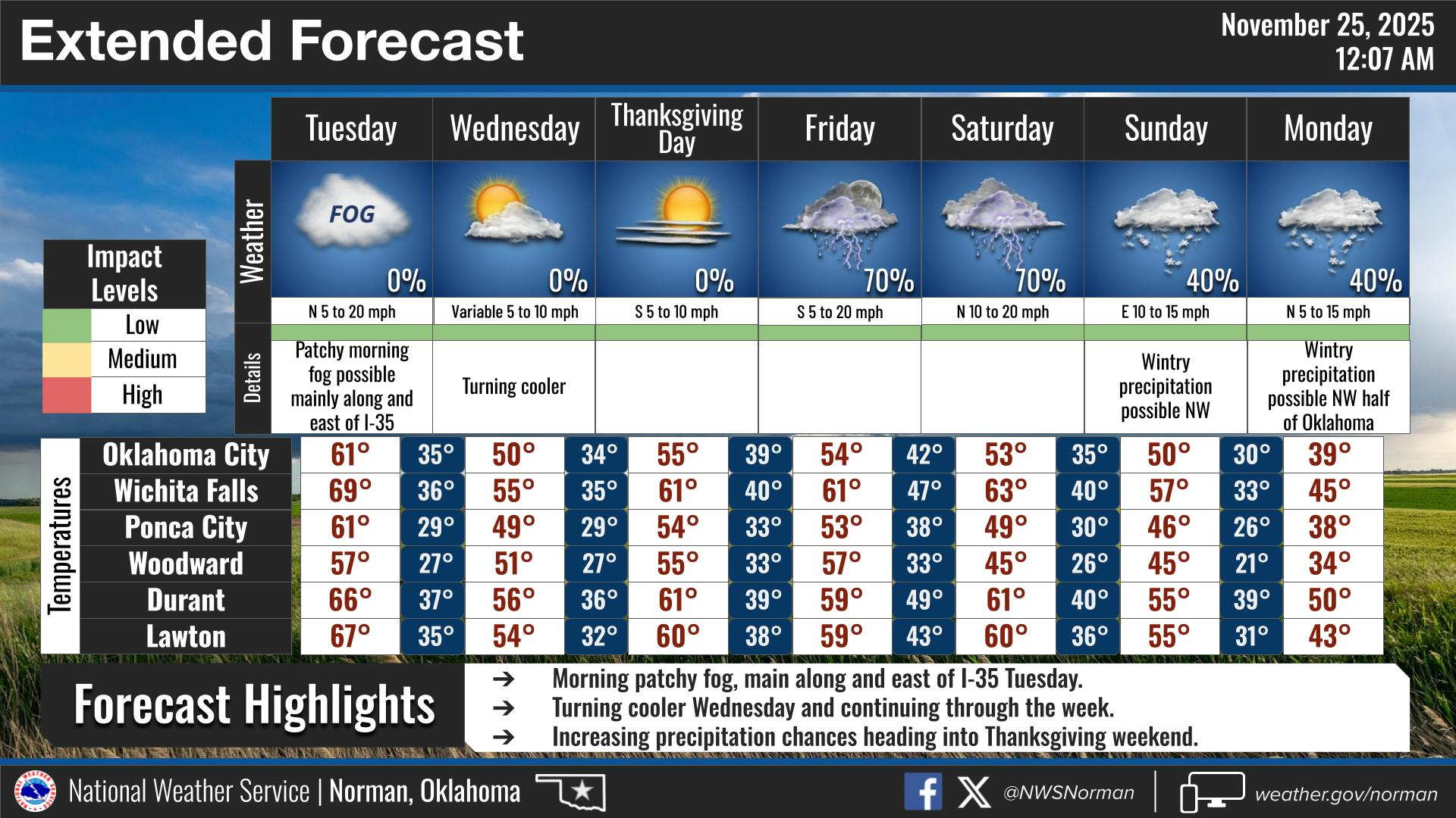
0250L-TUESDAY OUTLOOK FROM GARFIELD COUNTY EMERGENCY MANAGEMENT- 11/25/25
A cold front is heading our way and should reach the area sometime this morning. Winds will increase 10-20 mph and we’ll see gusts upwards of 30 mph. Highs will be around 60 but it will feel colder. Our low temps Wednesday morning will be in the 20’s so prepare, once again, for freezing temps overnight.
The graphics attached have some smaller print. Take the time to read that if possible. Thank you.
Overall, we’ll be ok, so here is your forecast from the NWS/NORMAN:
Tuesday- Sunny. Highs around 60. Northwest winds 15 to 20 mph with gusts up to 30 mph.
Tuesday Night- Mostly clear. Colder with lows in the upper 20s. Northwest winds 10 to 15 mph.
GARFIELD COUNTY EM is our notification and preparedness app. If you don’t have it, you’re NOT prepared! REMEMBER that each day’s post appears under the GCEM Blog icon on the app.
HAVE A GOOD DAY!