4:20 AM WEATHER UPDATE AND OUTLOOK FROM GARFIELD COUNTY EMERGENCY MANAGEMENT – 3/4/2026
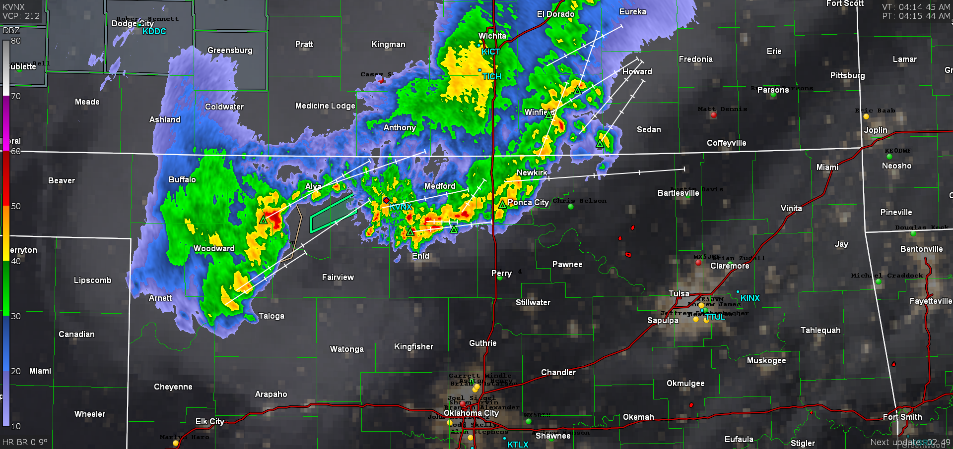
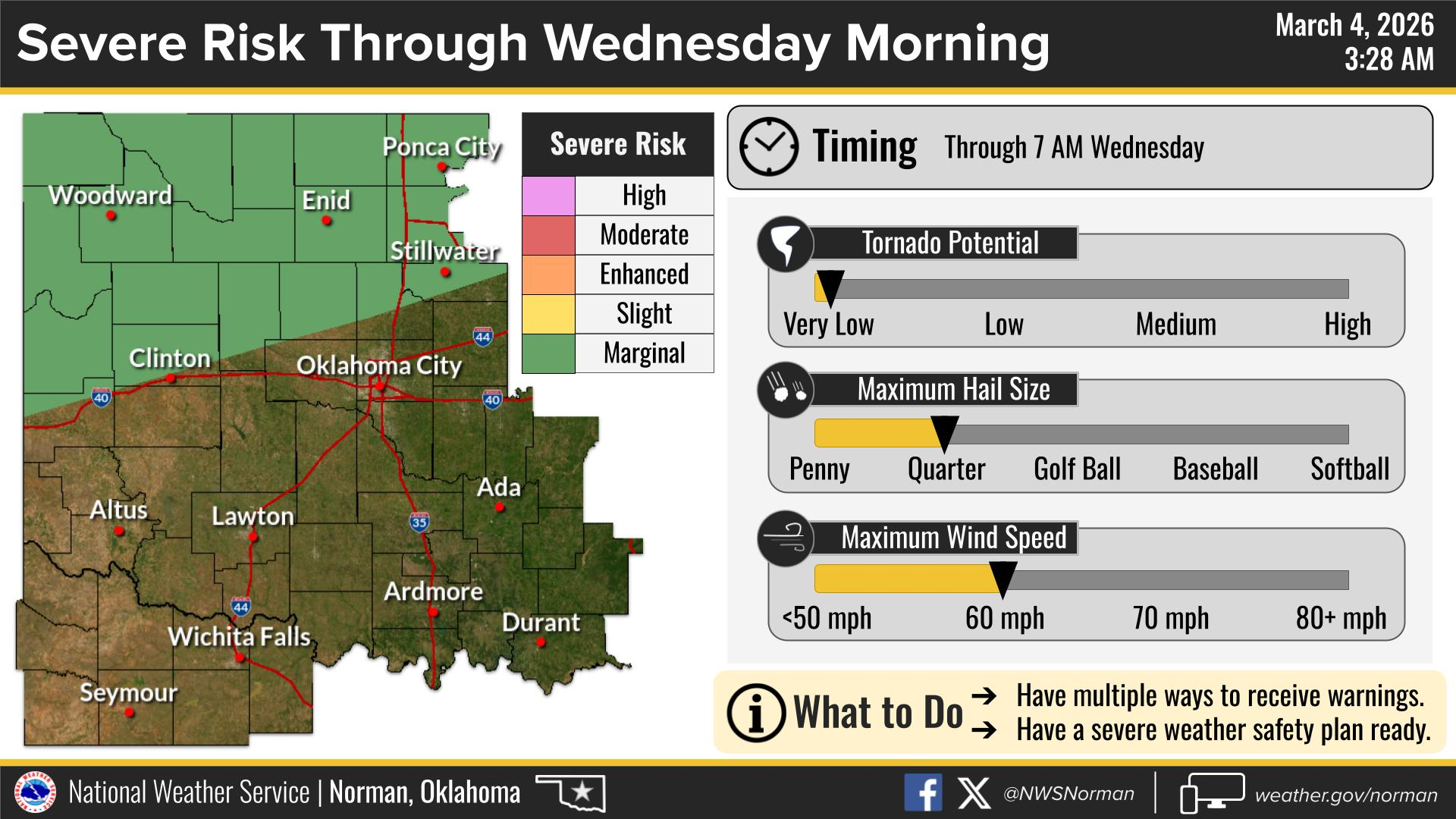
Good morning, we currently have thunderstorms moving through the area. Storms are not severe at this time, however we will remain in a Marginal risk for severe storms until around 7:00 am. With quarter size hail and 60mph wind gusts being the main threat.
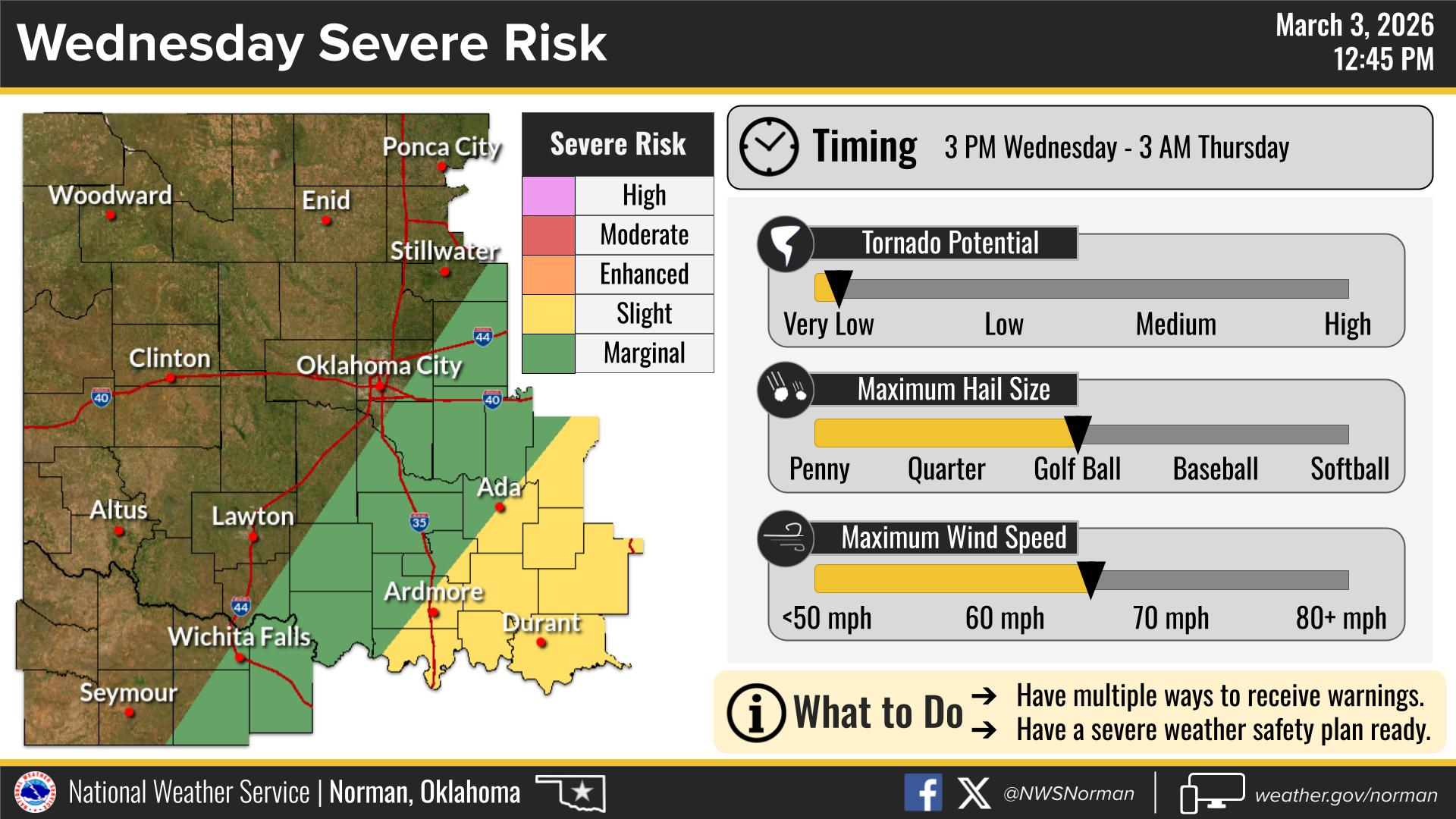
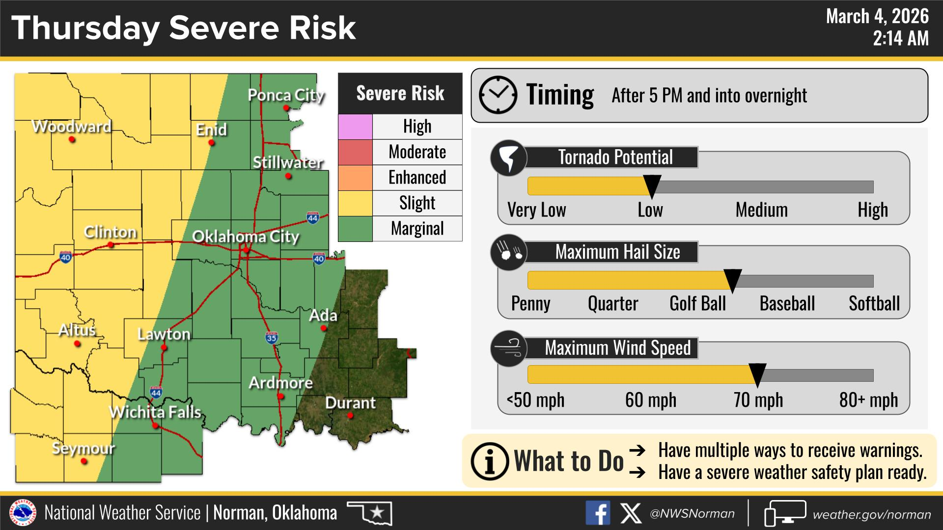
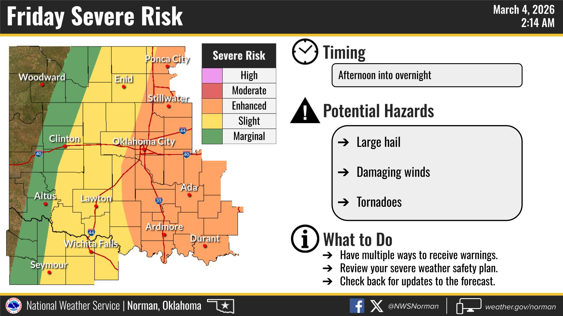
The severe threat for Wednesday still looks to stay in southeastern Oklahoma, with our threats picking back up on Thursday and Friday. Friday looks like it may be the more active day as of right now.
Here is today’s Forecast from the NWS/Norman:
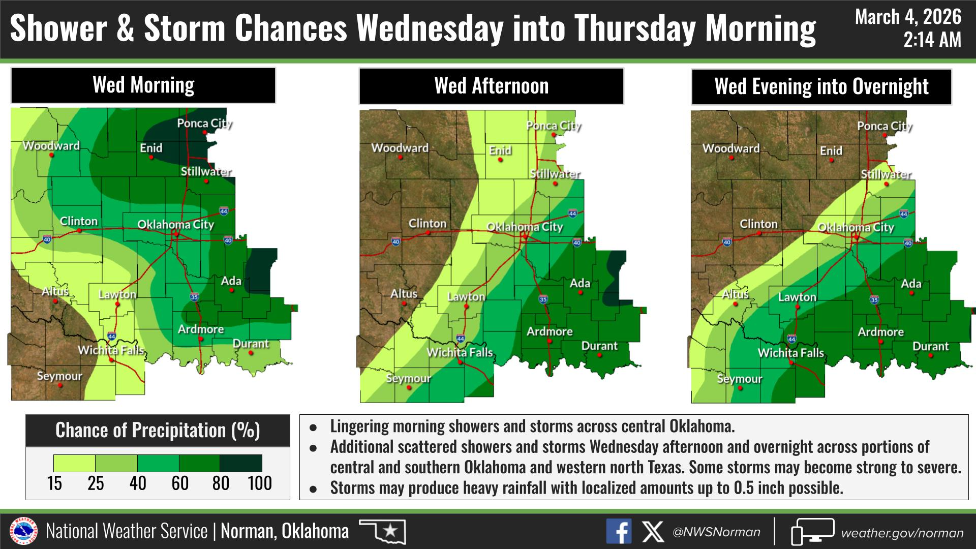
TODAY -Mostly cloudy. Showers with a slight chance of thunderstorms in the morning, then a slight chance of showers in the afternoon. Much cooler with highs around 50. North winds 5 to 10 mph. Chance of rain 90 percent.
TONIGHT – Partly cloudy. Lows around 40. Northwest winds around 5 mph, becoming south after midnight.
I will continue to monitor the storms moving through this morning, and advise as needed.
Have a great day!
Jacob Price EM-1