TODAY’S WEATHER OUTLOOK FROM GARFIELD COUNTY EMERGENCY MANAGEMENT – 2/16/2026
Wind Advisory in effect from February 17, 10:00 AM CST until February 17, 08:00 PM CST
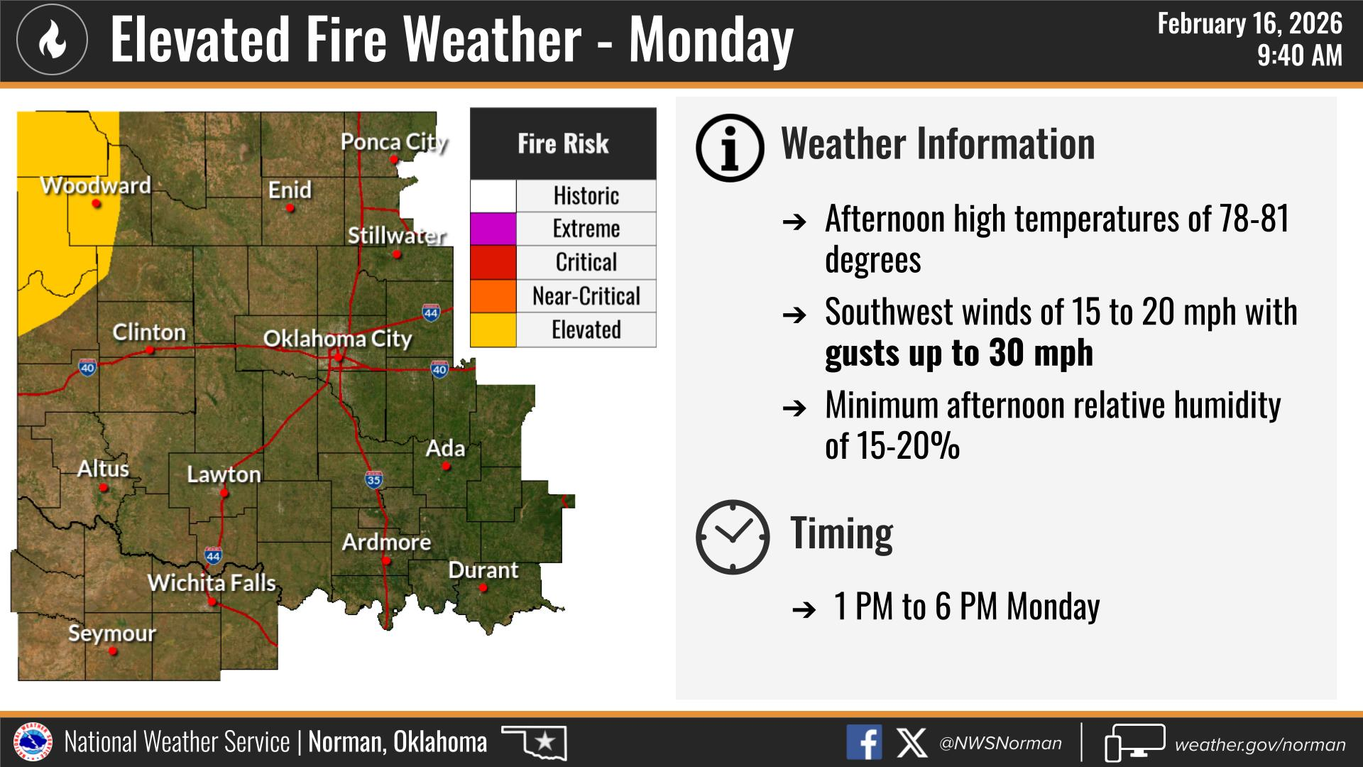
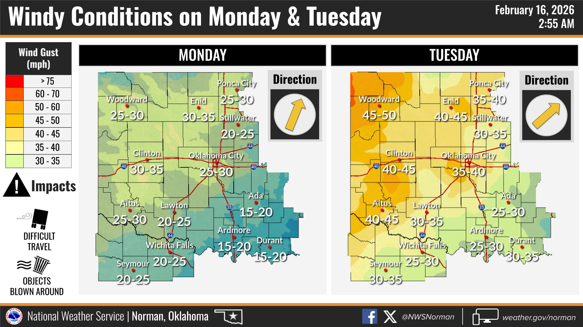
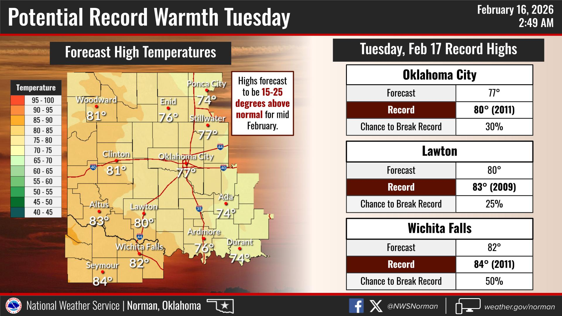
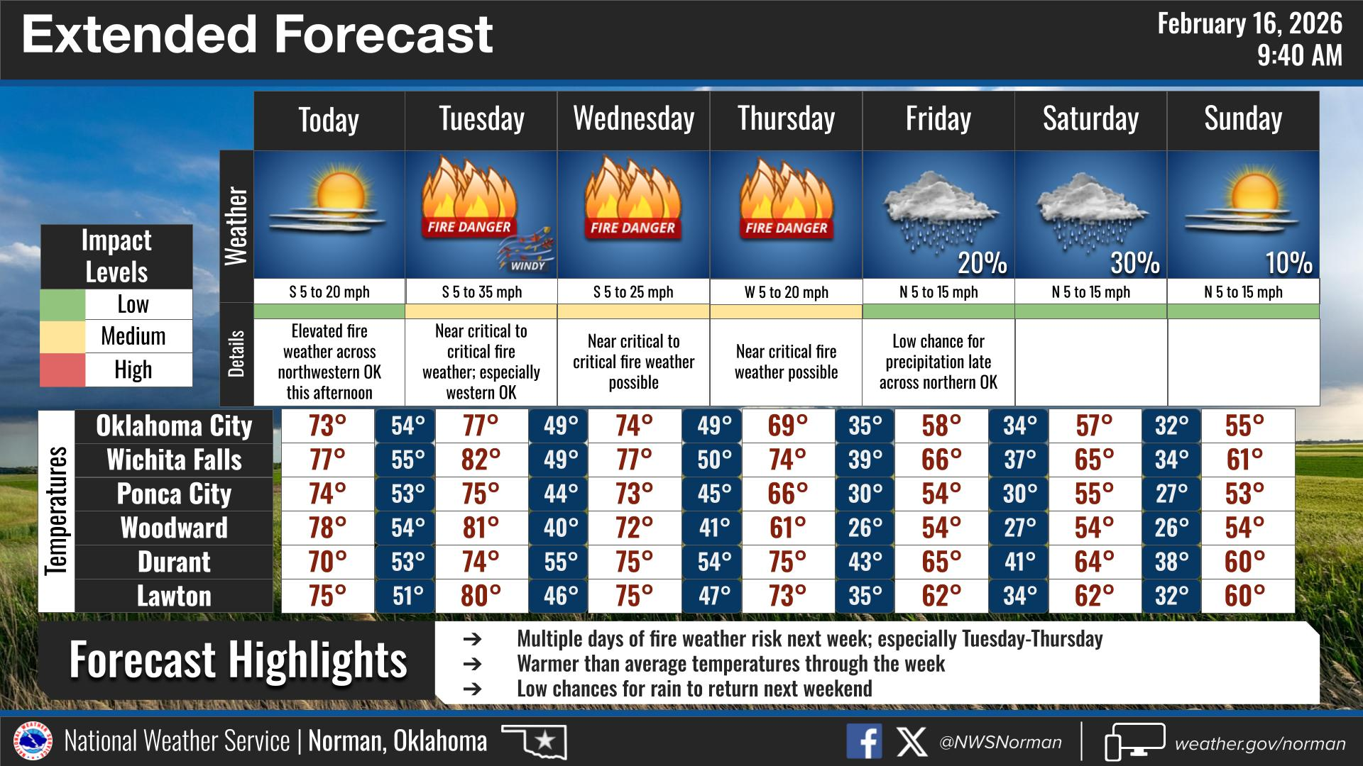
Clouds will increase as we go through the day, and it’s going to turn very warm and windy by this afternoon with highs reaching the mid-70s. South winds will stay breezy, so you’ll definitely feel it if you’re spending time outside today.
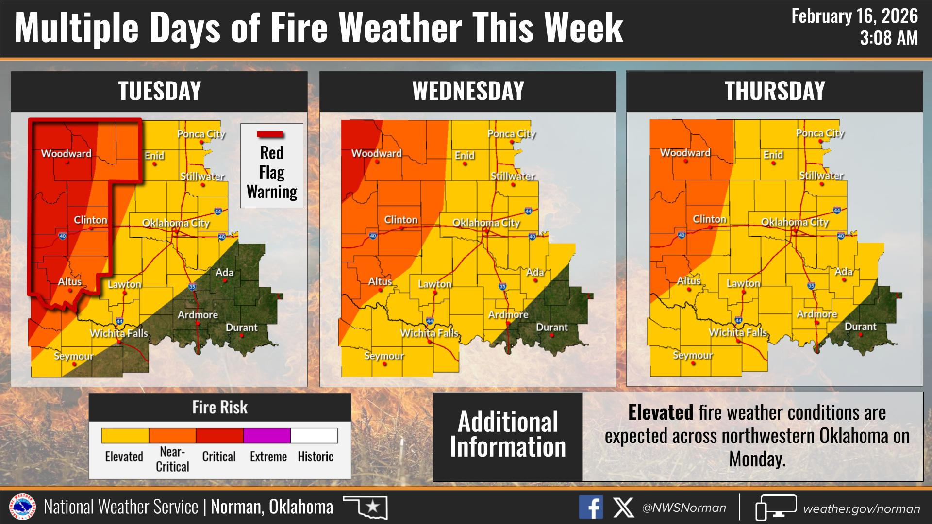
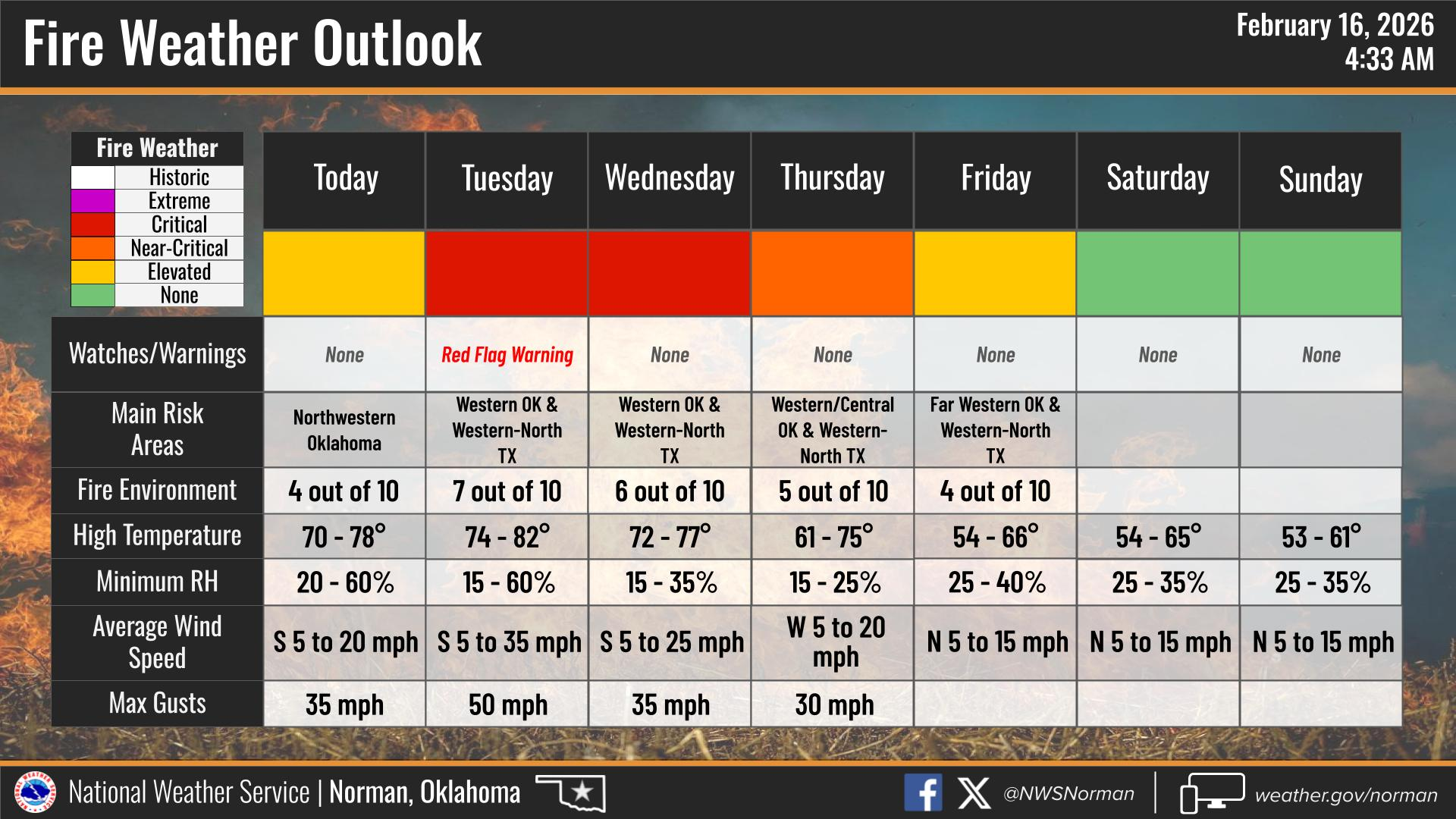
As for fire weather this week, we need to stay mindful of conditions over the next several days. We’re looking at a stretch of warm temperatures, gusty winds, and low humidity through mid to late week, which will lead to elevated grassland fire danger—especially during the afternoon hours. It won’t take much for a fire to spread quickly in these conditions, so please avoid outdoor burning and anything that could cause sparks.
HERE IS TODAY’S FORECAST FROM THE NWS/NORMAN:
TODAY – Sunny, breezy with highs in the mid-70s. South winds 15 to 25 mph with gusts up to 35 mph.
TONIGHT – Partly cloudy in the evening, then becoming mostly cloudy. Lows in the mid-50s. South winds 15 to 20 mph with gusts up to 35 mph.
Have a Great Rest of Your Day!
Jacob Price GCEM-1