0325L-TUESDAY OUTLOOK FROM GARFIELD COUNTY EMERGENCY MANAGEMENT- 10/28/25
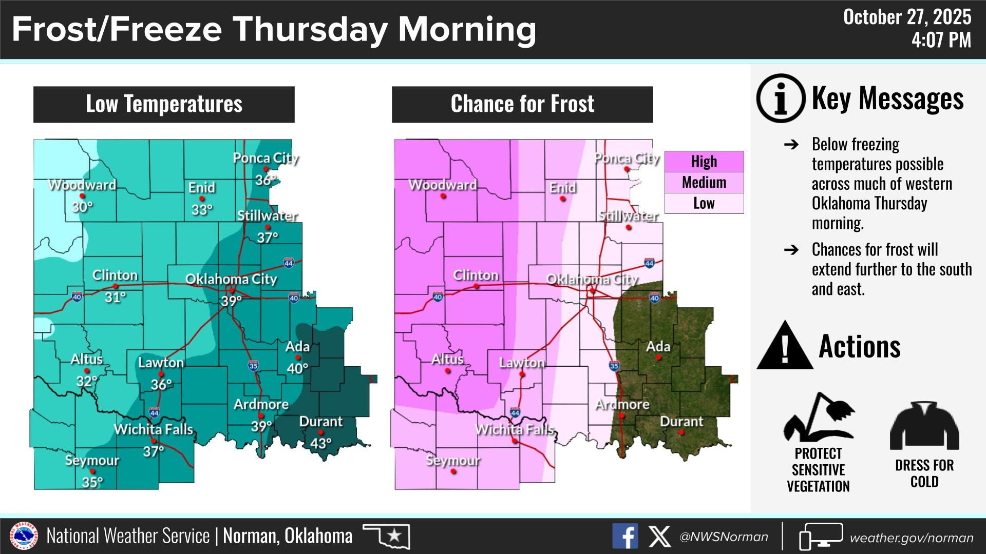
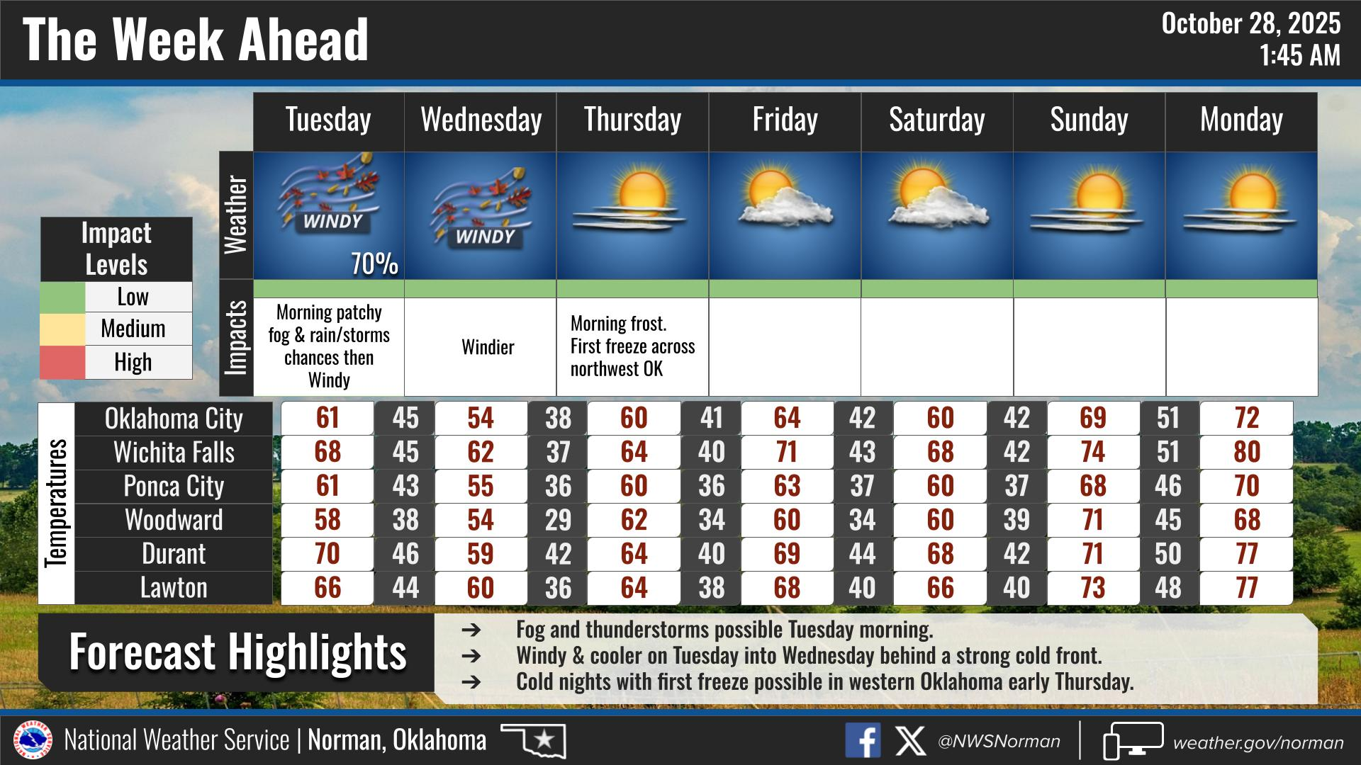
A cold front is on it’s way and it will bring a “chance” for a thunderstorm or two & pretty hefty winds. We could see wind gusts today upwards of 40 mph and upwards of 50 mph on Wednesday. It’s safe to say that it’s going to be windy. We will have a good chance to see our first freeze “Thursday” morning as forecast lows have us around 33. On Wednesday morning we’ll see WIND CHILL TEMPS around 32 with an overnight low around 40.
If your kids walk to school, make sure they are dressed for the colder temps this week. Also, disconnect the hoses from your outdoor faucets too. Here is a link for cold weather info and its also on our Garfield County EM app. https://www.weather.gov/safety/winter
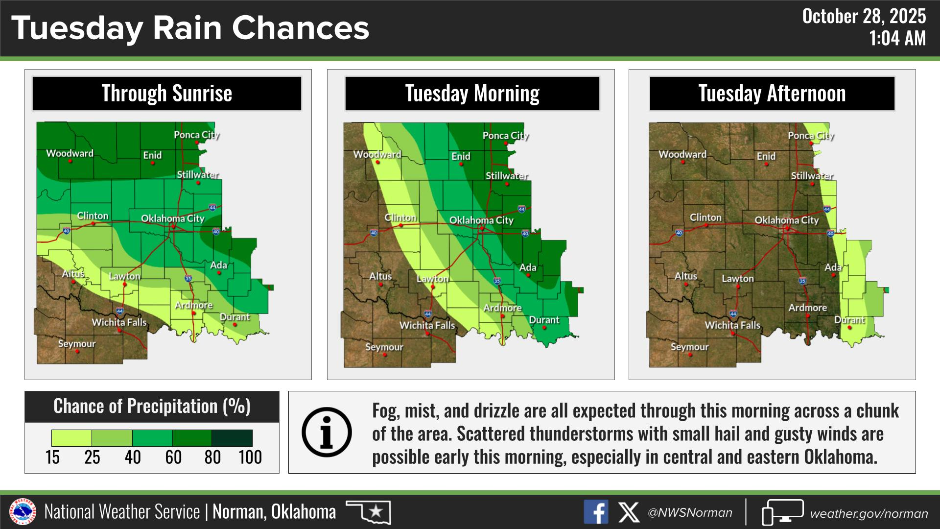
Overall, we’ll be ok, so here is your forecast from the NWS/NORMAN:
Tuesday- Patchy fog in the morning. Mostly cloudy with showers likely with a slight chance of thunderstorms in the morning, then mostly sunny in the afternoon. Breezy with highs around 60. North winds 20 to 25 mph with gusts up to 40 mph. Chance of rain 70 percent.
Tuesday Night- Mostly clear and breezy. Lows in the lower 40s. Northwest winds 20 to 25 mph with gusts up to 40 mph.
GARFIELD COUNTY EM is our notification and preparedness app. If you don’t have it, you’re NOT prepared! REMEMBER that each day’s post appears under the GCEM Blog icon on the app.
HAVE A GOOD DAY!