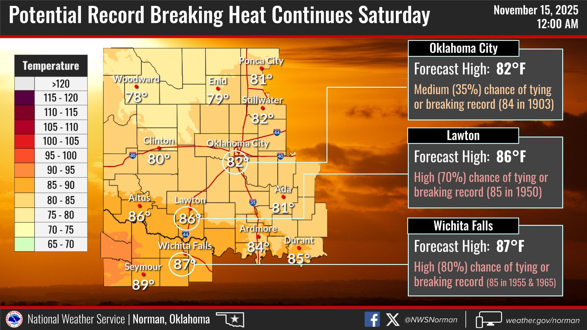
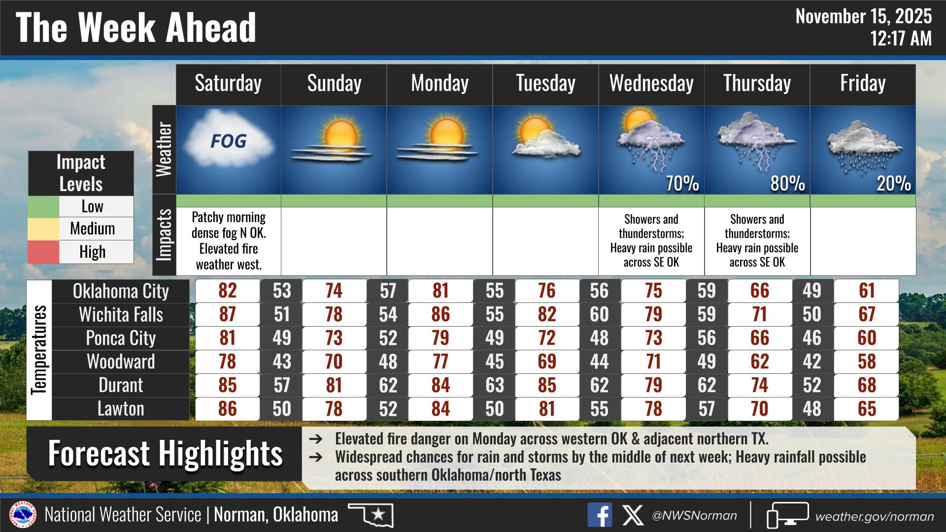
0300L-SATURDAY OUTLOOK FROM GARFIELD COUNTY EMERGENCY MANAGEMENT- 11/15/25
Today will be toasty with highs around 80 and light winds. We expect a front to push in around noonish, give or take, and we’ll mostly see a wind shift. The air behind this front is a touch cooler but we’ll see a temperature difference in tomorrows high around 10 degrees cooler than today. Other than that, it may rain next week. We’ll see what happens.
Overall, we’ll be ok, so here is your forecast from the NWS/NORMAN:
Saturday- Patchy fog in the morning. Sunny. Highs around 80. West winds 5 to 10 mph, becoming north in the afternoon.
Saturday Night-Clear. Lows in the mid-40s. North winds around 5 mph.
GARFIELD COUNTY EM is our notification and preparedness app. If you don’t have it, you’re NOT prepared! REMEMBER that each day’s post appears under the GCEM Blog icon on the app.
HAVE A GOOD DAY!