WEDNESDAY WEATHER OUTLOOK FROM GARFIELD COUNTY EMERGENCY MANAGEMENT – 4/15/2026
Good morning,
We are starting off partly sunny this morning with a current temperature of 72°.
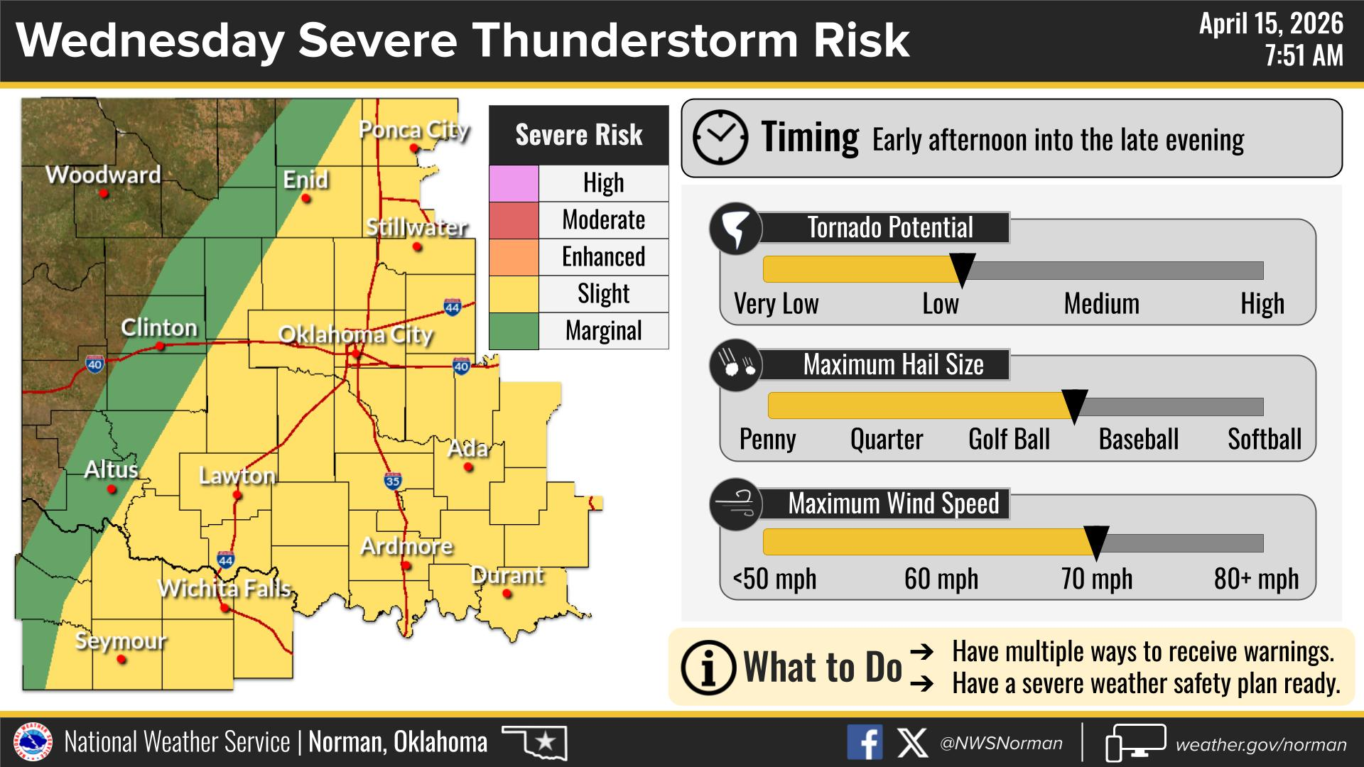
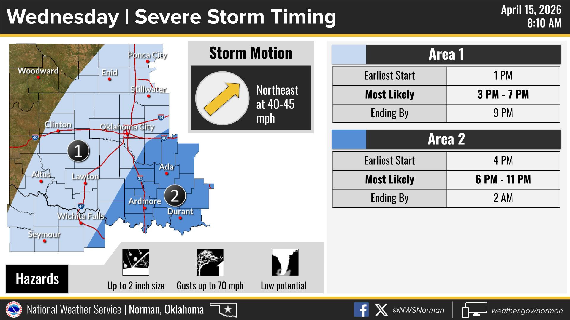
We have a marginal to slight risk for severe weather this afternoon, mainly between 3:00 PM and 7:00 PM.
Main hazards include:
- Golf ball to baseball size hail
- Damaging winds 70+ mph
- Tornado threat remains low, but not zero
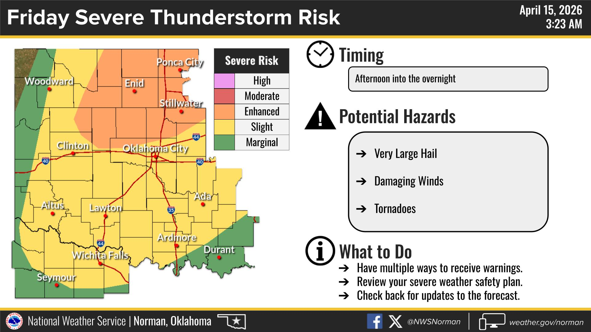
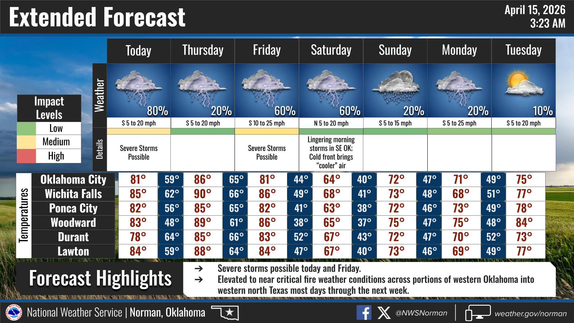
Looking ahead, Friday is the day to watch. Our area is currently in an enhanced risk for severe weather, with all hazards possible. Timing is still uncertain but appears to be Friday afternoon into the overnight hours. I will continue to share updates as we get closer.
Please stay weather aware and be prepared to take action if warnings are issued.
Official NWS Norman Forecast:
Today:
Partly sunny. A slight chance of showers this morning, then a chance of showers and thunderstorms this afternoon. Highs in the lower 80s. Southwest winds 15 to 20 mph, with gusts up to 30 mph. Chance of rain 50%.
Tonight:
Partly cloudy. A chance of showers and thunderstorms in the evening. Lows in the mid 50s. South winds 10 to 15 mph. Chance of rain 50%.
Have a great day,
Jacob Price, EM-1