WEATHER OUTLOOK FROM GARFIELD COUNTY EMERGENCY MANAGEMENT – 5/13/2026
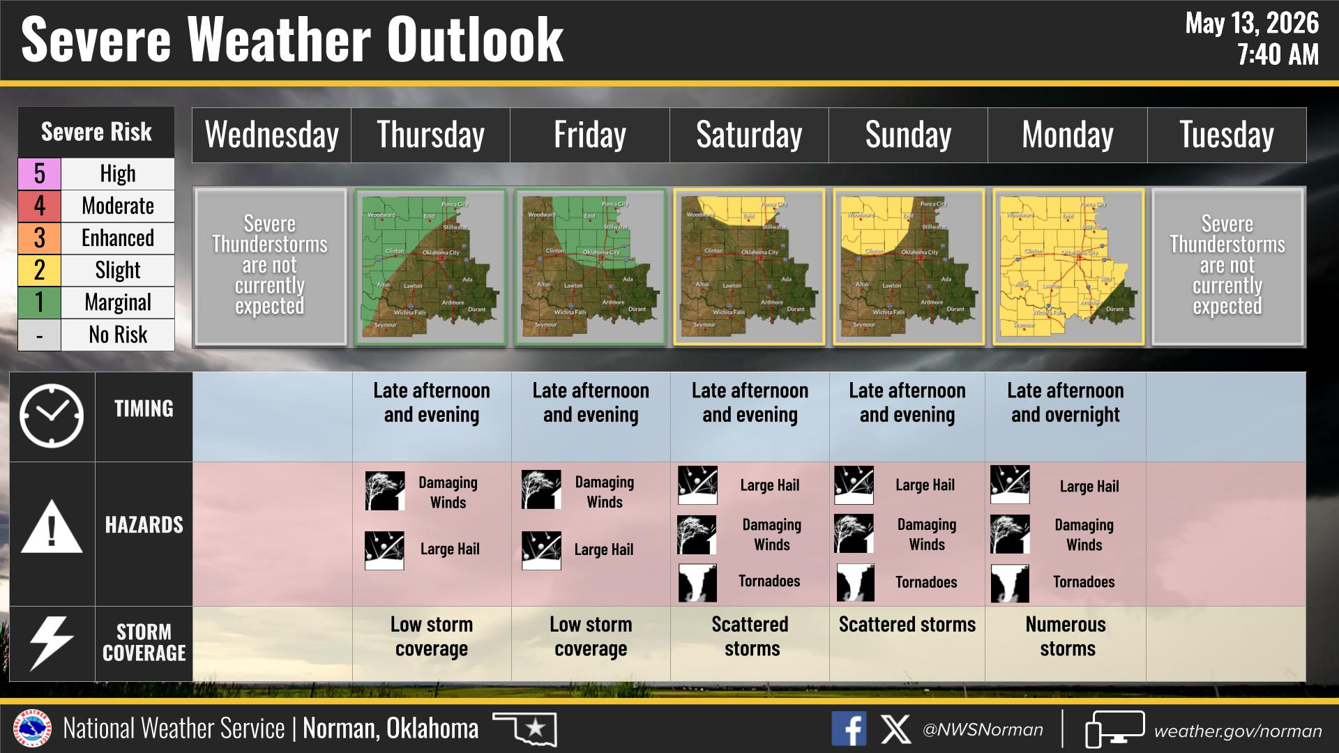
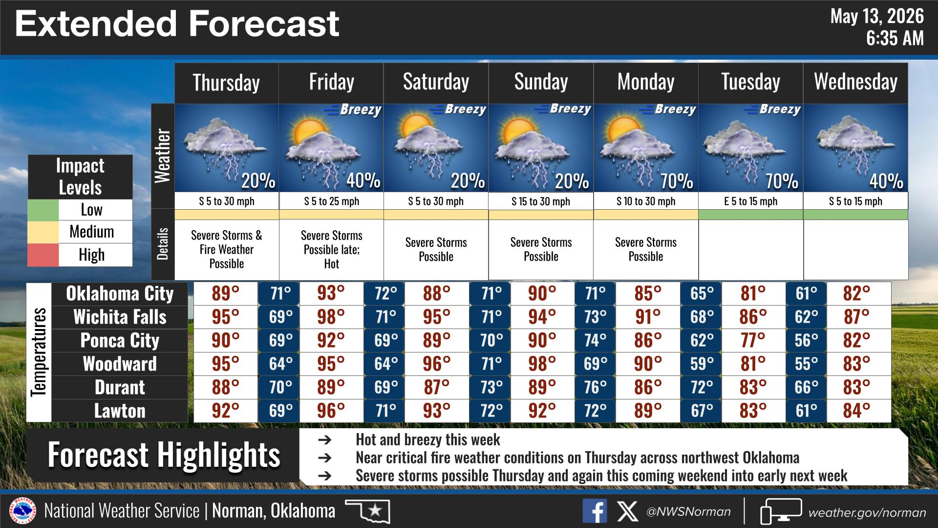
The National Weather Service in Norman is highlighting multiple chances for strong to severe thunderstorms across Oklahoma from Thursday through Monday.
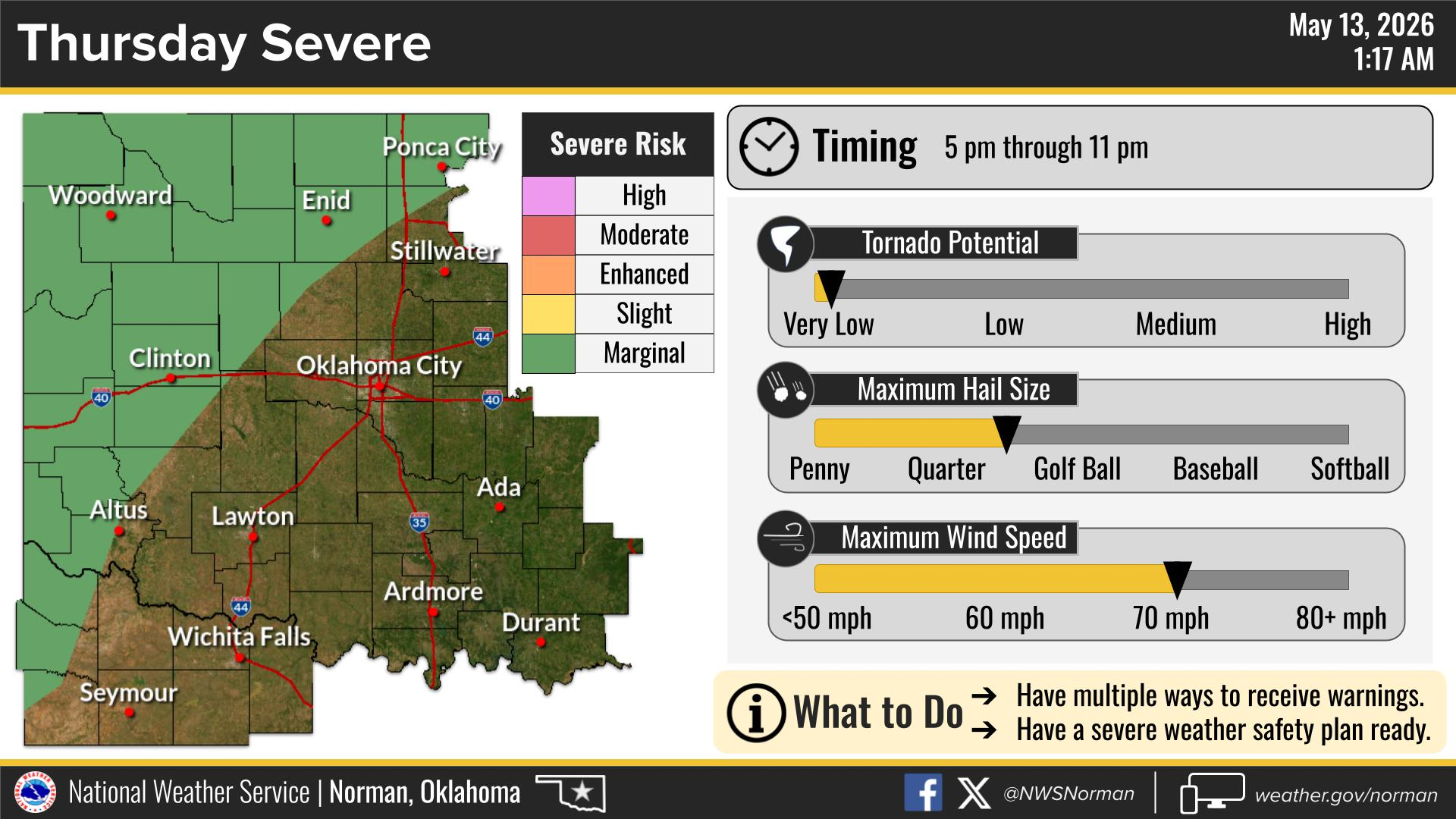
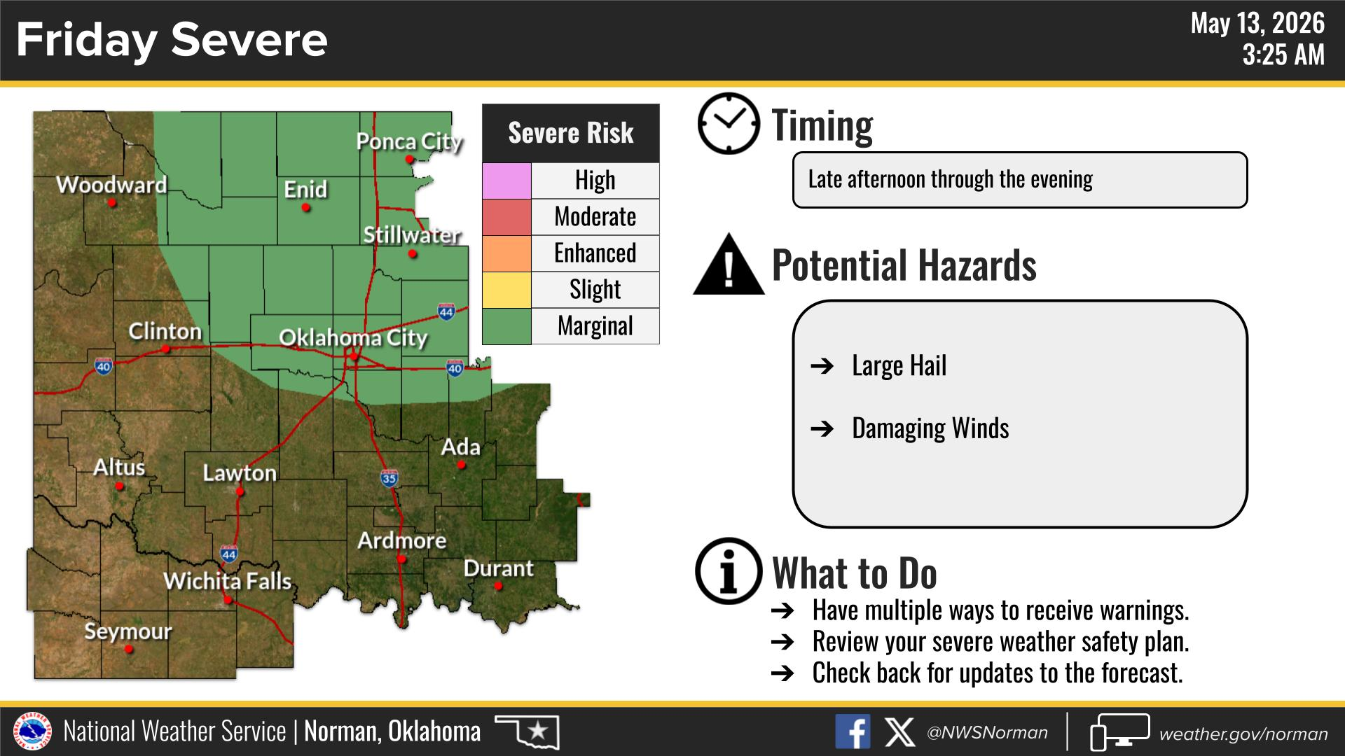
At this time, Thursday and Friday appear to bring a marginal risk for severe storms, but any storms that develop could produce damaging winds and large hail.
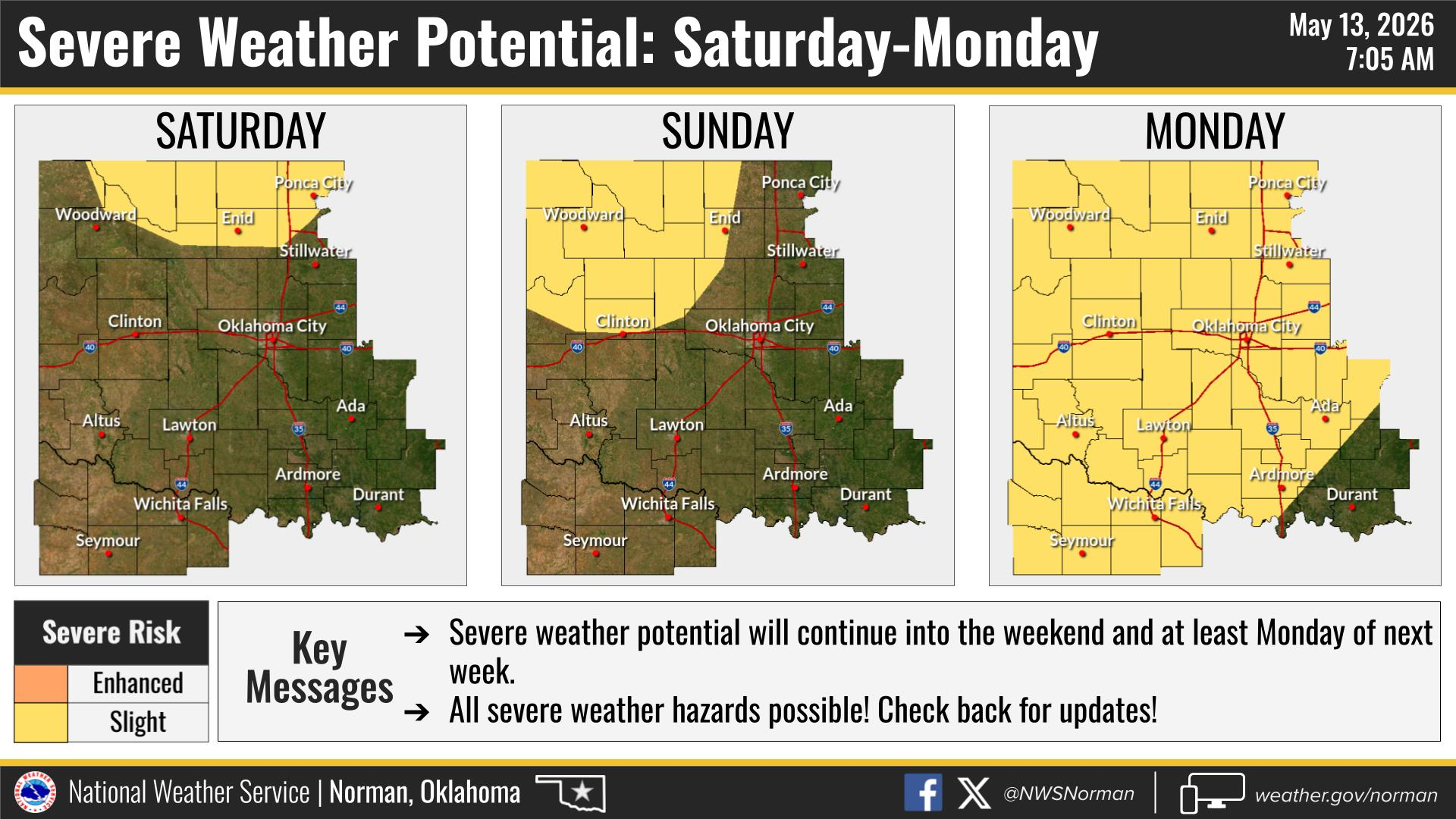
Storm chances increase through the weekend into early next week, with scattered to numerous storms possible Saturday through Monday. Hazards during this time may include:
• Large hail
• Damaging winds
• Tornadoes
The primary timing for storm development each day looks to be during the late afternoon and evening hours, with Monday potentially continuing into the overnight period.
Now is a good time to review your severe weather safety plans and make sure you have multiple ways to receive warnings.
We will continue to monitor forecast trends and provide updates as we get closer.
Here is your latest forecast from the National Weather Service in Norman:
Mostly clear this evening, becoming partly cloudy overnight. Lows in the upper 50s. East winds 10 to 15 mph with gusts up to 25 mph.
Mostly sunny, hot, and windy. Highs in the lower 90s. Southeast winds 15 to 25 mph with gusts up to 35 mph, becoming south 25 to 30 mph with gusts up to 45 mph during the afternoon.
Mostly cloudy with a slight chance of showers and thunderstorms during the evening, becoming partly cloudy after midnight. Windy conditions continue with lows in the upper 60s. South winds 20 to 30 mph with gusts up to 45 mph, decreasing after midnight. Rain chances remain low at 10 percent.
Have a good evening!
Jacob Price EM-1