0305L-TUESDAY OUTLOOK FROM GARFIELD COUNTY EMERGENCY MANAGEMENT- 11/18/25
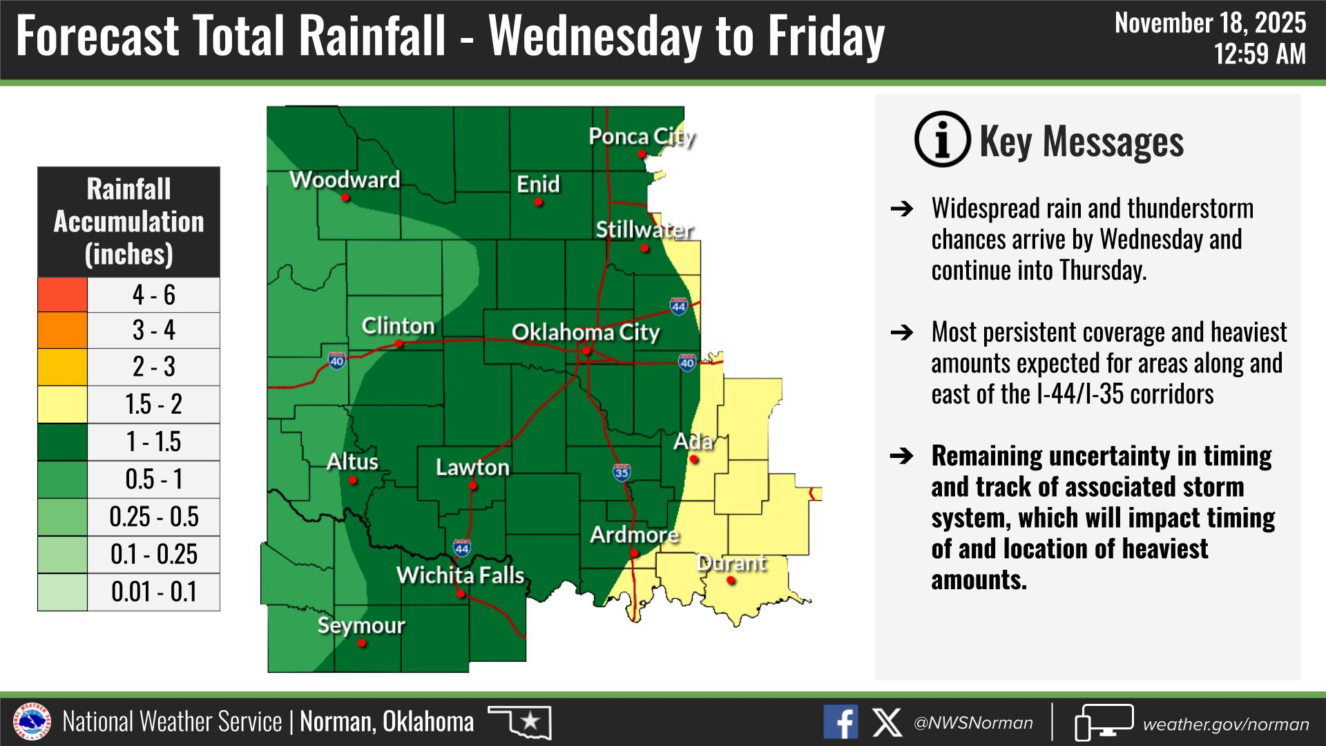
Another weak front will push into the area this morning only creating a wind shift. There may be a few clouds with it but we’ll still make it into the 70’s this afternoon. Otherwise, a nice day to get outside and enjoy the warm air and sunshine. Tomorrow will bring a chance for thunderstorms later in the day and overnight then off and on into the weekend. Graphics are showing that we might see an inch to inch and a half of rainfall. There are several variables out there so we’ll see how this incoming mess comes together.
Overall, we’ll be ok, so here is your forecast from the NWS/NORMAN:
Tuesday- Sunny. Highs in the lower 70s. Northwest winds 5 to 10 mph.
Tuesday Night- Partly cloudy in the evening, then becoming mostly cloudy. Lows in the lower 40s. Northeast winds around 5 mph.
GARFIELD COUNTY EM is our notification and preparedness app. If you don’t have it, you’re NOT prepared! REMEMBER that each day’s post appears under the GCEM Blog icon on the app.
HAVE A GOOD DAY!