SEVERE WEATHER UPDATE FROM GARFIELD COUNTY EMERGENCY MANAGEMENT – 4/14/2026
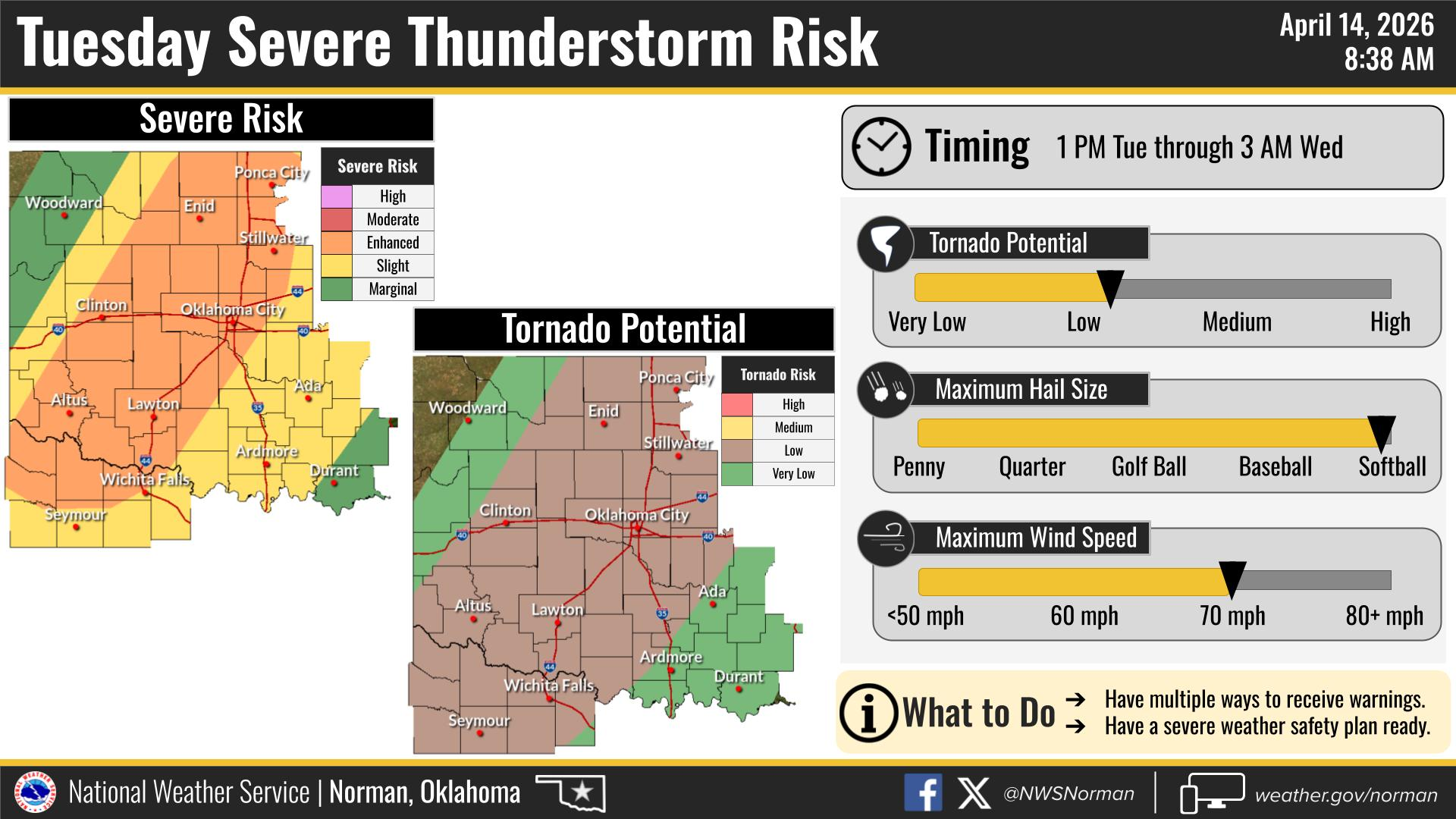
The Storm Prediction Center has upgraded our area to an Enhanced Risk for severe weather this evening.
Main threats include:
• Very large hail up to softball size
• Damaging winds of 70–80 mph
• Low, but not zero, tornado potential
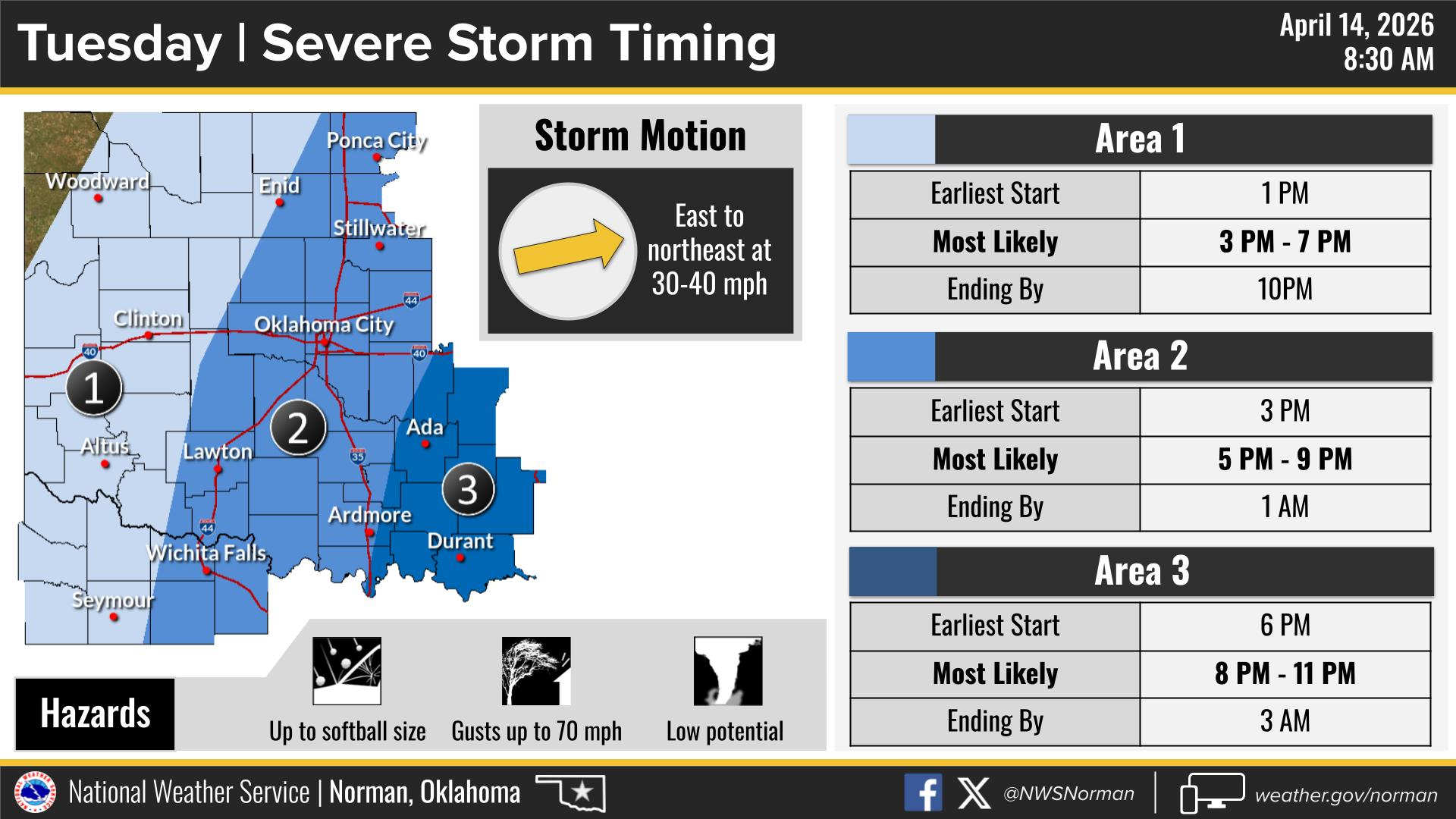
Storms are expected to develop along a dry line later this afternoon. The exact placement of that dry line remains uncertain.
Timing for storms is most likely between 3:00 PM and 9:00 PM.
We have a weather briefing scheduled with NWS Norman at 1:00 PM and will pass along any updates as new information becomes available.
We will continue to monitor conditions closely throughout the day and advise as needed.
Have a good day,
Jacob Price EM-1