0320L-WEDNESDAY OUTLOOK FROM GARFIELD COUNTY EMERGENCY MANAGEMENT- 11/26/25
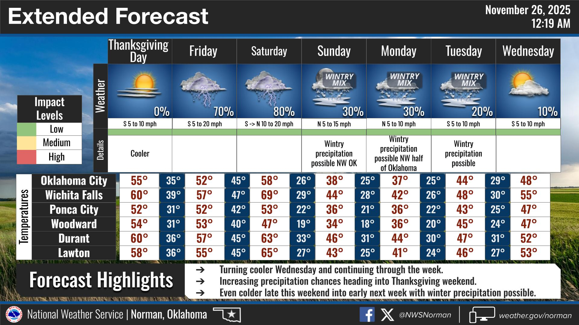
A little cooler today since we had a cold front push through. With light winds, it should be nice on the south side of any building. ENJOY THE DAY TODAY. Thanksgiving Day will be nice with highs in the upper 40s to low 50s. Here is an overview of this weekends weather from the NWS based on data from this morning. This probably will change some.
Saturday: Minimal impacts. Precipitation is expected to clear
out west to east well before freezing temperatures fill in from
the northwest Saturday evening.
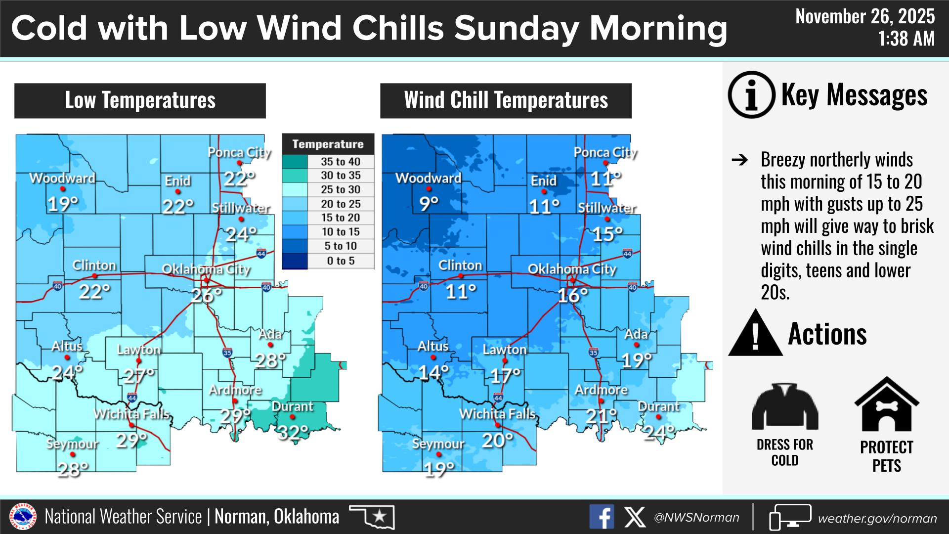
– Sunday: Daytime impacts look minimal as precip chances are less
than 10%. Minor impacts possible overnight as PoPs increase
during the evening/overnight, yielding 10% chance for light
freezing rain in areas generally northwest of I-44. Far
northwest Oklahoma precip would be more likely to be light snow
(20-30% chance).
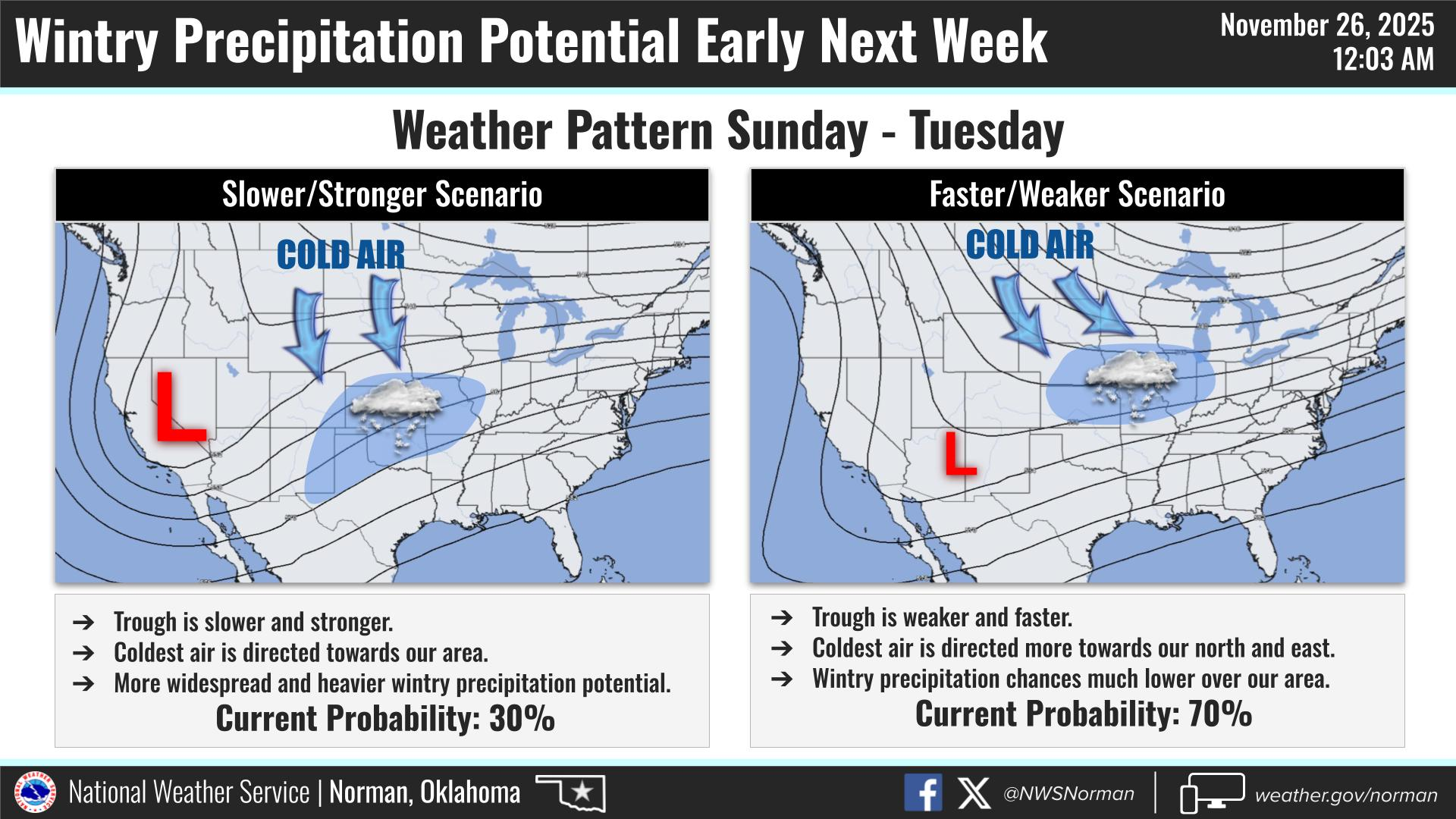
– Monday: Travel impacts possible as precipitation chances peak
at 20-40%. Snowfall probabilities are highest in the northwest
(30% for 1″+). Freezing rain probabilities are spread over a
larger area with the 10-15% axis centered just northwest of
I-44.
Overall, we’ll be ok, so here is your forecast from the NWS/NORMAN:
Wednesday- Mostly sunny. Highs in the upper 40s. Northwest winds 5 to 10 mph.
Wednesday Night- Partly cloudy in the evening, then clearing. Cold with lows in the upper 20s. Southeast winds around 5 mph.
GARFIELD COUNTY EM is our notification and preparedness app. If you don’t have it, you’re NOT prepared! REMEMBER that each day’s post appears under the GCEM Blog icon on the app.
HAVE A GOOD DAY!