WEATHER OUTLOOK FROM GARFIELD COUNTY EMERGENCY MANAGEMENT – 6/23/2026
We’ll be dealing with showers and thunderstorms off and on throughout the day across the area. Expect mostly cloudy skies with highs in the mid-80s and southeast winds around 5 to 10 mph.
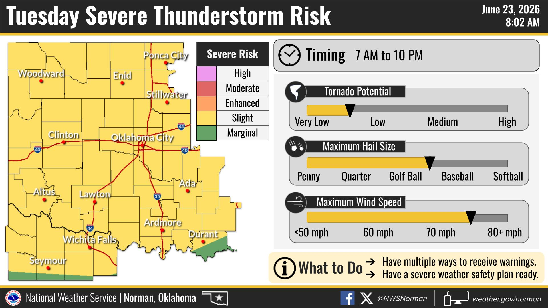
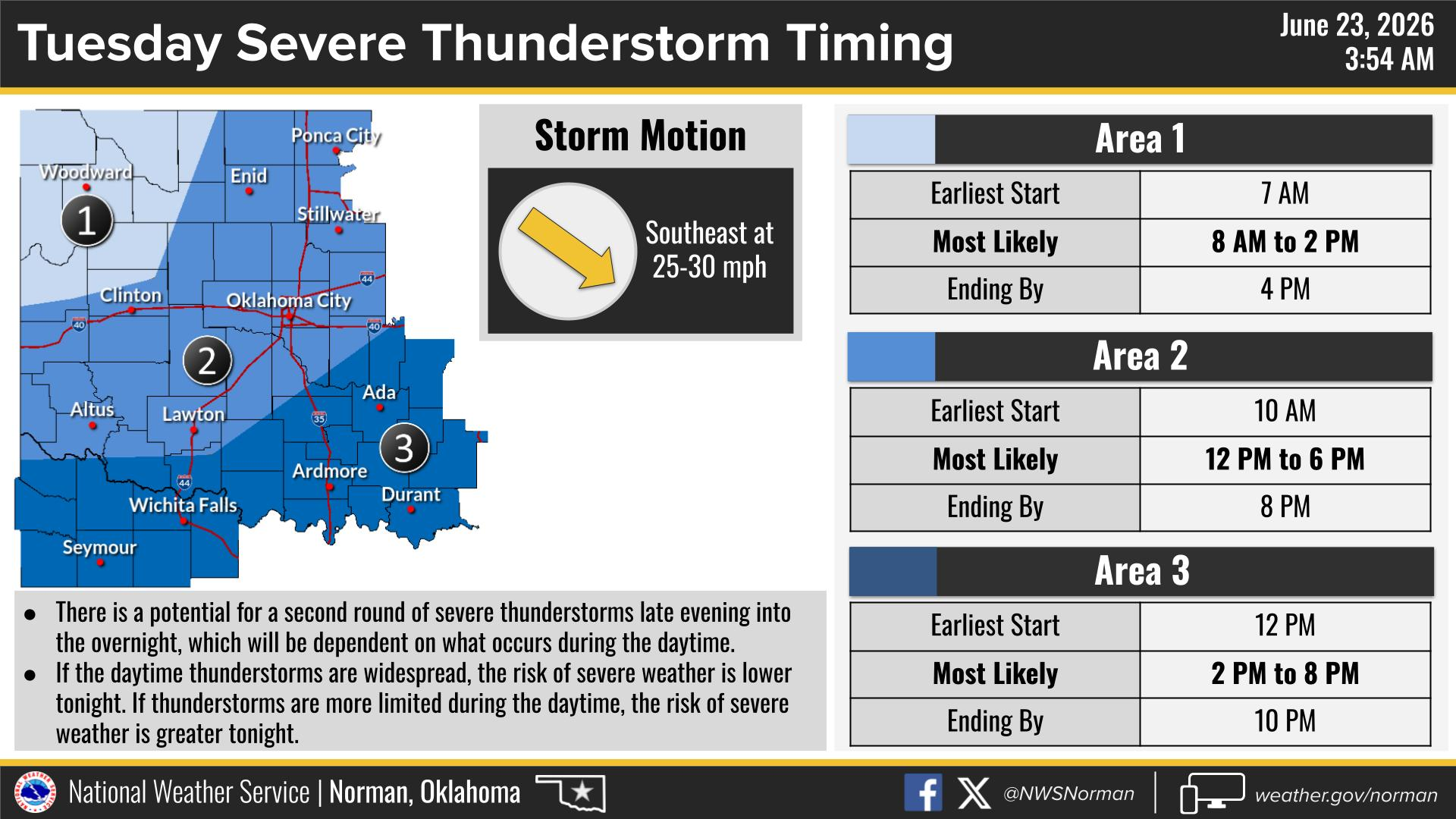
The greatest potential for severe weather appears to be between 12 PM and 6 PM today. While storms may develop outside of that window, this is the time frame we’ll be watching most closely.
Main hazards include:
🧊 Hail up to golf ball size
💨 Wind gusts up to 70 mph
🌪 A tornado threat that remains low, but not zero
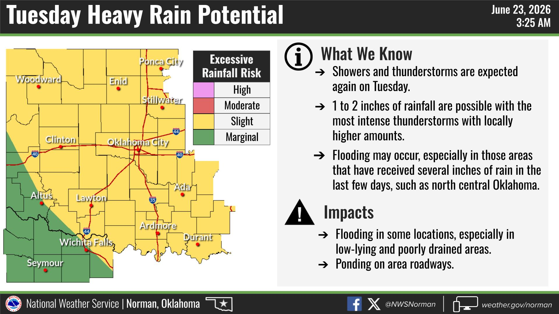
🌧 Heavy rainfall with 1 to 2 inches possible in the stronger storms, which could lead to ponding of water on roadways and minor flooding in low-lying areas.
Showers and thunderstorms may continue into this evening, and there is the potential for another round of storms late tonight depending on how storms evolve during the day.
We’ll continue to monitor conditions and provide updates as needed.
Stay weather aware!
Jacob Price EM-1