0255L-SATURDAY OUTLOOK FROM GARFIELD COUNTY EMERGENCY MANAGEMENT- 12/27/25
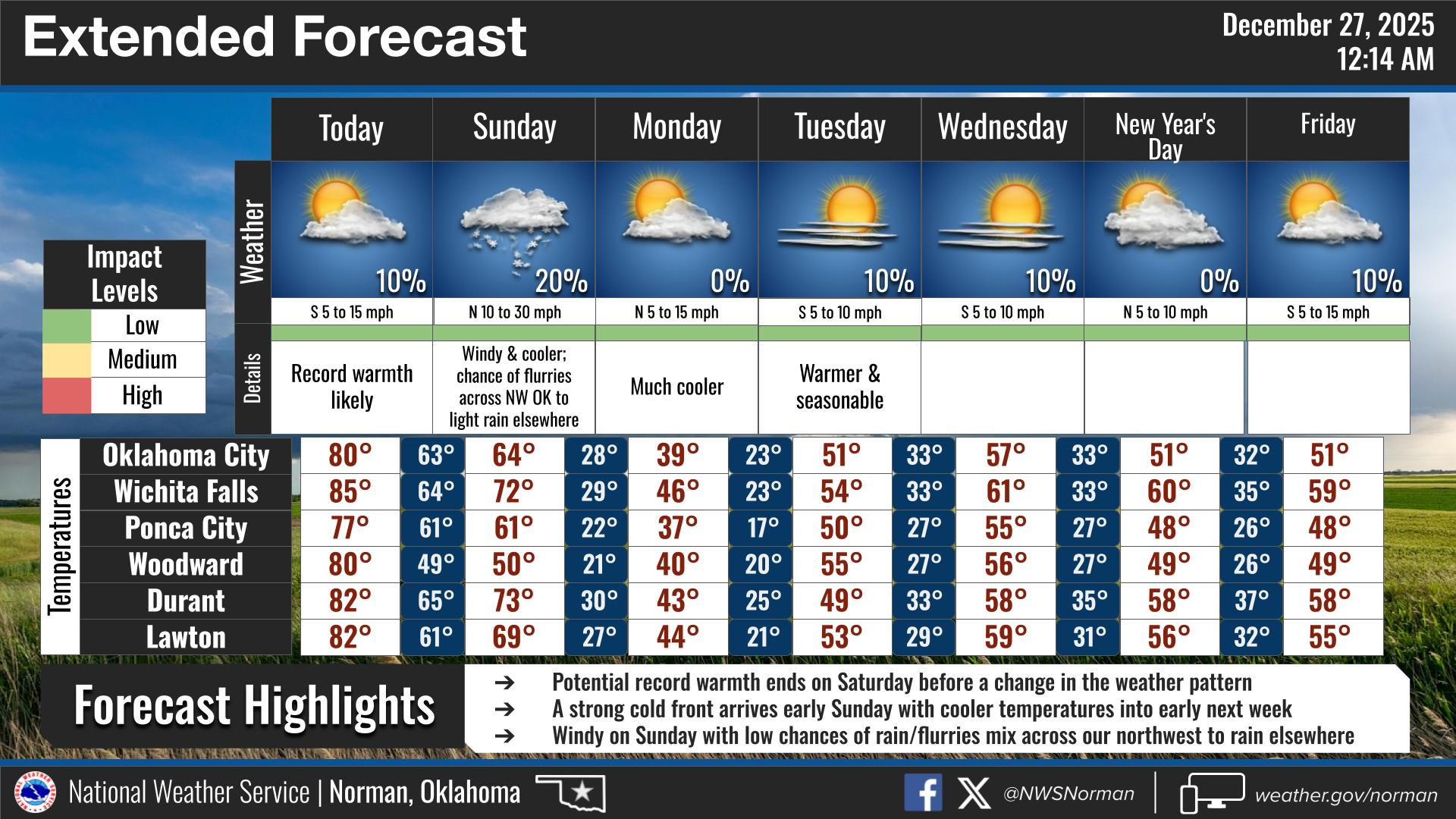
Another warm day expected with possibly record temps so get out and enjoy this today. Tomorrow will begin a cold decline with a LOW CHANCE for maybe some rain. Haven’t stated that in a while! Winds will be a little gusty today and tonight due to a strong cold front that will push in early Sunday. May want to dust off your jackets, you will need them.
Due to low humidity and dew point temps, the fire danger will be increasing so keep an eye out for smoke and fire. Along this line, keep the other eye out for suspicious activity concerning fires. Call 911 if you see either.
Overall, we’ll be ok so here’s your forecast from the NWS/NORMAN:
Saturday- Partly sunny. Highs in the upper 70s. SW winds 10-15 mph gusting to 20 mph.
Saturday Night- Cloudy. Lows in the upper 50s. South winds 10-15 mph gusting to 25 mph.
GARFIELD COUNTY EM is our notification and preparedness app. If you don’t have it, you’re NOT prepared! REMEMBER that each day’s post appears under the GCEM Blog icon on the app.
HAVE A GREAT DAY!