9:00PM WEATHER OUTLOOK FROM GARFIELD COUNTY EMERGENCY MANAGEMENT – 3/2/2026
Welcome to March!
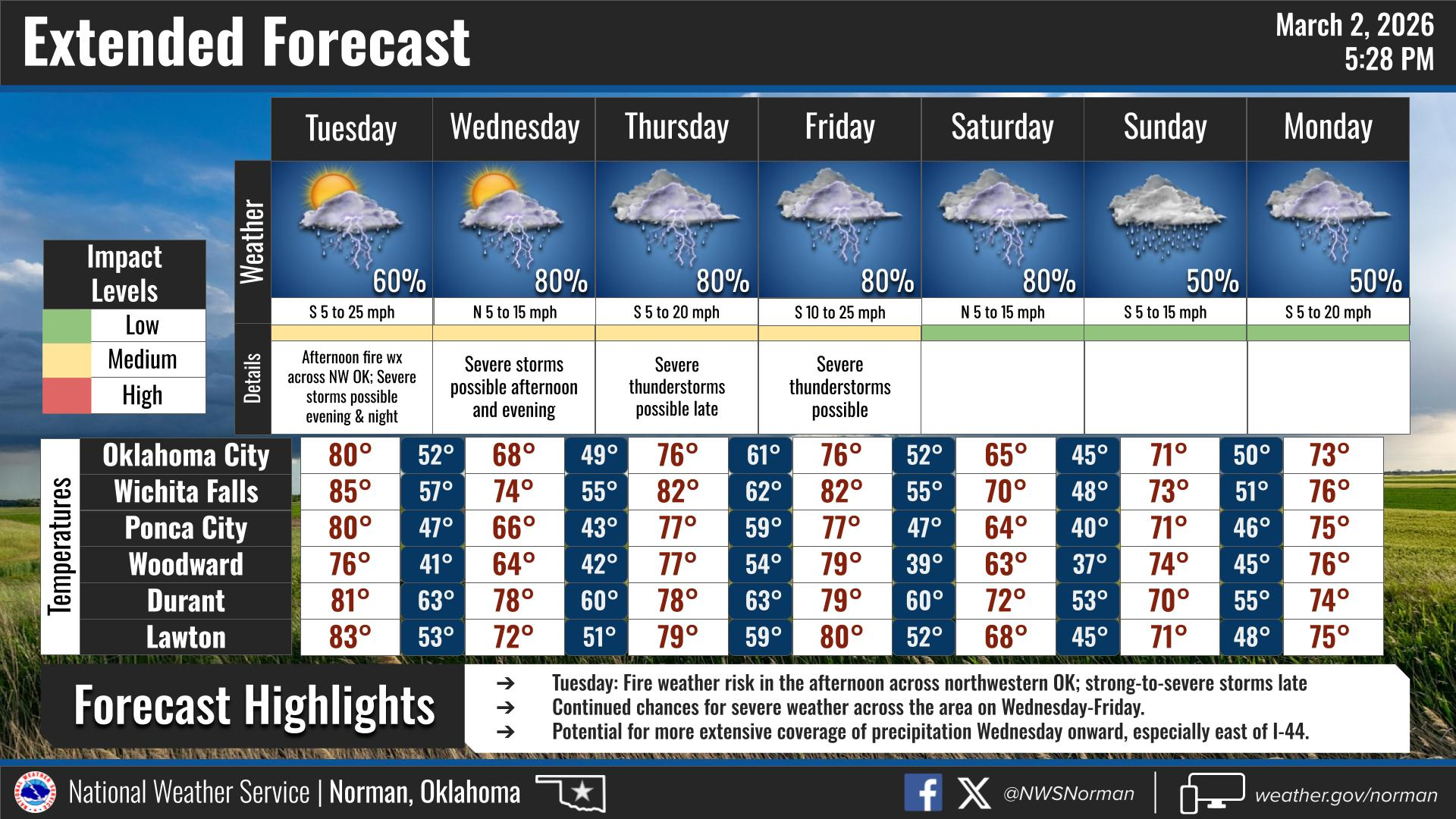
We will warm back up tomorrow. Tuesday will be mostly cloudy, windy, and much warmer, with afternoon highs climbing into the low 80s. South winds will increase throughout the day with gusts up t0 30MPH.
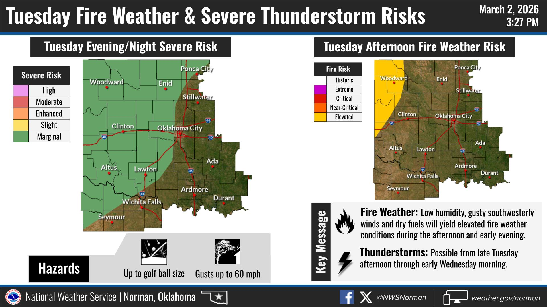
There is a marginal risk for severe thunderstorms Tuesday evening into Tuesday night. The main concerns would be large hail and damaging winds. The tornado risk is currently low, but as you know, it’s never zero.
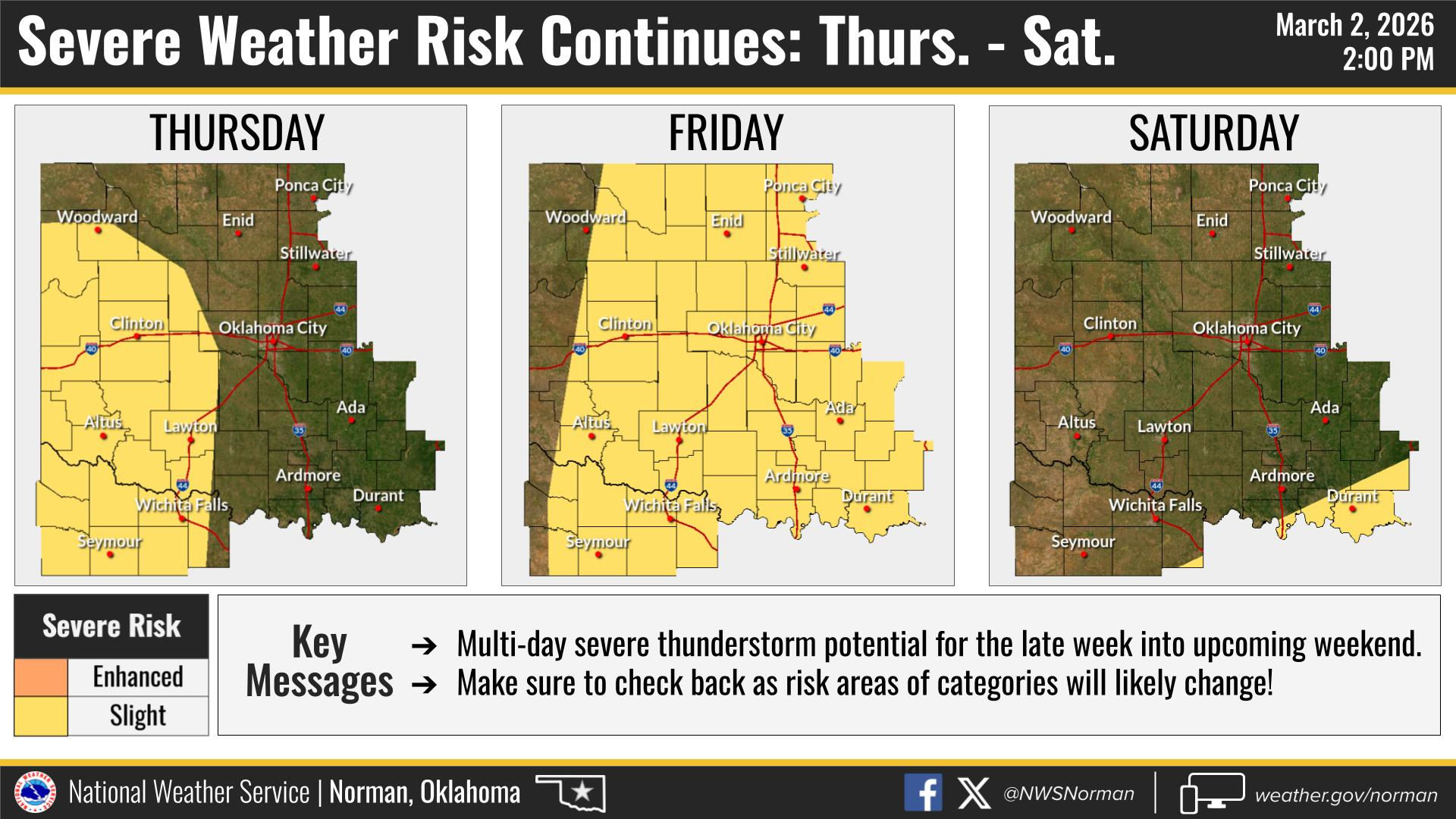
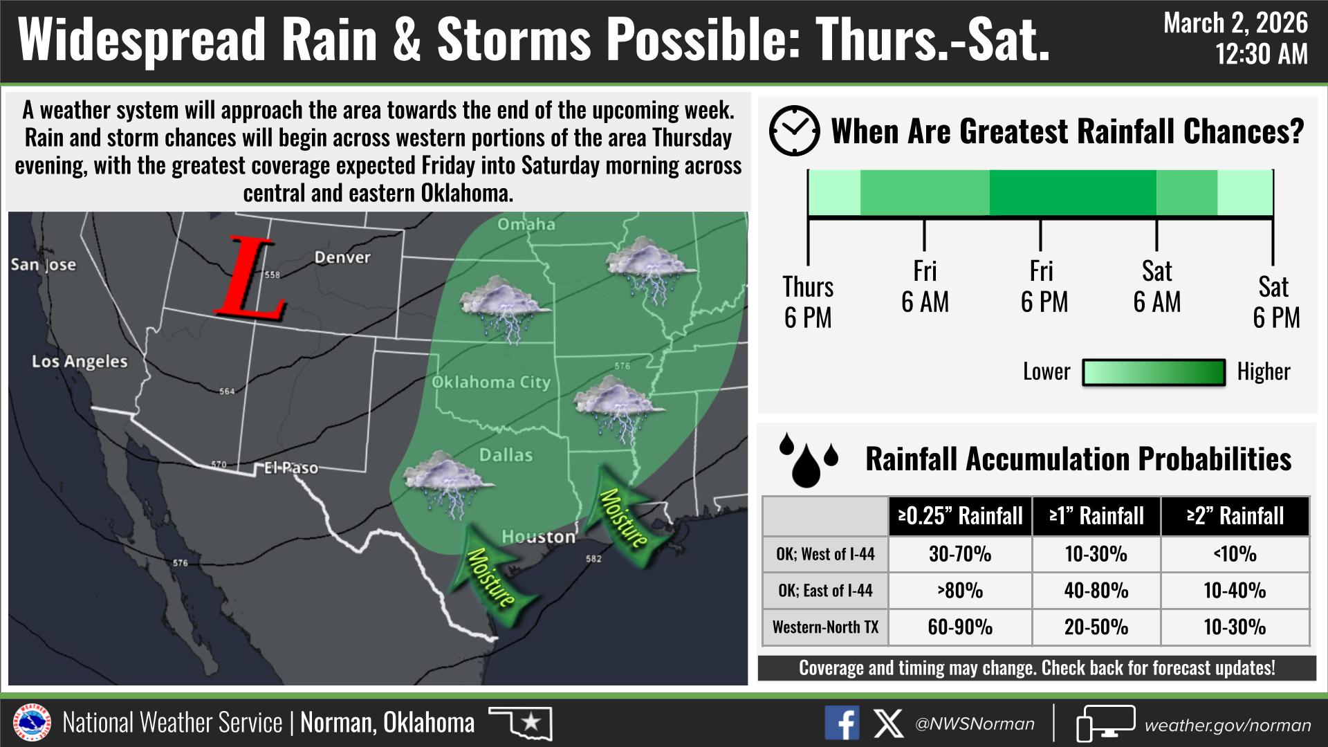
Looking ahead to later this week, another storm system is expected to move into the region Thursday night into Friday. This system could bring a better chance for more widespread thunderstorms, and there is potential for more severe weather. It’s too early to pin down exact timing and impacts, but this is something we will be watching closely over the next few days.
Now is a good time to make sure you are prepared for this upcoming storm season! Be sure to monitor our Facebook page, GCEM.Org, and download our Garfield County Emergency Management App. Any important, and official information will come through these three platforms.
HERE IS YOUR OFFICIAL FORECAST FROM THE NWS/NORMAN:
TONIGHT – Mostly cloudy, with a low around 44. East southeast wind 7 to 9 mph.
TUESDAY – A 20 percent chance of showers after noon. Partly sunny, with a high near 80. South southeast wind 10 to 20 mph becoming southwest in the afternoon. Winds could gust as high as 30 mph.
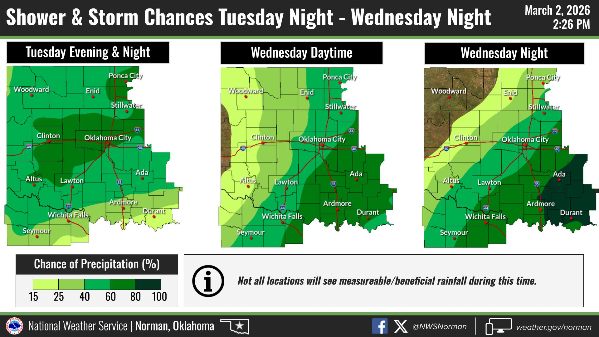
TUESDAY NIGHT – A chance of showers and thunderstorms. Mostly cloudy, with a low around 46. West wind 10 to 13 mph becoming north in the evening. Winds could gust as high as 20 mph. Chance of precipitation is 50%. New rainfall amounts between a tenth and quarter of an inch, except higher amounts possible in thunderstorms.
Have a great night!
Jacob Price EM-1