FRIDAY WEATHER OUTLOOK FROM GARFIELD COUNTY EMERGENCY MANAGEMENT – 3/13/2026
We’ll start off the morning in the mid-40s with mostly clear skies. Temperatures will warm up quickly through the morning, with afternoon highs expected to reach the upper 60s across the area.
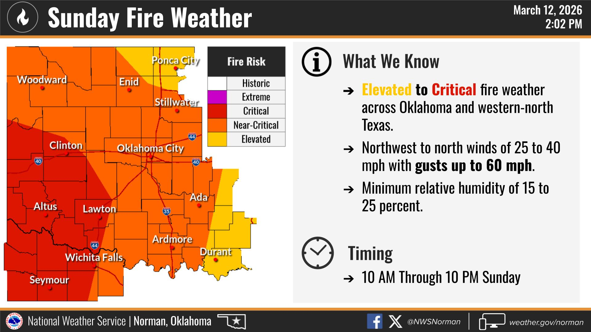
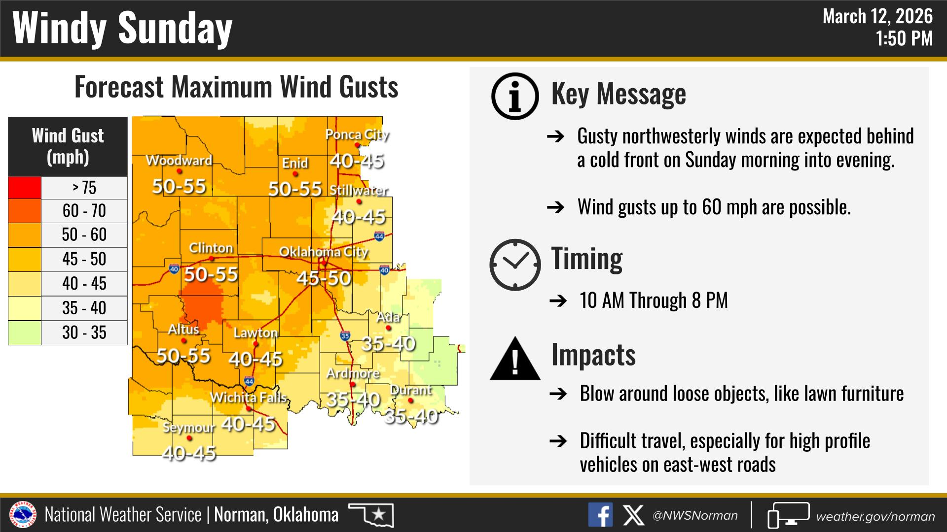
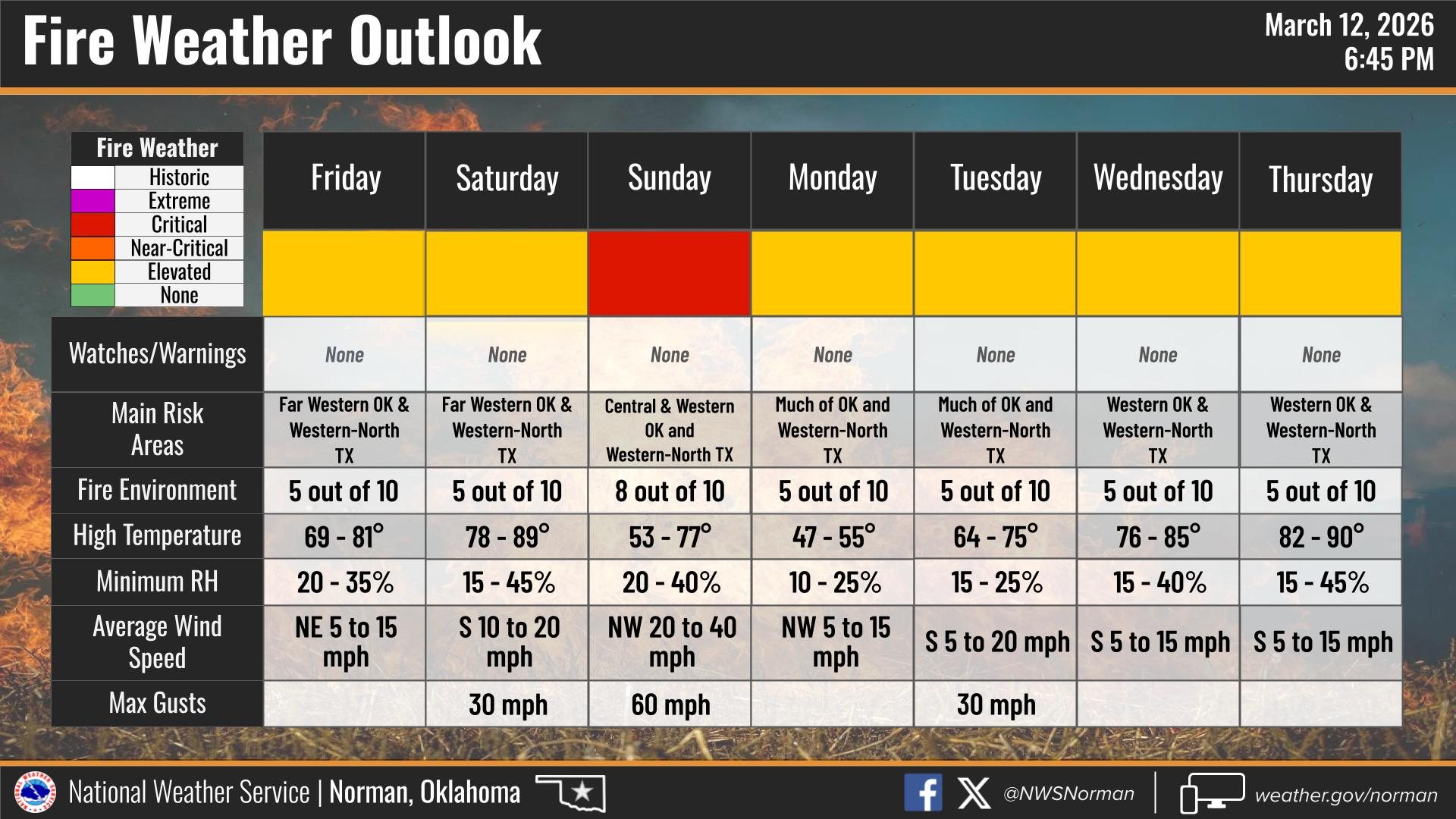
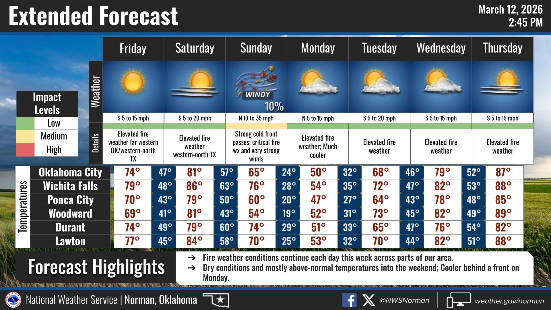
Winds will start out of the north at 8-13 mph in the morning and become easterly in the afternoon. Winds could gust as high as 20 mph. Dry vegetation, and combination of warm temperatures, wind, and lower humidity could lead to an elevated grass fire risk, so outdoor burning is not recommended through at least Thursday of next week. Sunday could be a near critical fire day for us. We will continue to watch it closely.
Overall, it should be a nice day with plenty of sunshine.
HERE IS YOUR FORECAST FROM THE NWS/NORMAN:
TONIGHT – Mostly clear, with a low around 43. South southwest wind 13 to 20 mph, with gusts as high as 30 mph.
FRIDAY – Sunny, with a high near 69. North wind 8 to 13 mph becoming east in the afternoon. Winds could gust as high as 20 mph.
FRIDAY NIGHT – Mostly clear, with a low around 42. South southeast wind 7 to 9 mph.
Have a great night!
J. Price EM-1