0350L-TUESDAY OUTLOOK FROM GARFIELD COUNTY EMERGENCY MANAGEMENT-5/11/21
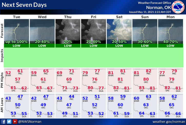
1-Rain chances remain in the area through Wednesday with a slight break Thursday then it’s back through at least Monday. Temps will remain around 60 for highs through Wednesday then we’ll see Thursday in the 70s and then the 80s return for the weekend with those thunderstorm chances. Winds will remain out of the northeast through early Thursday then shift back southerly bringing in moisture and warmer temps. Keep in mind that this WILL CHANGE some over the next several days.
2- Whatever happens, we’ll deal with it and move on. Being that this is MAY, hopefully we do warm up, soon. Here is your forecast from the NWS/NORMAN;
Today-Rain showers in the morning and likely in the afternoon. Highs in the upper 50s. Northeast winds 10 to 15 mph with higher gusts.
Tonight-Mostly cloudy. A slight chance of rain showers in the evening. Lows in the mid-40s. Northeast winds around 10 mph. Chance of showers 20 percent.
FINALLY: Be sure and get our GARFIELD COUNTY EM app. It has a lot of preparedness information and NWS warnings and advisories come through automatically. Keep in mind, there is no better app to have here than ours. It just might save your life.
HAVE A GOOD DAY!
MIKE