We have a fairly active weather pattern setting up over the next several days across the area.
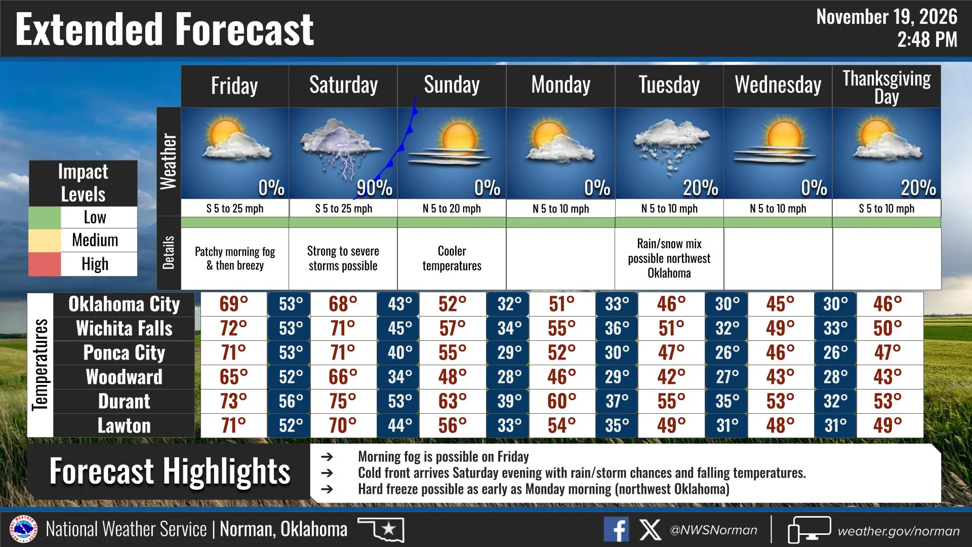
Tonight will be partly cloudy with temperatures around 50°.
Friday looks sunny and breezy, with highs in the upper 60s and south winds gusting up to 35 mph.
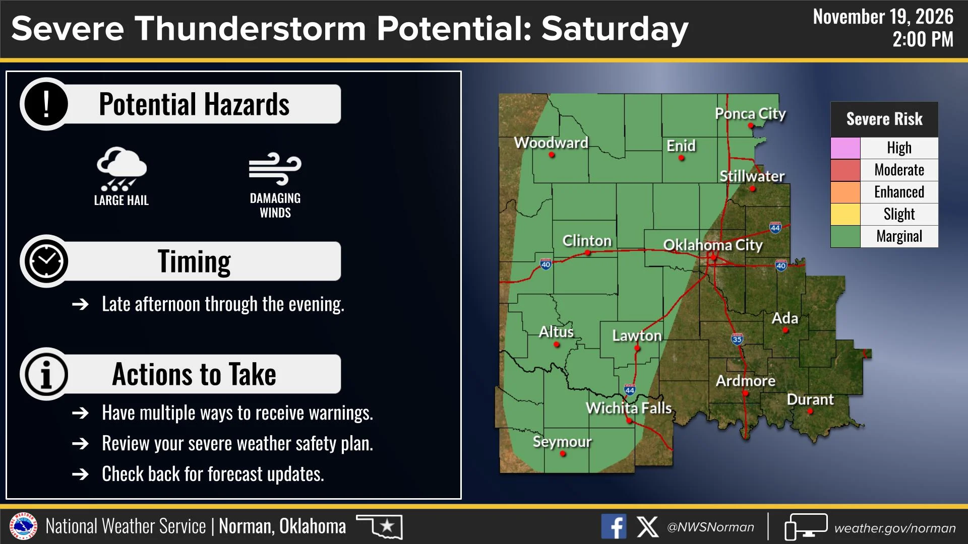
Saturday is when we’ll be watching the weather a little closer. Showers and thunderstorms are expected to develop during the afternoon and continue into the evening. The National Weather Service has outlined a marginal risk for severe thunderstorms, with the potential for large hail and damaging winds. The timing currently looks to be late afternoon through the evening hours.
Rain chances remain high Saturday night before cooler and drier weather moves in Sunday, with highs in the lower 50s.
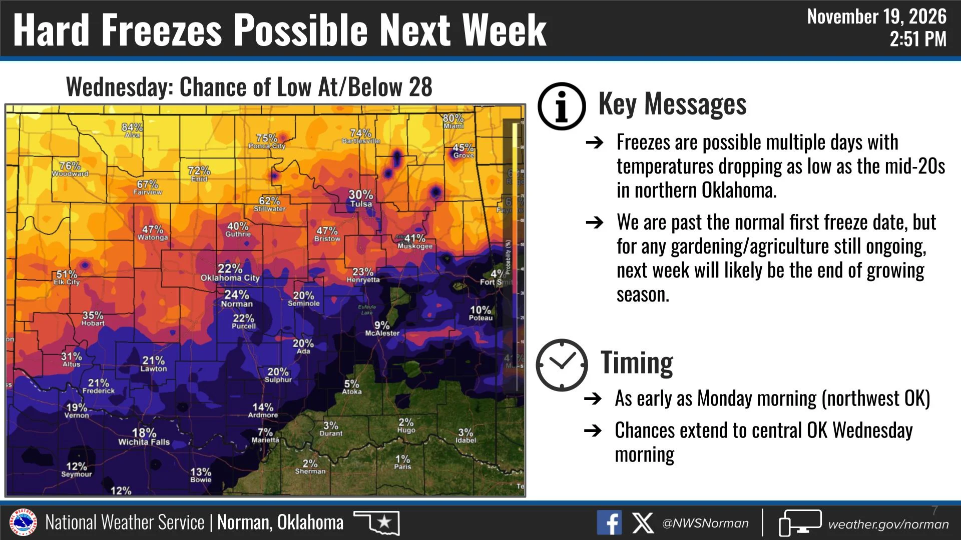
Looking ahead to next week, we could see our first hard freeze of the season. Forecast guidance is showing the potential for temperatures dropping into the mid-20s across northern Oklahoma as early as Wednesday morning. Freezing temperatures may be possible over multiple days, so if you still have plants, outdoor plumbing, or other items that need protection, this may be a good time to start preparing.
As always, forecasts can change, especially this far out. Continue to check back for updates as we get closer.
Have a great weekend!
Jacob Price
Director, Garfield County Emergency Management