0420L-MONDAY OUTLOOK FROM GARFIELD COUNTY EMERGENCY MANAGEMENT-5/10/21
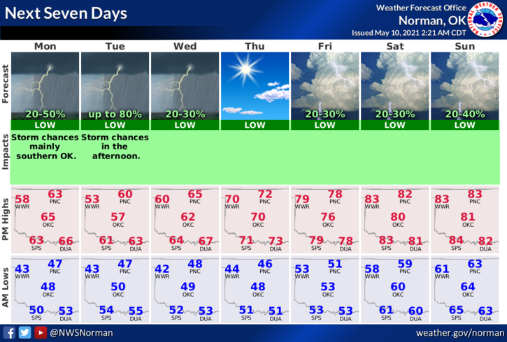
1- An upper level disturbance is moving across Kansas today giving us a good chance for showers during the day. Tonight, an approaching shortwave trough will keep us in the rainfall department during the overnight hours. This will be the pattern we’ll see off and on during this week along with lower high temperatures. We should average in the low 80s right now for mid-May but we don’t control the weather. Overnight low temps will average in the low to mid 40s.
2-Overall, we should be ok. Expect northeasterly winds being gusty at times, pretty much all week. Enjoy the cooler weather because as most know, when nature decides to get back to normal, it will be hot and humid. Here is your forecast from the NWS/NORMAN;
Today-40 percent chance of rain showers in the morning then decreasing clouds. Highs in the mid- 60s. Northeast winds 10 to 15 mph with higher gusts.
Tonight-Partly cloudy. A chance of rain showers and a slight chance of thunderstorms after midnight. Lows in the mid-40s. Northeast winds 10 to 15 mph. Chance of precipitation 40 percent.
Have a good day.
MIKE