WEDNESDAY WEATHER OUTLOOK FROM GARFIELD COUNTY EMERGENCY MANAGEMENT – 01/07/2026
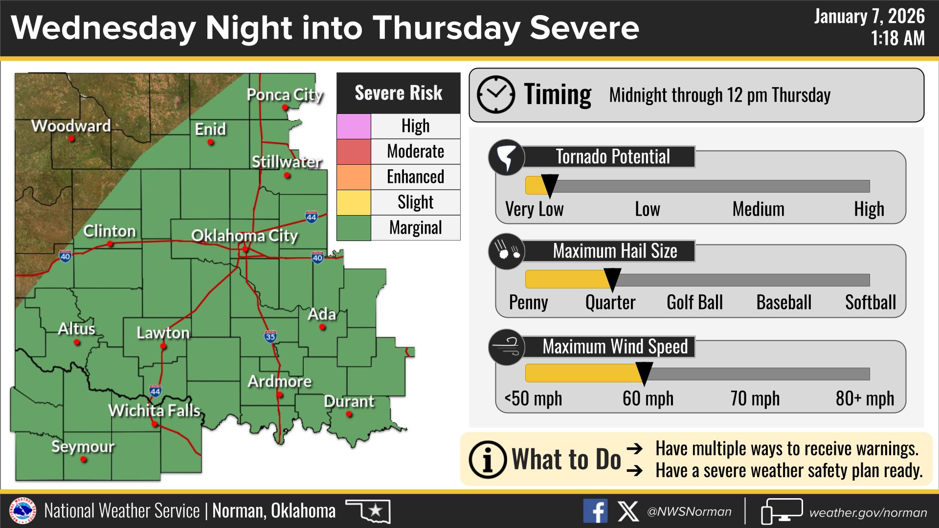
We will remain unseasonably mild through the first half of Wednesday, but we could see some changes later in the day. We are tracking an approaching storm system that will bring our first significant rain chances later tonight. Please stay weather aware as a few of these storms could be strong to severe, with gusty winds and hail being the main threat.
Here is your detailed forecast from the NWS/Norman:
The Details
Today – Partly sunny. Highs in the upper 60s. South winds 15 to 20 mph with gusts up to 30 mph.
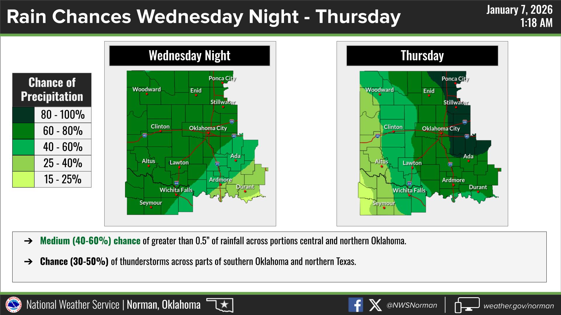
Tonight – Mostly cloudy. Showers likely with a slight chance of thunderstorms after midnight. Not as cool with lows in the lower 50s. South winds 10 to 15 mph. Chance of rain 70 percent.
Safety Tips
- Severe Potential: While widespread severe weather is not expected for Garfield County, a few storms overnight could produce small hail and gusty winds.
- Fire Safety: Elevated fire weather remains a concern through the afternoon hours due to breezy south winds and dormant vegetation.
- Stay Informed: Be sure to download the Garfield County App. This is a great way to receive real time information during severe weather events.
Stay safe and have a great Wednesday!
Jacob Price GCEM-1