0400L-THURSDAY OUTLOOK FROM GARFIELD COUNTY EMERGENCY MANAGEMENT- 10/20/22
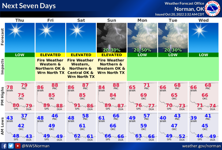
1- Warming up with light winds. A surface trough will be working its way across the area today and bringing with it, warmer and dryer air. Not a raindrop in sight. Tomorrow, warmer temps, and stronger winds will enhance the fire threat across the state.
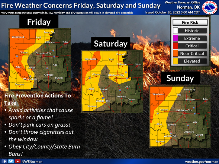
2- I am attaching a graphic concerning the fire weather concerns but don’t get fixated on where the lines are. They will move around quite a bit as the weekend wears on. Read this graphic carefully and send it to everyone. We are very dry and all it takes to start a fire now is a spark. We ask that NO CONTROLLED BURNING OCCUR as fire does create it’s own weather and right now will basically fly across a field even in light winds.
3- If you see smoke or fire, call 911 immediately and watch out for suspicious activity.
4- Here is your forecast from the NWS/NORMAN;
Today- Sunny. Highs in the upper 70s. Northwest winds 5 to 10 mph.
Tonight- Clear. Lows in the upper 40s. South winds 5 to 10 mph.
HAVE A GOOD DAY!