0315L-FRIDAY OUTLOOK FROM GARFIELD COUNTY EMERGENCY MANAGEMENT-10/21/22
THE NWS HAS ISSUED A “RED FLAG WARNING” IN EFFECT FROM 1PM THIS AFTERNOON UNTIL 8PM THIS EVENING. * WINDS…SOUTH TO SOUTHWEST 18 TO 22 MPH WITH GUSTS UP TO 35 MPH.* HUMIDITY…10 TO 20 PERCENT. * TEMPERATURES…85 TO 90.
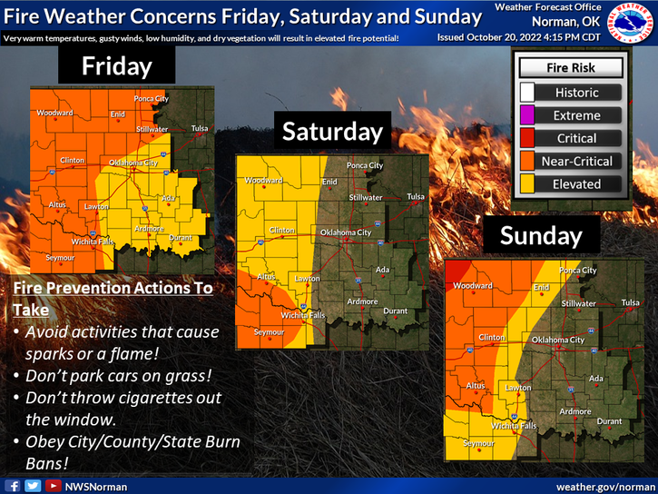
1- Yesterday afternoon we had a fire that involved 5 fire departments in grass that was 5 feet tall and flames upwards of 15-20 feet. We were lucky that winds were relatively low. Otherwise, we’d still be out there. We are NOT in a burn ban but if you utilize anything that involves a flame, take precautions. You may be paying for the response. Thanks to Goltry, Helena, Lahoma, and Kremlin for helping Hillsdale-Carrier Fire District on yesterday’s fire.
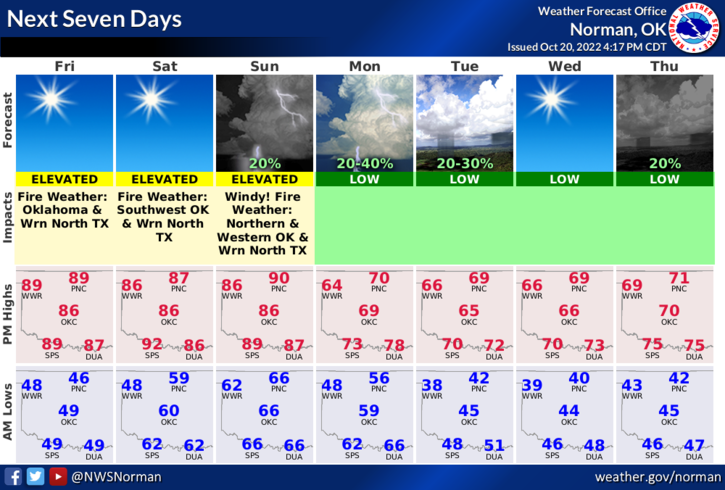
2-Weather-wise, winds will gradually increase today from the SOUTH and end up 15-20 gusting upwards 30-35mph. By Sunday, we could see wind gusts upwards to 45 mph. This will be a dangerous weekend for fire so be extremely careful out there. As stated in previous posts, we do have an arsonist at large out there so if you see suspicious activity, call 911 or the sheriff’s office immediately. Thank you in advance.
3-OVERALL, we’ll be ok so enjoy the warmer weather for a few days. Here is your forecast from the NWS/NORMAN;
Today-Sunny. Highs in the upper 80s. South winds 15 to 20 mph with gusts up to 30 mph.
Tonight-Partly cloudy in the evening, then clearing. Lows in the upper 50s. South winds 15 to 20 mph with gusts up to 30 mph.
HAVE A GOOD DAY!