0330L-THURSDAY OUTLOOK FROM GARFIELD COUNTY EMERGENCY MANAGEMENT-8/25/22
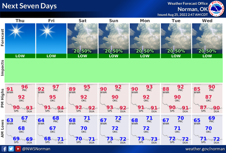
1- Today will be similar to yesterday with temps in the mid-90s with light easterly winds. This is your typical late August day. Friday looks to be similar and then we’ll have a few troughs move through the area, one over the weekend and another, next week giving us a chance for some showers and possibly a few thunderstorms. Chances for rain through the forecast period are around 30 to 50% so we’ll see what happens.
2- On those rain chances, per guidance, everything depends on whether the upper high stays where it is or drifts back over us bringing temps back up and rain chances back down. It’s located to our west and is allowing these troughs to push through our area. Again, we’ll see what happens.
3- Overall, we’ll be ok so enjoy the warmth and go soak in some sunshine. Here is your forecast from the NWS/NORMAN;
Thursday-Sunny, with a high near 95. Light and variable wind becoming east 5 to 7 mph in the afternoon.
Thursday Night-Mostly clear, with a low around 66. East southeast wind 5 to 9 mph becoming south after midnight.
HAVE A GOOD DAY!