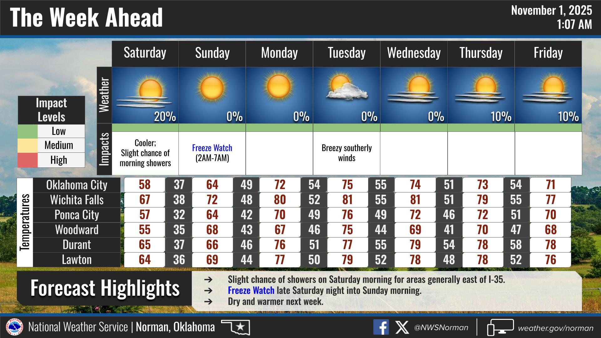
0315L-SATURDAY OUTLOOK FROM GARFIELD COUNTY EMERGENCY MANAGEMENT- 11/1/25
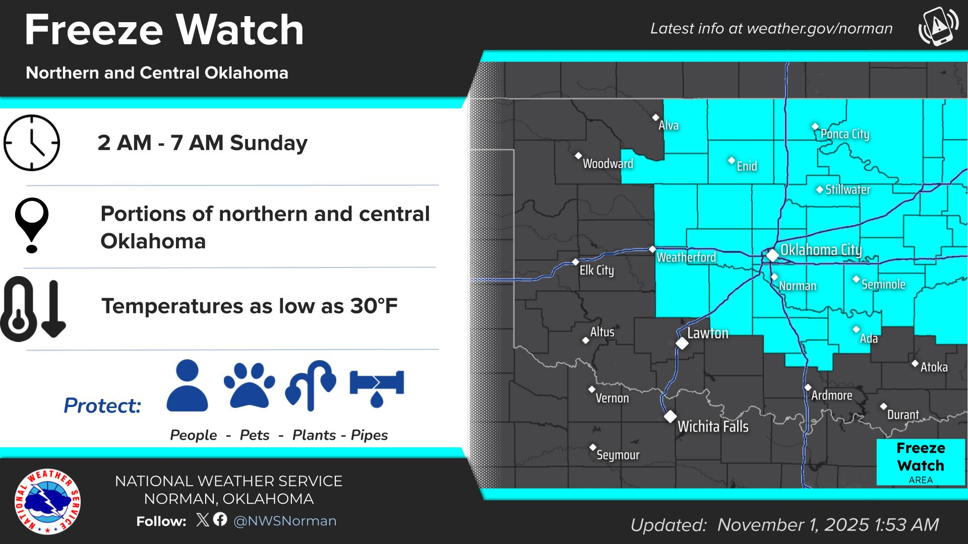
A weak cold front has pushed into and through our area overnight. This may bring a shower or two here too but it shouldn’t affect us too much if it does. We do expect to be mostly sunny for the majority of the day and we’ll be under a FREEZE WATCH EARLY Sunday morning from 0200L until 0700L. We should reach that freezing temp and below during this timeframe. We’ll see what happens.
Overall, we’ll be ok, so here is your forecast from the NWS/NORMAN:
Saturday- Sunny. Highs in the mid-50s. North winds 5 to 10 mph.
Saturday Night- Clear, cold with lows in the lower 30s. Northeast winds around 5 mph, becoming southeast after midnight.
GARFIELD COUNTY EM is our notification and preparedness app. If you don’t have it, you’re NOT prepared! REMEMBER that each day’s post appears under the GCEM Blog icon on the app.
HAVE A GOOD DAY!