0255L-SATURDAY OUTLOOK FROM GARFIELD COUNTY EMERGENCY MANAGEMENT- 11/8/25
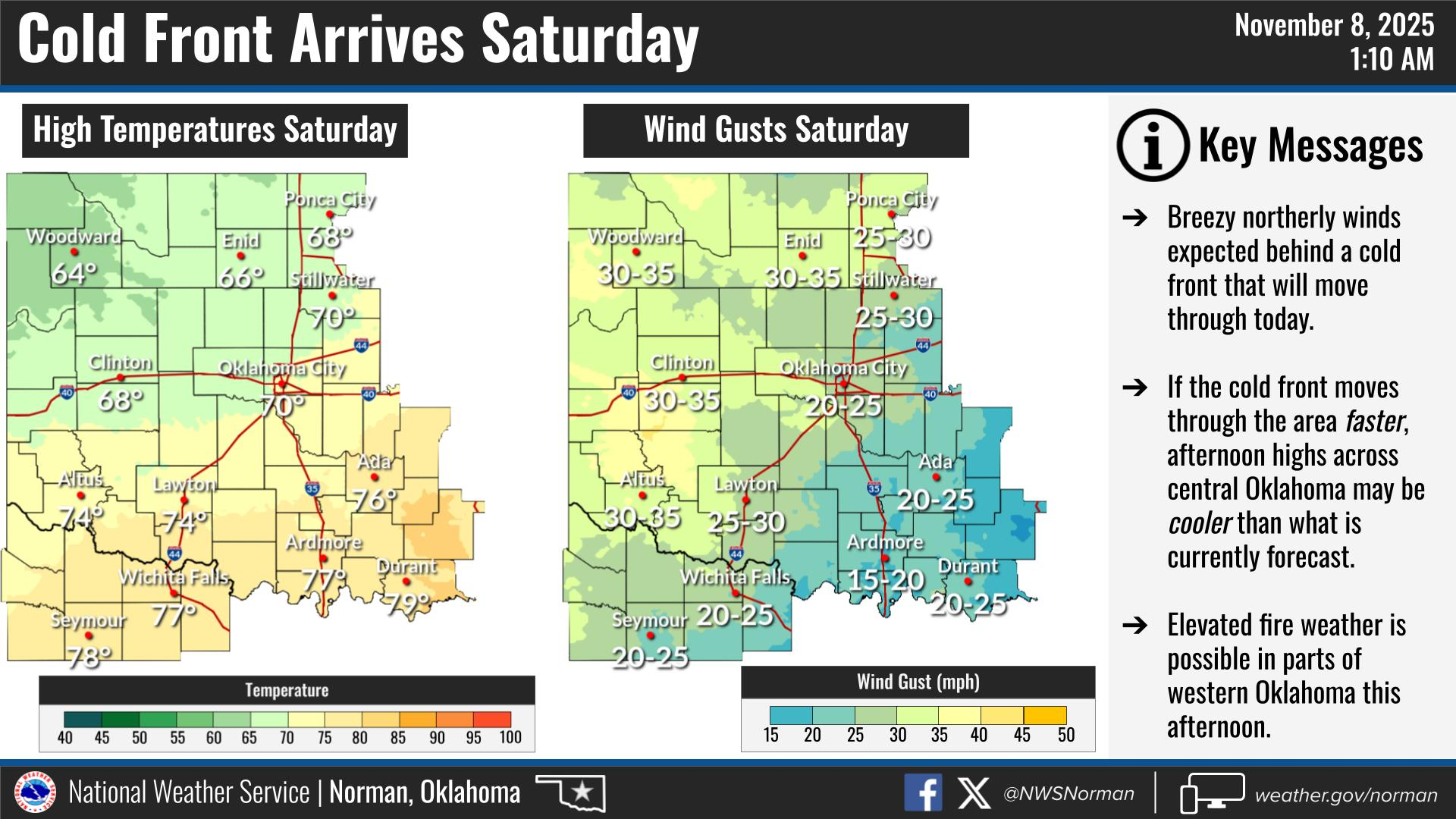
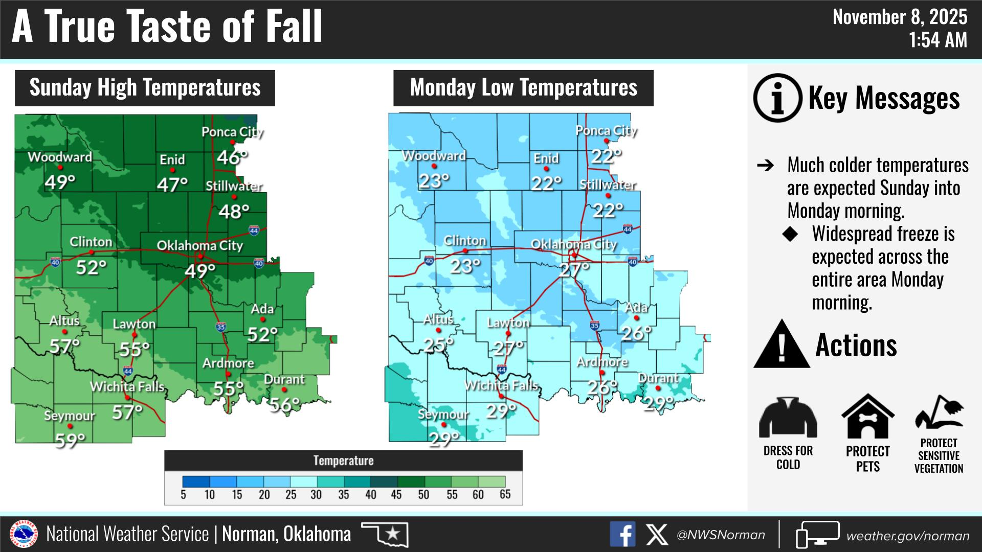
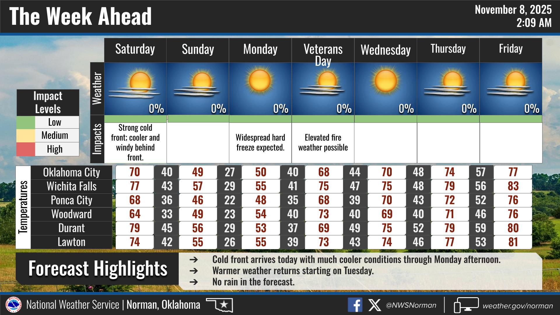
A COLD FRONT will push into the area this morning bringing with it some strong winds. Some wind gusts could reach 35 mph. The colder air will begin to filter in slowly during the day and a bit more tonight. Sunday’s high will be in the 40’s with strong winds once again. Sunday night the winds will die down and the much colder air will arrive giving us our first real taste of freezing temps down into the low 20’s. Windchill temps could drop into the mid-teens. Tuesday we’ll see a good increase in temps and we’ll be back where we are now for the rest of next week.
As stated in previous posts, the fire danger is increasing so use caution while doing anything related to fire. If a wildland fire does occur, stay away from the area so emergency vehicles don’t have to wait on you to move out of the way. With high winds in the forecast, fire will spread quickly and could put someone’s home or business in jeopardy.
Overall, we’ll be ok, so here is your forecast from the NWS/NORMAN:
Saturday- Sunny, breezy with highs in the mid-60s. West winds 15 to 20 mph, becoming north 15 to 25 mph in the afternoon.
Saturday Night- Mostly clear. Lows in the mid-30s. Northwest winds 10 to 15 mph with gusts up to 25 mph.
GARFIELD COUNTY EM is our notification and preparedness app. If you don’t have it, you’re NOT prepared! REMEMBER that each day’s post appears under the GCEM Blog icon on the app.
HAVE A GOOD DAY!