0315L- SUNDAY OUTLOOK FROM GARFIELD COUNTY EMERGENCY MANAGEMENT- 11/9/25
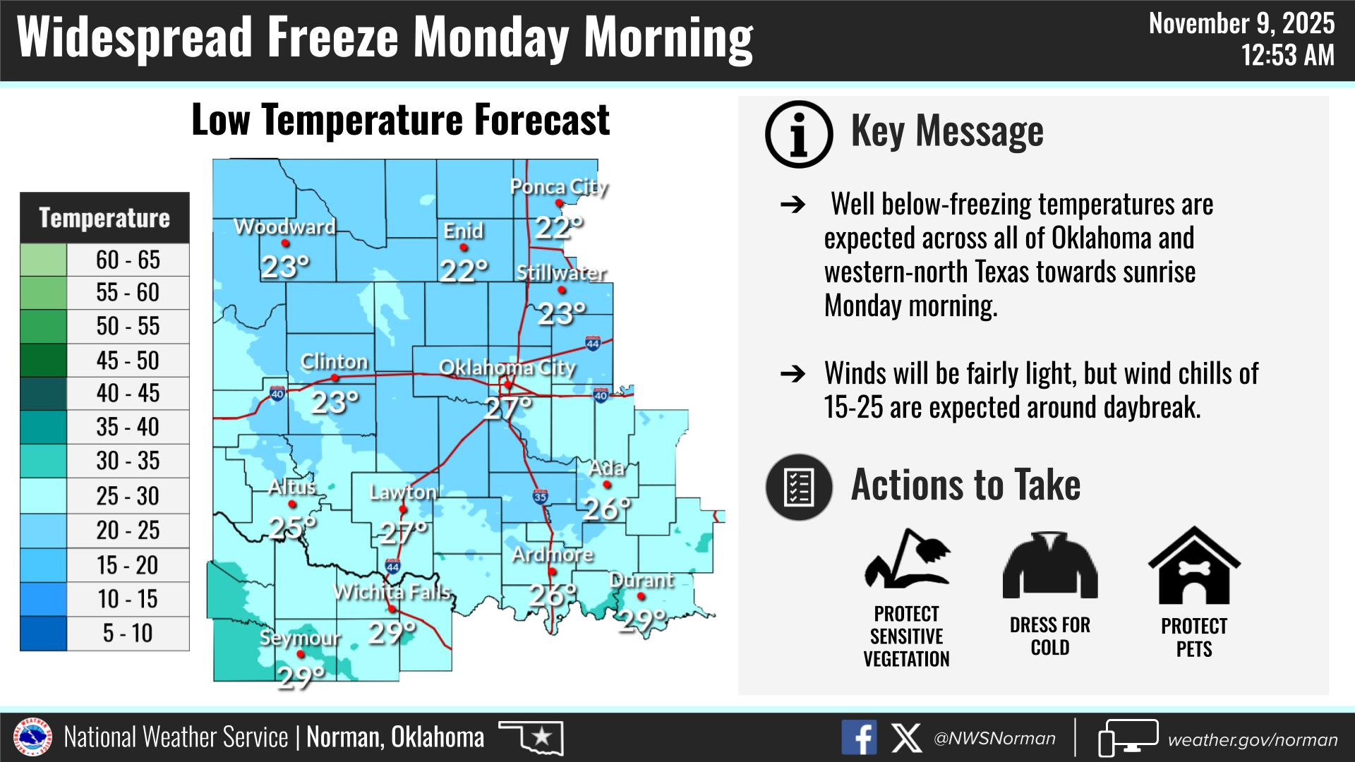
FREEZE WARNING IN EFFECT FROM 9 PM TONIGHT UNTIL 9 AM MONDAY MORNING.
Overnight low temps Sunday night into Monday morning are expected to be in the low to mid 20’s. Be sure to take all the necessary precautions to prevent pipes from freezing, checking your vehicles, and the outdoor animals. After Monday, temps will recover and we’ll be warmer through most of the week. There is an indication that we could see another cold snap with precipitation this time, around next weekend. Don’t hold your breath on that yet. We’ll see how that verifies later this week. Just be prepared for tonight.
Overall, we’ll be ok, so here is your forecast from the NWS/NORMAN:
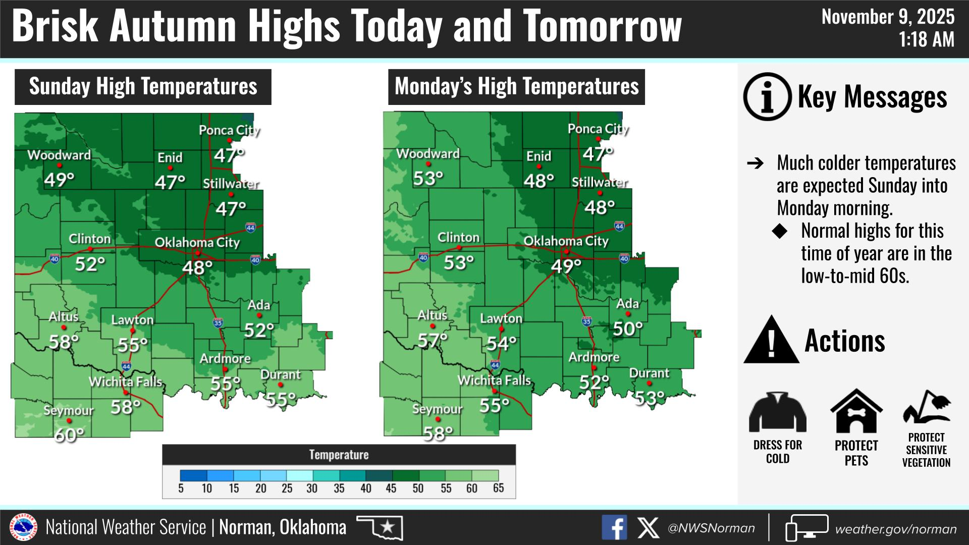
Sunday- Sunny. Much cooler with highs in the upper 40s. North winds 15 to 20 mph with gusts up to 30 mph.
Sunday Night- Clear, cold with lows in the lower 20s. North winds 5 to 10 mph.
GARFIELD COUNTY EM is our notification and preparedness app. If you don’t have it, you’re NOT prepared! REMEMBER that each day’s post appears under the GCEM Blog icon on the app.
HAVE A GOOD DAY!