0358L-THURSDAY OUTLOOK FROM GARFIELD COUNTY EMERGENCY MANAGEMENT- 11/13/25
THE WARMTH WILL CONTINUE so enjoy this while you can. Winds will be fairly light so there shouldn’t be any dust storms for a while. We will continue to warm up even more as we get into the weekend and rain chances have mostly gone away. Don’t let the panic social media-rologists scare you on social media. Stay up to date with any storm possibilities from the pros at your area National Weather Service office and The Storm Prediction Center.
While out and about yesterday, I overheard folks talking about how warm we are and this proves the earth is warming up. Then, this morning in a comment from a forecaster stated the following:
1999 and 2016 are the recent standards for extremely warm Novembers in our area (interestingly enough, both were during peaking La Nina’s as well, though those were much stronger than our current one). I was happy to see this because folks tend to state things without research and I was going to research this today.
The Fire Danger is slowly creeping up so keep this in mind as we continue to dry out. Call 911 if you see smoke and or fire.
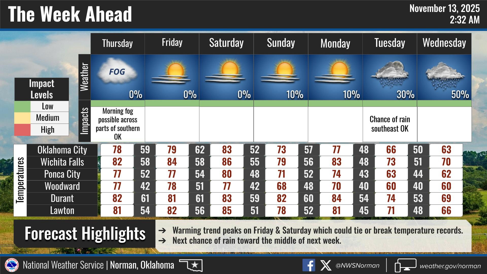
Overall, we’ll be ok, so here is your forecast from the NWS/NORMAN:
Thursday- Mostly sunny. Highs in the mid-70s. South winds 5 to 10 mph.
Thursday Night- Mostly clear in the evening, then becoming partly cloudy. Lows in the upper 40s. South winds 5 to 10 mph.
GARFIELD COUNTY EM is our notification and preparedness app. If you don’t have it, you’re NOT prepared! REMEMBER that each day’s post appears under the GCEM Blog icon on the app.
HAVE A GOOD DAY!